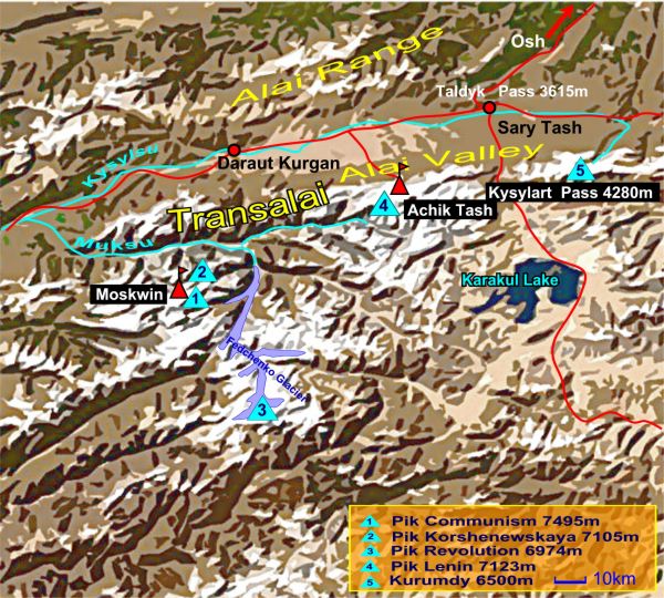
Moskwin Lager / Pik Chetriokh
Südlich des Muksu Flusses, der die westliche Transalaikette begrenzt, erheben sich Pik Kommunismus (7495 m) und Pik Korshenewskaya (7105 m) als Knotenpunkte der Peter 1.-Kette in Ost-West-Richtung und der Akademiekette von Nord nach Süd. Ein weiteres Gebirgsmassiv ist der Pik Revolution (6974 m, auch Dreispitz genannt) etwa 50 km südöstlich des Pik Kommunismus. An seiner Nordseite entspringt der Fedchenko Gletscher, mit 77 km der längste ausserpolare Eisstrom der Erde. Das Moskwin Lager am Fuss des Pik Kommunismus (Pik Ismail Samani) ist vom Lager Atschik Tash nur mit dem Hubschrauber zu erreichen.
South of the Muksu River - which limits the western Transalai Range - Pik Communism (7495 m - now Pik Ismail Samani) and Pik Korshenewskaya (7105 m) are rising as the crossing points of two mountain ranges: Peter-1st - Range from west to east and Academy of Sciences Range from north to south. Another cumulation point 50 km south east of Communism Peak is Pik Revolution (6974 m) which forms the source of the Fedchenko Glacier, the longest ice stream in non-polar regions, about 77 km long. The Moskwin Camp at the foot of Pik Communism (Pik Ismail Samani) can only be reached by helicopter.
Moskwin Lager
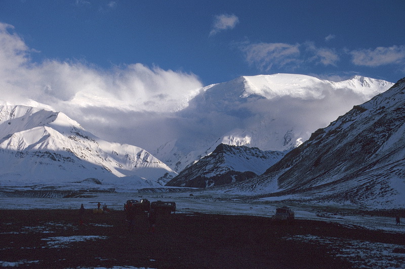 |
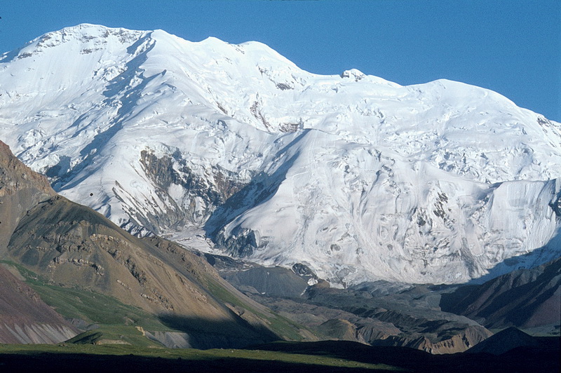
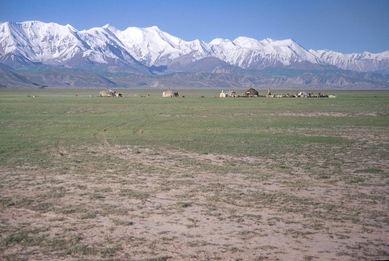
Die meisten bergsteigerischen Unternehmungen im nördlichen Pamir beginnen im Lager Atschik Tasch, einer kleinen internationalen Zeltstadt am Fusse des Pik Lenin (7134 m - rechts im Hintergrund). Das Lager kann mit geländegängigen Kleinbussen erreicht werden und liegt auf etwa 3700 m Höhe. Sommerliche Neuschneefälle sind hier nichts Ungewöhnliches. The Atschik Tasch Camp, a small tent village at the foot of Pik Lenin (7034 m - right behind) is the basis for most alpine undertakings in the Pamir area. The camp is reached by small offroad busses. Even in summer snowfalls are not unusual at an altitude of 3700 m. |
 |
Östlich des Pik Lenin erhebt sich der 5920 m hohe Pik 19. Parteitag. Im Mittelgrund die Moränen des Lenin Gletschers. Peak of the 19th Party Convention (5920 m) east of Pik Lenin with the moraines of the Lenin Glacier below. |
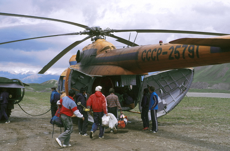
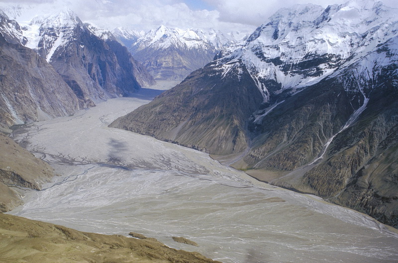
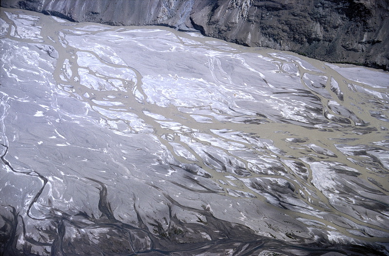
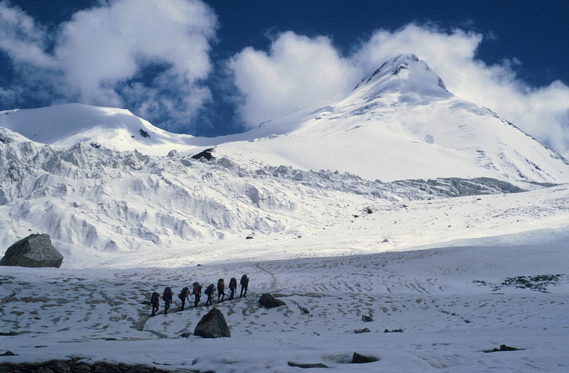
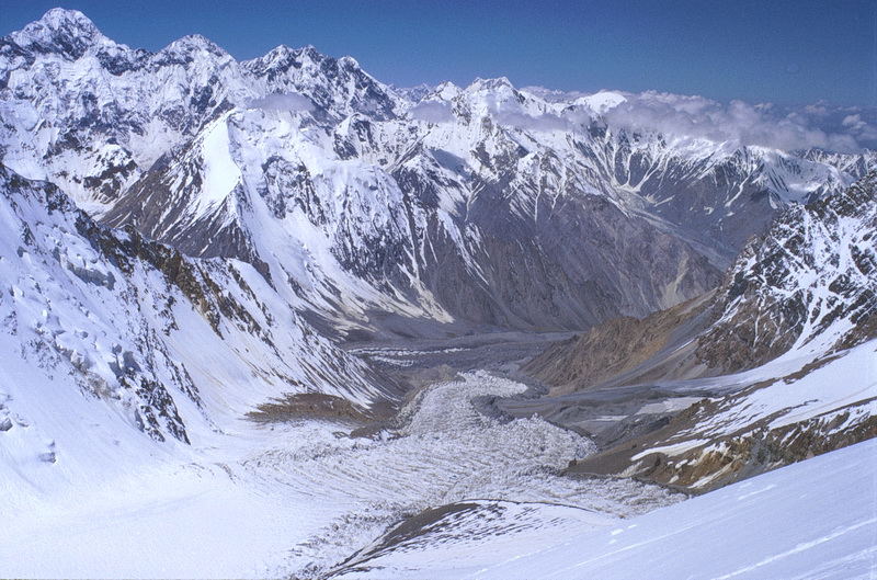
Mit einem Aeroflot Hubschrauber geht es nach wenigen Tagen weiter ins Moskwin Lager am Fusse des Pik Kommunismus oder zum Fortambek Lager am Pik Moskwa, von dem man wiederum das Lager Staubwiese am Pik Korshenewskaya erreicht. Der Helikopterflug führt entlang und über die Fünftausender der westlichen Transalai Kette, hinter der die Akademie Kette mit dem Pik Kommunismus liegt und über das Tal des Muksu Flusses welcher den Fedchenko Gletscher entwässert. Der Fedchenko Gletscher ist mit 77 km Länge und über 900 qkm der längste ausserpolare Gletscher der Erde. Hier wird klar, warum die Lager des Pamir nur mit Hubschraubern erreichbar sind.
The easiest way to reach the Moswin Camp below Pik Communism as well as the Fortambek Camp at the foot of Pik Korshenewskaya is by helicopter. The flight leads along the 5000 m peaks of the western Transalai Range behind which Pik Communism is situated and across the valley of Muksu River which drains the Fedchenko Glacier. About 77 km long covering an area of 900 square kilometers the Fedchenko Glacier is the largest non-polar glacier on earth. A detailed view of the Muksu River shows why helicopters are necessary to get to the Pamir camps.
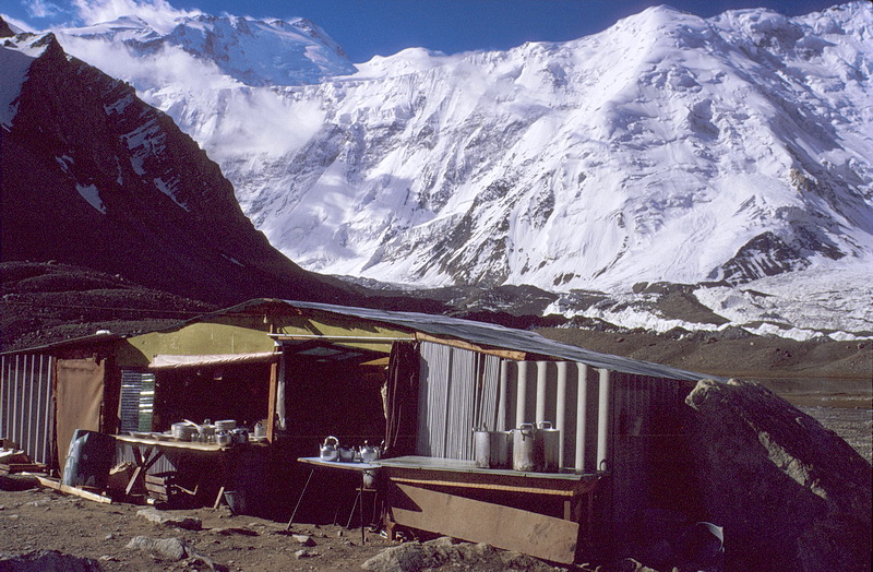
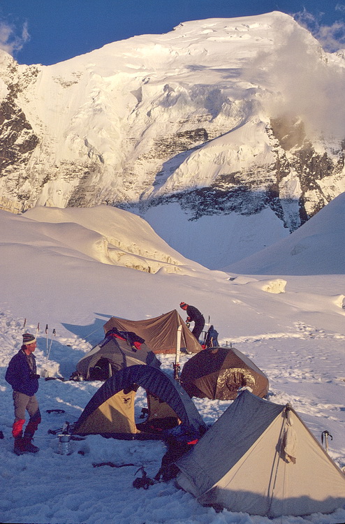
Die Küche des Moskwin Lagers auf etwa 4400 m Höhe. Im Hintergrund der etwa 2000 m hohe Borotkin Pfeiler, welcher den kürzesten und einfachsten Anstieg zum Pik Kommunismus ermöglicht. Der Gipfel rechts im Hintergrund ist der Pik Dushanbe (6950 m) über den der Anstieg erfolgt. Zuvor quert man das etwa 6000 m hohe Pamir Firnplateau (hinter der Eiswand). Es ist etwa 2 km breit und 10 km lang.
The kitchen of the Moskwin Camp at an altitude of 4400 m with the 2000 m Borotkin Pillar in the background which marks the shortest and 'easiest' ascent to Pik Communism. After crossing the Pamir Ice Plateau (6000 m - behind the ice wall) which is about 10 km long and 2 km wide Pik Dushanbe (summit in the background to the right - 6950 m) has to be climbed on the ascent route to Pik Communism.
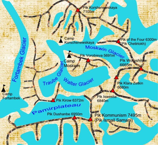
Das Moskwin Lager aus Richtung Pik Kommunismus (nach Nordwesten) gesehen. Im Hintergrund rechts der Gipfel des Pik Korshenewskaya (7105 m). Direkt nördlich des Moskwin Lagers fliesst der zerklüftete Moskwingletscher herunter.
View of the Moskwin Camp in north western direction. In the background Pik Korshenewskaya (7105 m). North of the Moskwin Camp the serac-covered Moskwin Glacier flows down.
Pik der Vier / Pik Chetriokh
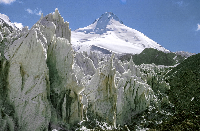
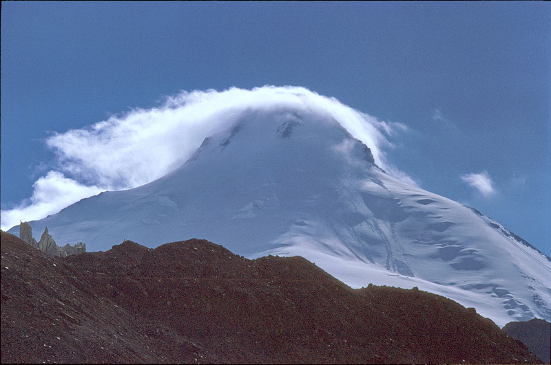
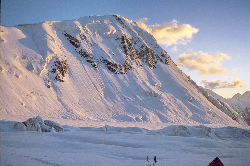
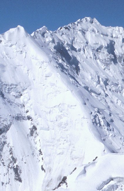
Der Pik der Vier (6300 m) von der südlichen Seitenmoräne oberhalb des Moskwin Lagers aus gesehen. Der Anstieg erfolgt über den Südrücken rechts. Die Wolkenhaube entsteht, wenn feuchte Luft über den Gipfel strömt. Durch Hebungsvorgänge kühlt sie ab und kondensiert zu einer Wolke, die sich beim Absinken der Luft hinter dem Berg wieder auflöst.
Peak of the Four (6300 m) seen from the southern side-moraine above Moskwin Camp. The ascent route leads up the south ridge to the right. The summit cloud is due to the elevation of humid air which leads to condensation and is dispersed again after sinking down behind the summit.
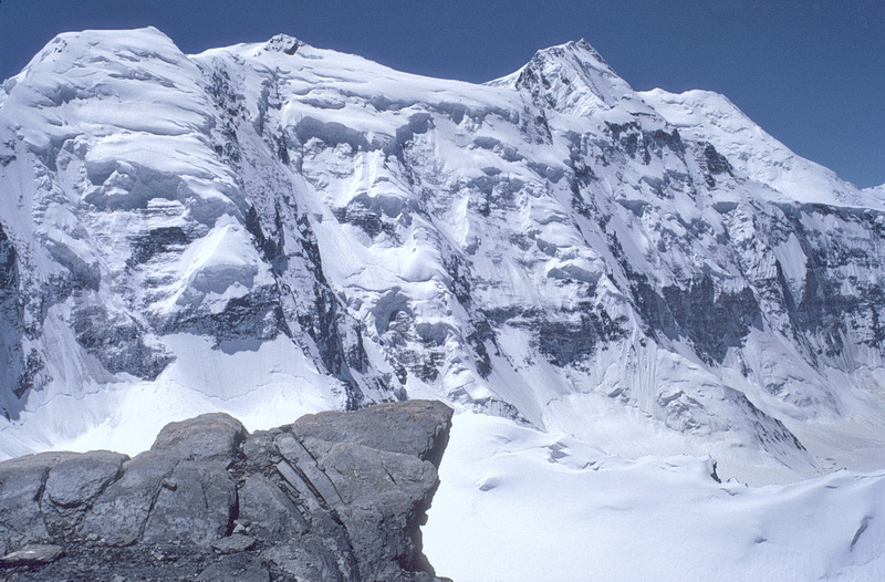
Übergang von der Moräne auf den Moskwin Gletscher. In diesem Bereich ist auf Eisschlag aus der Nordflanke des Pik Vorobieva (rechts ausserhalb des Bildes) zu achten. Das obere Gletscherbecken des Moskwin Gletschers (ca. 5000 m) quert man schräg nach links zu den Hängen des Pik der Vier. Im Hintergrund links der Pik Woroschilow (6665 m), rechts der Pik Klara Zetkin (6680 m).
Entering the Moskwin Glacier with Peak of the Four behind. In this area one should take care of potential icefall from the north face of Pik Vorobieva (right outside the picture). The upper glacier basin of the Moskwin Glacier (5000 m) is crossed diagonally to the left to reach the slopes of Peak of the Four. In the background to the left Pik Woroschilow (6665 m), to the right Pik Klara Zetkin (6680 m).
 |
Zur Besteigung des Pik der Vier vom Moskwin Lager aus ist ein Zwischenlager unterhalb des Berges am orografisch rechten Ufer des Moskwin Gletschers auf etwa 5200 m erforderlich. Im Hintergrund der Pik Klara Zetkin (6665 m). Daneben der Pik MFTI (5691m, auch Pik Vorobiewa genannt) im Abendlicht vom Zwischenlager am Pik der Vier. Oben die Eisbalkone, auf die bei der Querung des Moskwin Gletschers zu achten ist. An additional camp on the Moskwin Glacier (5200 m) is necessary to climb Peak of the Four. Behind Pik Klara Zetkin (6665 m). The right image shows Pik MFTI (5691 m, also called Pik Vorobiewa) seen from the intermediate camp below Peak of the Four. While crossing the Moskwin Glacier care should be taken of the seracs above. |
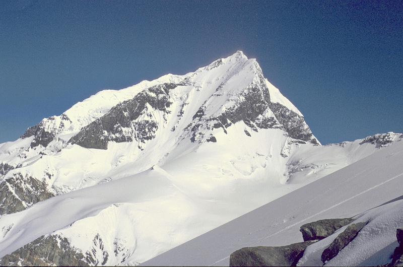 |
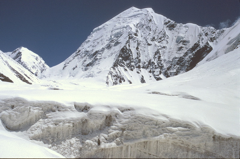
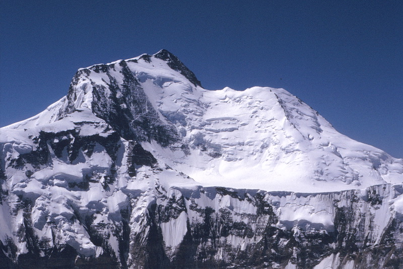
Die Südseite des Pik Korshenewskaya (7105 m). Im Vordergrund der mässig steile Firnhang, der zum Gipfel des Pik der Vier führt. South face of Pik Korshenewskaya (7105 m). In the foreground the moderately steep snow slope which leads to the summit of Pik of the Four. |
 |
Blick vom Gipfel des Pik der Vier nach Westen auf den Moskwin Gletscher. Das Moskwin Lager liegt auf der Felsinsel links etwas oberhalb der Gletscherzunge. Im Hintergrund ganz links der Pik Moskwa (6785 m). View from the summit down to the Moskwin Glacier. The Moskwin Camp is situated on the rock island left above the glacier tongue. In the background to the left Pik Moskwa (6785 m). |
 |
Blick auf den Borotkinpfeiler, von dessen höchsten Punkt man wenige hundert Meter zum Pamirplateau (etwa 6000 m) absteigt. Direkt auf dem Rand des Rückens verläuft die Aufstiegsspur. The Borotkin Pillar with the ascent route following the ridge. From its top one has to descend a few hundred meters down to the Pamir Plateau (6000 m). |
 |
Eine Etage höher als der Borotkinpfeiler führt der Anstieg zum Pik Kommunismus weniger steil den Rücken des Pik Dushanbe (6950 m) hinauf auf fast 7000 m. Above the Borotkin Pillar the further ascent to Communism Peak leads up the moderately steep flank of Pik Dushanbe (6950 m). |
 |
Vom Pik Korshenewskaya sieht man den Anstieg auf den Dushanbe und die Querung durch die Nordflanke des Pik Kommunismus auf den Gipfelgrat. Pik Kommunism and the upper part of the ascent as seen from Pik Korshenewskaya. The route leads up to Pik Dushanbe, traverses the north face and finally leads up the summit ridge. |
 |
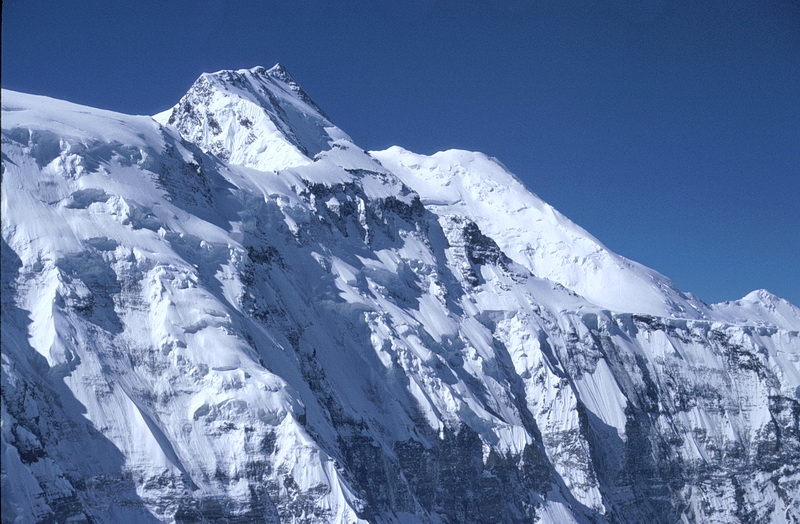
Das Massiv des Pik Kommunismus unterhalb der Gipfelfelsen des Pik der Vier. Von links: Pik Klara Zetkin (6665 m), Pik Iswestia (6840 m), Pik Kommunismus (7495 m), Pik Dushanbe (6950 m). The massif of Peak Communism from below the summit rocks of Peak of the Four. From left to right: Pik Klara Zetkin (6665 m), Pik Iswestia (6840 m), Communism Peak(7495 m), Pik Dushanbe (6950 m). |