Tagestouren im Hunzatal
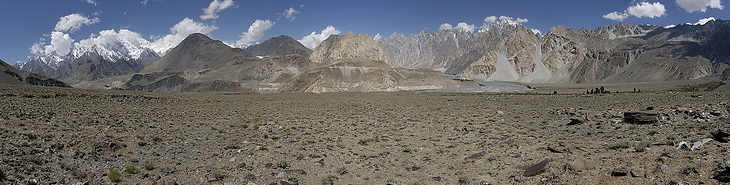
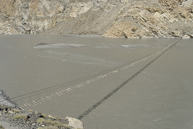
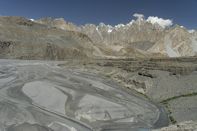
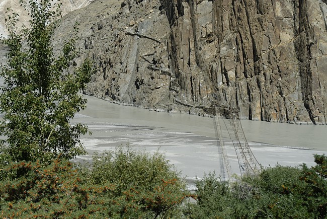
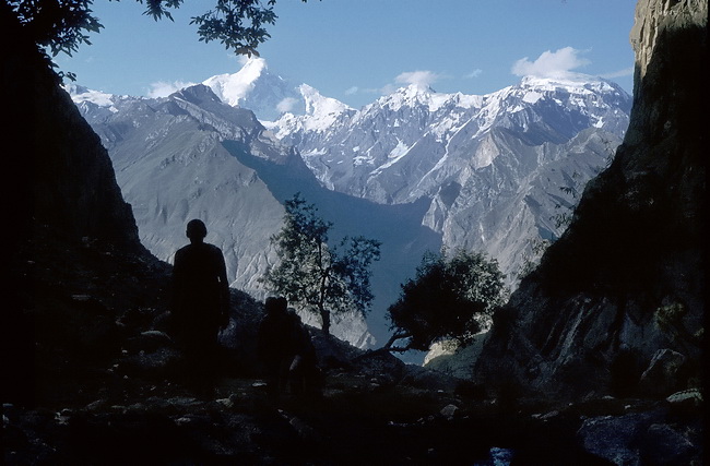
Abseits des Karakorum Highway überspannen immer noch abenteuerliche Hängebrücken den Hunzafluss. Das Panorama wurde auf dem weiten Schwemmlandkegel östlich von Pasu aufgenommen und zeigt links in Wolken den Ultar Peak mit der Endmoräne des Ghulkingletschers und in Bildmitte den nach links hinaufziehenden Patundasrücken.
Away from the Karakoram Highway adventurous suspension bridges are spanning the Hunza River. This Panorama was taken east of Pasu and shows Ultar Peak (left in clouds) and the moraine of the Ghulkin Glacier. In the center we can see the Patundas Ridge rising from right to left.
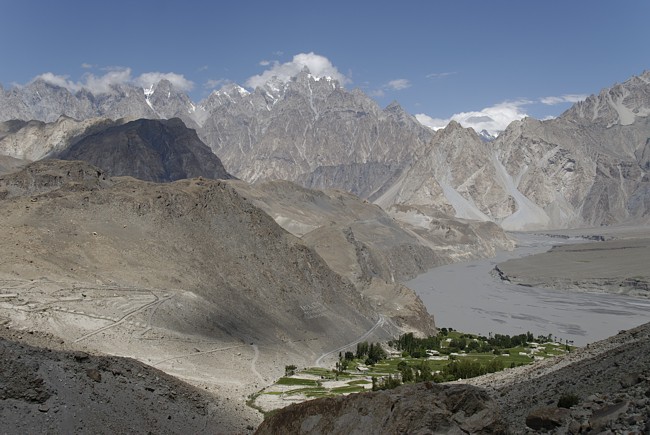 |
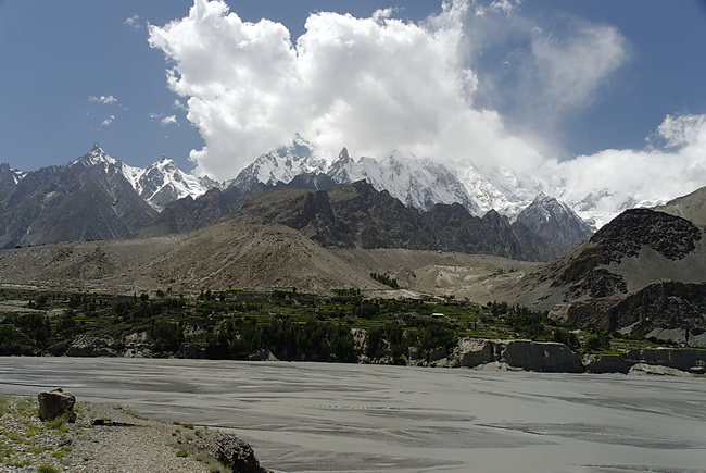
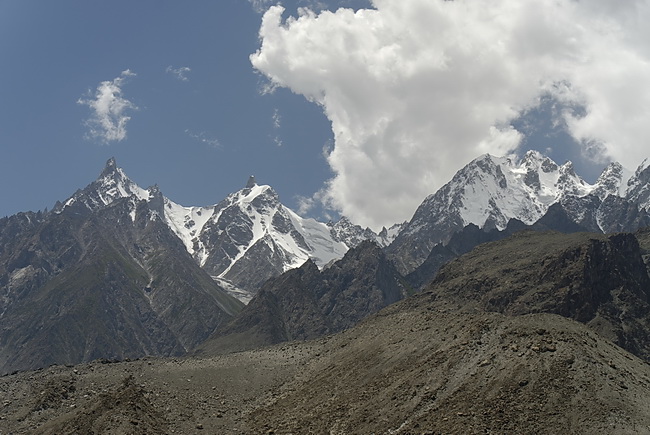
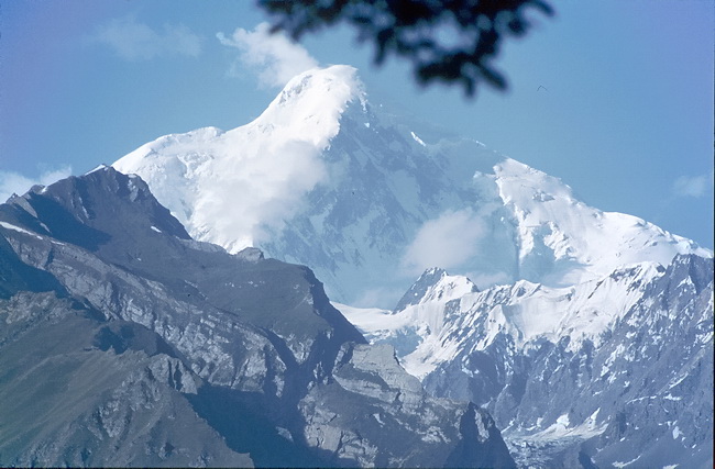
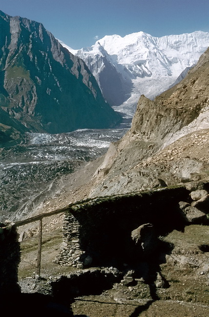
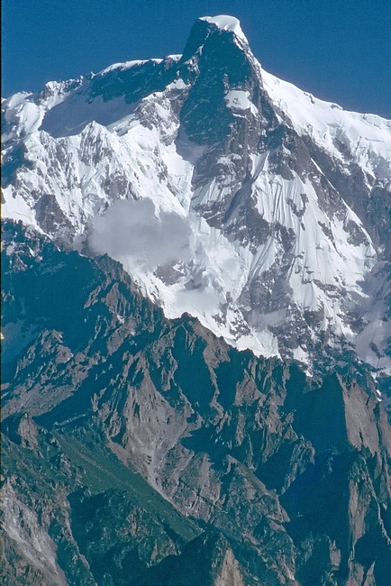
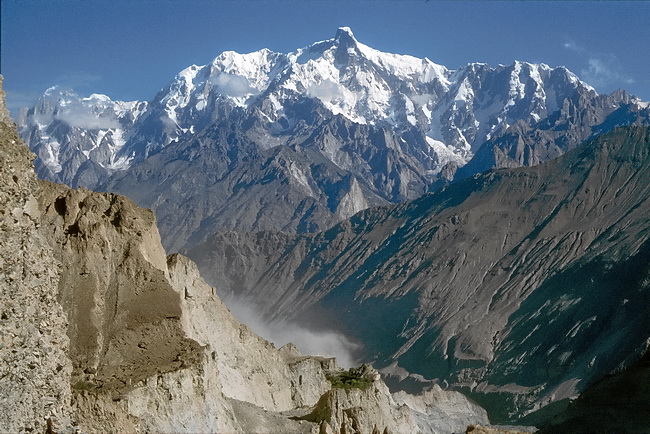
Von der Stirnmoräne des Ghulkingletschers hat man einen schönen Überblick über das obere Hunzatal und den Hunzafluss. Im Hintergrund die Pasu Kathedralen (6106 m). Hinter der Flussbiegung liegt Pasu. The moraine of the Ghulkin Glacier is a nice panorama point for the upper Hunza Valley, Hunza River and the Pasu Cathedrals (6106 m) behind. The village of Pasu is situated just behind the bend of the river. |
 |
 |
 |
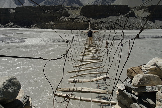
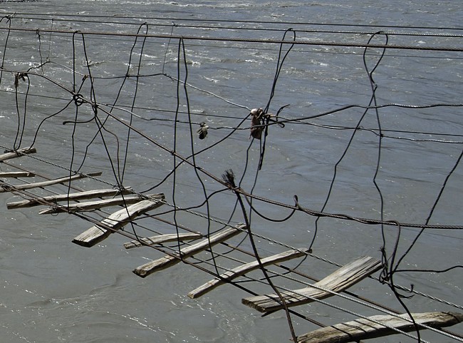
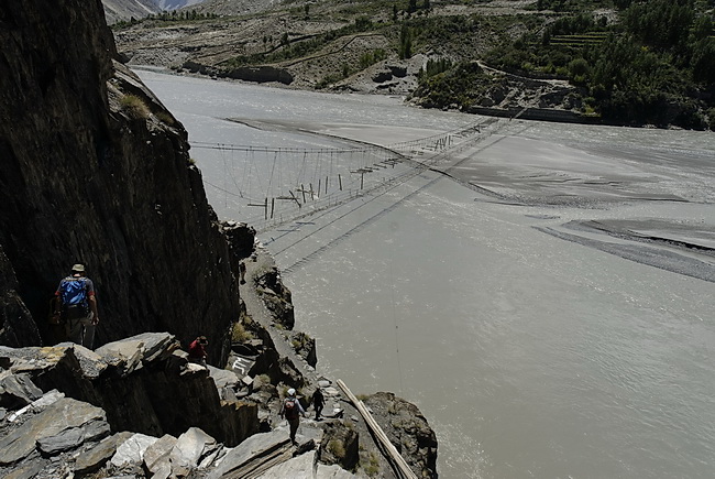
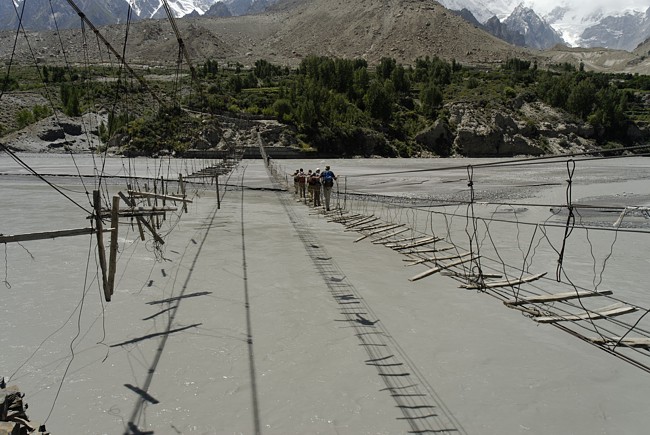
Eine schwankende Angelegenheit: die Hängebrücken über den Hunzafluss. Crossing the Hunza River on shaky ground showed us where the suspense in suspension bridge comes from. |
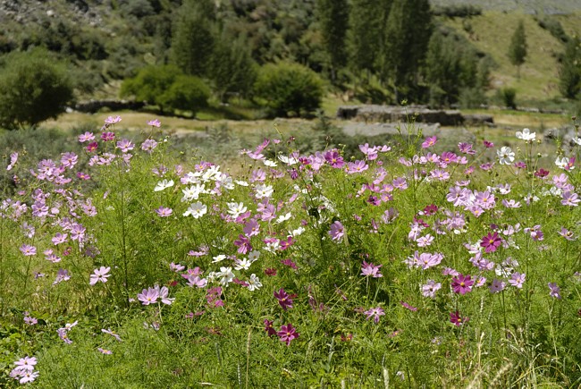
Jenseits des Hunzaflusses öffnet sich der Blick auf das Ultarmassiv. Nur wo künstlich bewässert wird, blüht alles im Überfluss.
Opposite the Hunza River: the Ultar Massive. Where artificial irrigation is practised everything is in full blossom.
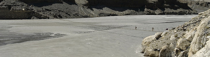
Ausserhalb der grünen Oasen erstreckt sich eine Hochgebirgswüste. Der Hunzafluss ist stellenweise fast einen Kilometer breit.
Beyond the green oasis only high-alpine desert can be found. The Hunza River is up to 1 km wide.
 |
 |
 |
Bei Ghulkin wartet die nächste Brücke. Near Ghulkin the next bridge was awaiting us. |
Tageswanderung zum Ultargletscher
Zur Akklimatisation kann man in einer Tageswanderung von Karimabad (2500 m) hinauf zum Ultargletscher (3200 m) steigen. Der Weg führt durch eine Schlucht hinauf zur Gletscherzunge, wo eine Hochalm liegt.
The ascent from Karimabad (2500 m) to the Ultar Glacier (3200 m) is a very good hike to improve the acclimatisation. The path leads through a canyon up to the tongue of the glacier and an alpine pasture nearby.
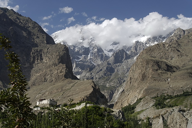
Schon von Karimabad aus erkennt man die Schlucht, durch die ein Weg zum Ultargletscher hinaufführt. Links das Baltit Fort, rechts der Gipfel des Bojohagur Duanasir (Ultar II - 7329 m). Der Höhenunterschied von Karimabad zum nur 8 km entfernten Gipfel beträgt gut 5000 m.
Already from Karimabad we could see the canyon we had to pass to get to the Ultar Glacier. The building on the left side is Fort Baltit. The upper part of Bojohagur Duanasir (Ultar II - 7329 m) which is only 8 kms away. The difference in altitude between Karimabad and the summit is nearly 5000 m.
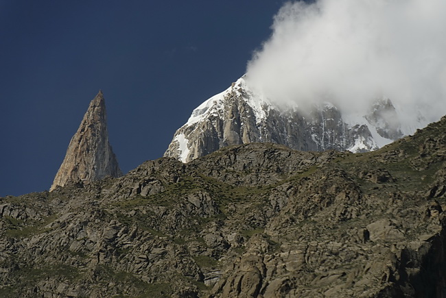
Felsnadel des Bubulimating (6000 m) im Südwestgrat des Bojohagur Duanasir und Hunza Peak (6220 m).
The needle of Bubulimating (6000 m) which belongs to the south-west ridge of Bojohagur Duanasir and Hunza Peak (6220 m).
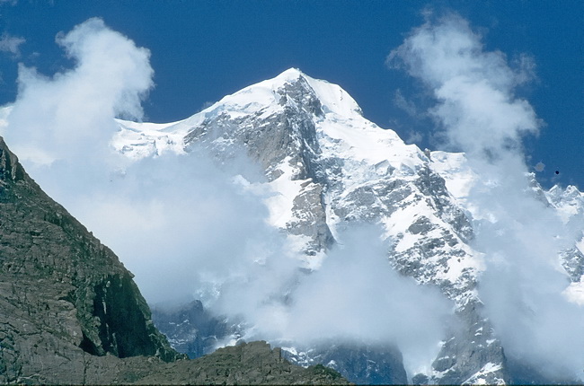
Oberhalb der Schlucht weitet sich der Blick zum Diran (7257 m) und den Gipfeln Pheker (5495 m) und Mirshikar (5486 m) rechts davon.
On top of the canyon the view is widening up to the summit of Diran (7257m) and the summits of Pheker (5495 m) and Mirshikar (5486 m) right of it.
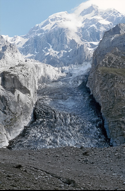 |
Der Weg endet auf einer Alm mit Blick auf den zerklüfteten Ultargletscher. The path ends at an alpine pasture with view to the rugged Ultar Glacier. |
Tagesfahrt nach Hopar zum Bualtargletscher
Das Nagartal zweigt bei Karimabad in südöstliche Richtung vom Hunzatal und entwässert den Hispar-, Bualtar-, Miar- und den Barpugletscher. Bis Hopar führt eine Jeepstrasse. Nicht in unserem Programm war die Wanderung zum Rush Lake (4614 m) mit einem Zwischenlager auf etwa 3300 m und die Besteigung des Rush Peak (5098 m). Die Aussicht vom Rush Lake auf die umliegenden Eisgipfel und Gletscher des Hispar Muztagh ist beeindruckend. Zur Orientierung dient die Kammverlaufskarte 1:200.000 'Karakoram, Gilgit, Hunza, Rakaposhi, Batura Area', Trekking and Mountaineering Map.
Near Karimabad the Nagar Valley is branching off from the Hunza Valley. It drains the Hispar-, Bualtar-, Miar-, and Barpu Glacier. A jeep road leads to Hopar where the our pictures were taken. An amazing panorama of the peaks and glaciers of Hispar Muztagh can be obtained from Rush Lake (4614 m) and Rush Peak (5098 m), a tour that needs one additional camp at 3300 m and unfortunately was not on our list. In 1981 we used the 'Karakoram Trekking and Mountaineering Map 1:200.000' for a basic orientation.
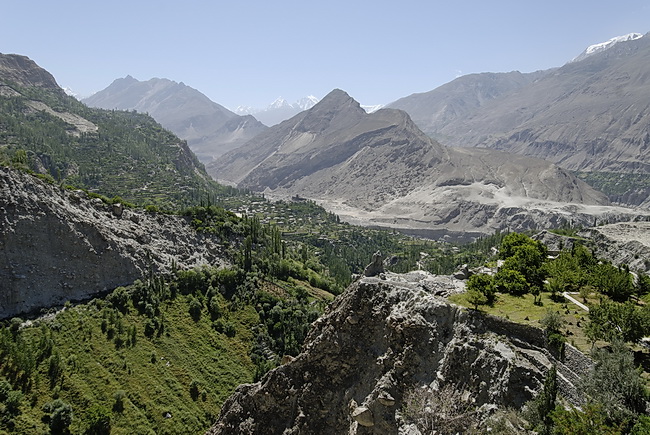 |
Im Mittelgrund das Hunzatal, rechts dahinter das Nagartal, ganz im Hintergrund die Eisgipfel am südlichen Ufer des Hispargletschers. Hunza- and Nagar Valley (right in the background) with the snow peaks beyond the Hispar Glacier. |
 |
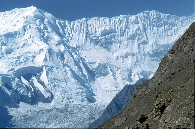
Von der grünen Oase Hopar blickt man auf den zerklüfteten Bualtargletscher (23 km lang, auch Hopargletscher genannt). Ganz links der Grataufschwung zum Miar Peak. The Bualtar Glacier (23 km - also called Hopar Glacier) seen from the green oasis of Hopar. On the left side we can see the beginning of the ridge leading to the summit of Miar Peak. |
Die Riffelwände gehören zum Südostgrat des Diran (rechts ausserhalb des Bildes) und haben eine Grathöhe von etwa 6400 m. Ähnlich hoch sind die Gipfel im rechten Bild südöstlich von Hopar zwischen Rush Peak und Spantik.
The combed ice walls belong to the south-east ridge of Diran (right outside the picture) and about 6400 m high. The peaks in the right picture are about 6300 m situated south-east of Hopar between Rush Peak and Spantik.
 |
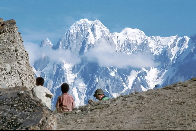
Von der Moräne des Bualtargletschers bei Hopar sieht man den Gratverlauf des Ultar Peak (7388 m). Ganz links der Hunza Peak. The ridge of Ultar Peak seen from the moraine of the Bualtar Glacier near Hopar starting with Hunza Peak to the left.
|