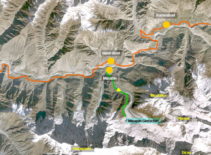
Wanderung zum Minapin Gletscher
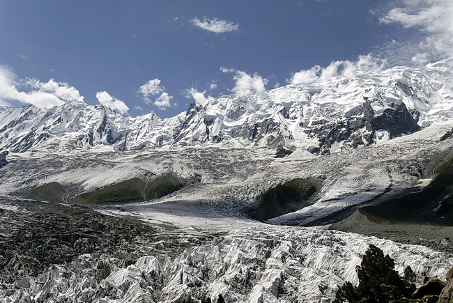
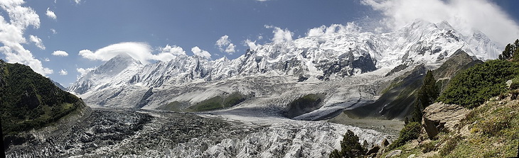
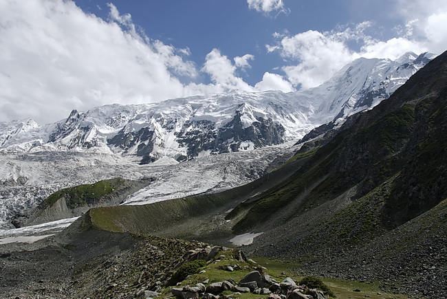
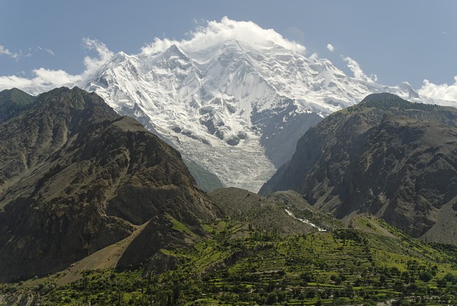
Unterhalb der imposanten Nordflanke des Rakaposhi liegt das Dorf Minapin auf 2050 m, dem Ausgangspunkt für unsere Wanderung zur Hochalm von Hapakund (2850 m), wo wir für zwei Nächte unsere Zelte aufstellten. Von dort führt eine 2-stündige Wanderung zur Seitenmoräne des Minapingletschers mit eindrucksvollen Ausblicken auf Rakaposhi, Diran und den Gletscher.
The village of Minapin (2.050 m) just below the impressive North Face of Rakaposhi was the starting point of our hike up to the alpine pasture of Hapakund (2.850 m) our campsite for the next two nights. From here a nice walk (2 hours) leads up to the moraine of the Minapin Glacier, a nice vantage point to take some panorama shots of Diran, Rakaposhi and the glacier.
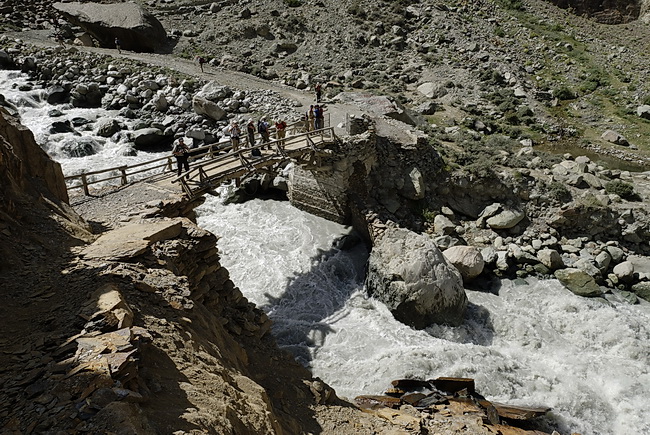
An der Brücke über den Minapinflusses bei Nalla auf etwa 2000 m Höhe beginnt der Aufstieg.
At the bridge across the Minapin River near Nalla about 2000 m a.s.l. the ascent starts.
 |
Auf der orographisch linken Seite des Minapinbaches führt der bequeme Anstieg zum Lager 1 unseres dreitägigen Trekkings. The first camp on our three days trek is reached on a comfortable trail along the left side of the Minapin stream. |
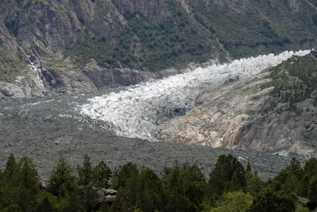
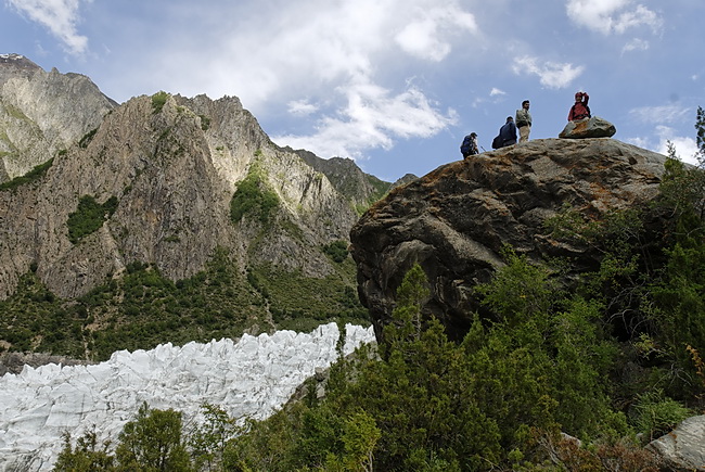
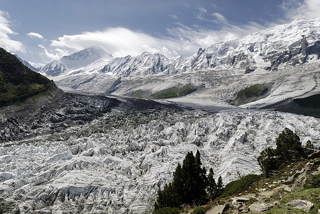
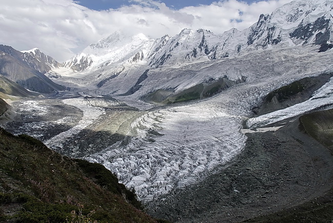
In einer S-Kurve windet sich der 18 km lange Minapingletscher zu Tal. Die Gletscherzunge liegt auf etwa 2500 m, der üblichen Höhe im westlichen Karakorum. Im östlichen Karakorum enden die Gletscher in Folge des ariden Klimas etwa 2000 m höher.
The tongue of the 18 km Minapin Glacier is situated at an altitude of around 2500 m which is very common for the western Karakoram. In the eastern part the glaciers are ending already 2000 m higher due to the aride climate of this area.
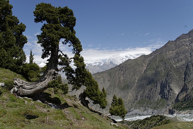
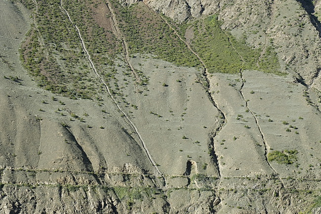
In Höhen um 3000 m gleicht die Landschaft den Alpen: grüne Weiden und Nadelwald. Die parallelen Linien sind Wasserleitungen, wie sie für das Hunzatal üblich sind. Das Wasser wird von den Gletscherbächen ins Tal geleitet und nach überlieferten Wasserrechten und Plänen auf die Felder verteilt.
At altitudes of around 3000 m the scenery has an alpine character with green meadows and coniferous forest. The parallel lines are special plumbings which are common in the Hunza Valley. The water is transported from the glaciers down to the valley and distributed according to traditional plans.
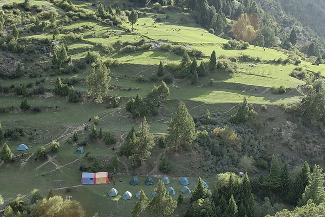 |
Das idyllische Zeltlager liegt auf etwa 2800 m Meereshöhe bei Hapakund am Weg zum Rakaposhi Basecamp. On the way to the Rakaposhi Basecamp we found an idyllic campsite near Hapakund at about 2800 m. |
Über das Hunzatal hinweg geht der Blick nach Norden zum Sangemar Sar – 7050 m in älteren Karten, 6950 m bzw. 6990 m in neueren Karten und 6962 m in Google Earth. Rechts vom Sangemar Sar der Pasu Sar (7493 m ) mit dem Felsgipfel des Pasu Diar (7284 m - ganz rechts) sowie Batura I (7785 m - links in Wolken). Rechts ausserhalb des Bildes folgen Shispare und Ultar Peak.
View across the Hunza Valley towards Sangemar Sar, a summit of 7050 m (in older maps) which has been degraded to 6950 or 6990 m in more recent ones and 6962 m in Google Earth. From left to right Sangemar Sar, Pasu Sar (7493 m), and the rock summit of Pasu Diar (7284 m).Batura I (7785 m) is still hidden by clouds.
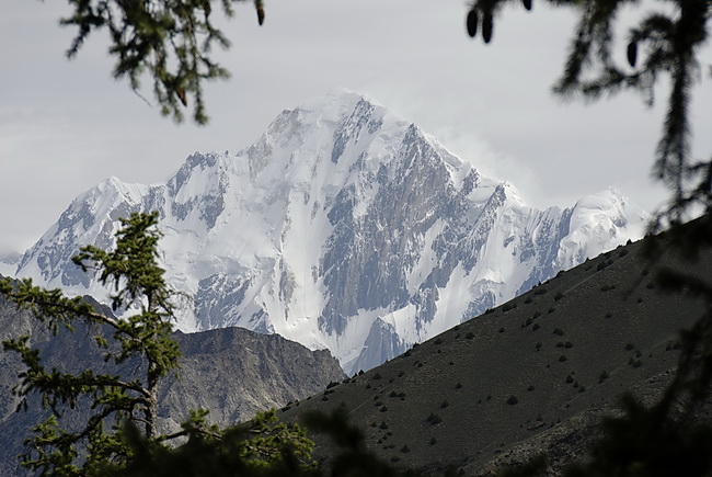
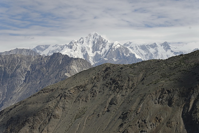
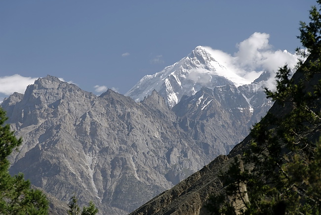
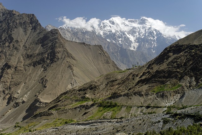
Nach Südosten weitet sich das Tal mit Blick auf den Diran (7266 m) mit seiner Nordflanke.
In south-eastern direction the valley widens until the north face of Diran (7266 m) appears in the background.
 |
Vom Verbindungsgrat zum Rakaposhi (rechts außerhalb des Bildes) münden zahlreiche Gletscher in den Minapingletscher. Quite a few glaciers flowing down from the ridge leading to Rakaposhi (right outside the picture) are feeding the Minapin Glacier. |
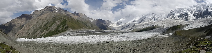
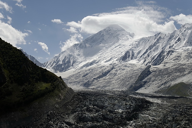
Im Karakorum scheinen die Gletscher nur wenig zurück zu weichen.
The global retreat of the glaciers does not seem to be much of an issue in the Karakoram area.
 |
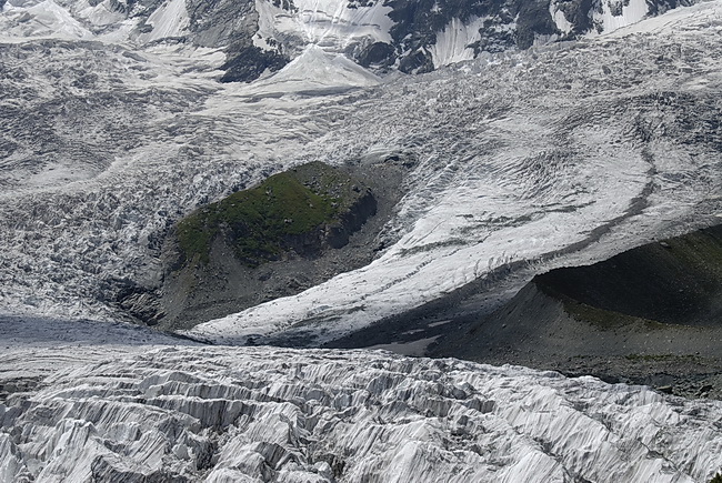
Hier kann man schön beobachten, wie die verschiedenen Mittelmoränen eines Gletscher entstehen. In this picture one can easily see how the different central moraines of a glacier are formed. |
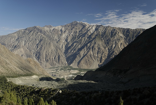
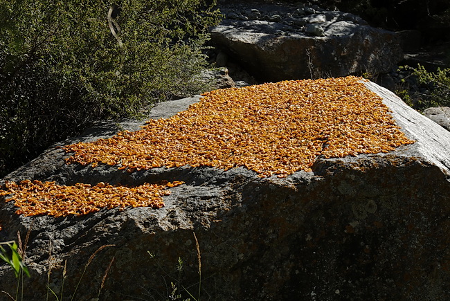
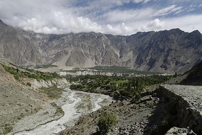
Blick ins Hunzatal auf die grüne Oase von Nasirabad. Der Gipfel im Hintergrund ist 'nur' 4544 m hoch und heisst Hachindar. Getrocknete Aprikosen sollen ein Geheimnis für das gesunde und lange Leben der Einwohner des Hunzatales sein.
View of the Hunza Valley and the green Oasis of Nasirabad. The summit behind is 'only' 4544 m high and called Hachindar. Dried apricots are supposed to be one of the secrets for the long and healthy life of the inhabitants of Hunza Valley.
Beim Abstieg kommt im Norden der Shispare (7611 m) ins Blickfeld. Er ist der zweithöchste Gipfel in der 32 km langen Mauer des Batura Muztagh. Das Ultarmassiv mit dem Bojohagur Duanasir (7318 m - Bildmitte) und dem Ultar Peak (7350 m - rechts) sind die östlichsten Gipfel des Baturamassivs. Links etwas dahinter in Wolken der Shispare.
During the descent Shispare (7611 m) the second highest peak in the 32 km wall of the Batura Muztagh appears. The Ultar Massive with Bojohagur Duanasir (7318 m - center) and Ultar Peak (7350 m - right of it) are the eastmost summits of the Batura Range. Shispare on the left side is still hidden by clouds.
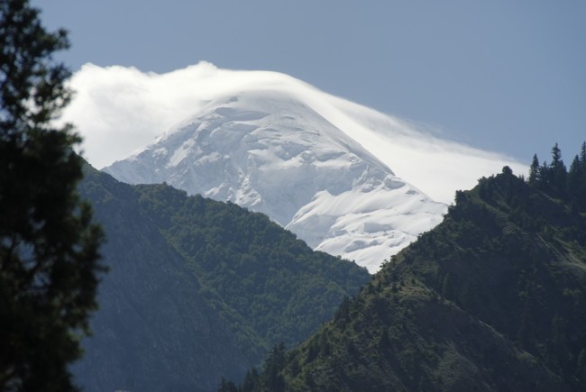
Ein letzter Blick zur Nordflanke des Diran. Zurück im Tal wird erstmals der Rakaposhi ('Fischschwanz' - 7788 m) in voller Grösse sichtbar. Im Vordergrund die Ortschaft Minapin.
Final view of the Diran north-face. Back down in the valley we had a excellent view of Rakaposhi ('fishtail' - 7788 m) and the village of Minapin.