Karakorum Highway I
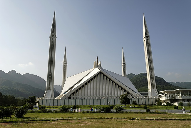 |
Shah-Faisal-Moschee in Islamabad. Sie wurde in den Jahren 1976 -1984 fertiggestellt und von König Faisal Shah-Faisal-Masjid. This modern mosque was built between 1976 and 1984, financed by King Faisal and the government of Saudi Arabia. The four minarets are 90 m high. |
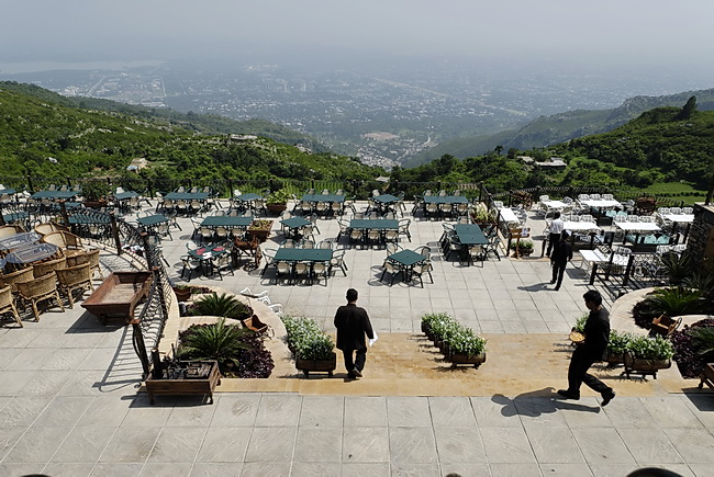 |
Restaurant "The Monal" in den Margalla Hügeln (1000 m) mit Blick auf Islamabad. Die Hauptstadt Pakistans wurde erst in den sechziger Jahren erbaut und hat knapp eine Million Einwohner. Wesentlich orientalischer wirkt hingegen die Nachbarstadt Rawalpindi.
Restaurant "The Monal"in the Margalla Hills (1000 m) with view of Islamabad the capital of Pakistan since the nineteen sixties. Though nearly one million people live in Islamabad, the nearby city of Rawalpindi has much more oriental flair. |
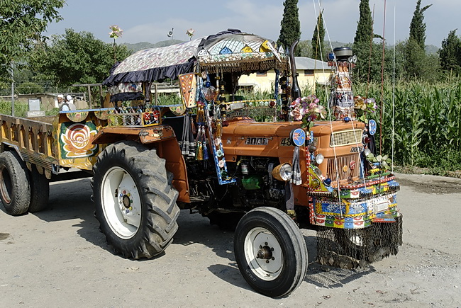
Der Karakorum Highway durchquert nördlich von Islamabad zunächst ein grünes Mittelgebirge bis die Straße bei Besham den Indus erreicht.
The Karakorum Highway crosses a green low mountain range north of Islamabad until the road reaches the Indus River near the town of Besham.
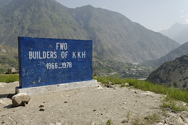
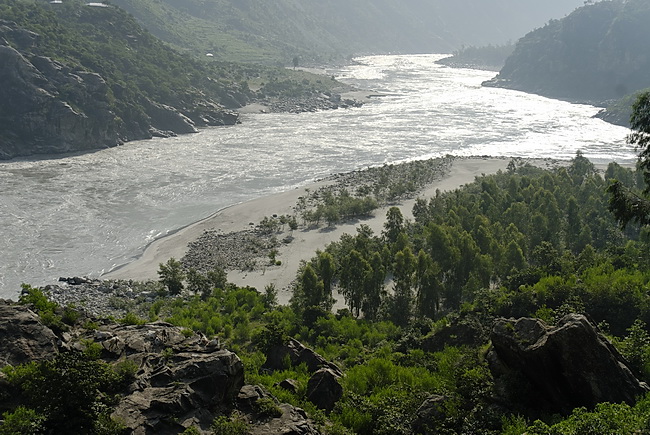
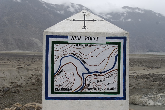
Der Karakorum Highway (KKH) wurde in 12 Jahren von den Chinesen erbaut. Er führt über 806 Km von Rawalpindi über Gilgit im Hunzatal auf den Kunjerab Pass an der chinesischen Grenze. Nach weiteren 480 km entlang der Siebentausender des chinesischen Pamirs erreicht die Straße Kashgar. Bei Besham verlässt der Indus die Himalayaschluchten.
The Karakoram Highway (KKH) was constructed within 12 years by the Chinese. Starting at Rawalpindi it passes Gilgit and the Hunza Valley and finally reaches the Chinese border at Kunjerab Pass. Along the 7000 meter peaks of the Chinese Pamir Range, the mainly alphalted road ends at Kashgar after 905 miles. Near Besham, the Indus river leaves the Himalayan gorges.
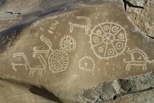
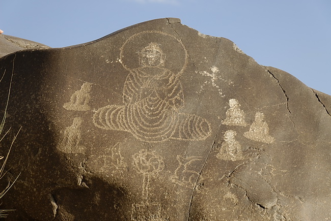
Im Indus- und Hunzatal, sowie den angrenzenden Tälern gibt es schätzungsweise 50.000 Felszeichnungen aus der Jungsteinzeit vor 10.000 Jahren bis ins 1. Jahrtausend unserer Zeitrechnung. Unsere Bilder entstanden bei Chilas. Die Felszeichnung zeigt den historischen Buddha Sakyamuni, der seinen ersten 5 Schülern (seinen Weggefährten aus der Askesezeit) im Gazellenhain von Sarnath die vier Edlen Wahrheiten und das Prinzip von Ursache und Wirkung erklärt.
An estimated 50.000 rock carvings dated from the early Stone Age 10.000 years ago until the first millenium are found in the valleys of Indus, Hunza and other parts of this area. Our fotos were taken near the town of Chilas.These carvings show the historical Buddha Sakyamuni explaining the Four Noble Truths and the principle of cause and effect to his first five students who were formerly his companions during his period of fastings. The teachings were given in the deer forest of Sarnath near Varanasi.
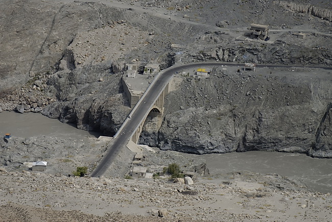
Von der legendären Rakhiotbrücke führt eine Schotterstrasse vom Indus (1100 m) hinauf nach Tato (2500 m). Tato ist der Ausgangsort zur Märchenwiese auf der Rakhiotseite des Nanga Parbat. Blick auf den Indus und den Karakorum Highway oberhalb der Rakhiotbrücke. Die Landschaft ist im Talgrund wüstenhaft, grüne Wälder gibt es nur zwischen 2000 und 3500 Meter.
A narrow road leads up from Rakhiot Bridge and the Indus River (1100 m) to the village of Tato (2500 m). Tato is the starting point for Fairy Meadows on the north side of Nanga Parbat.A view to the Indus River and the Karakoram Highway. The scenery is desert-like, green forests are only growing at an altitude of 2000 m to 3500 m.
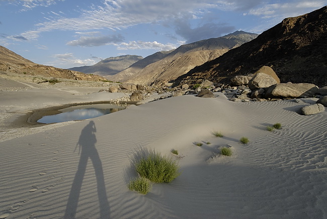
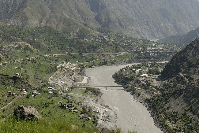
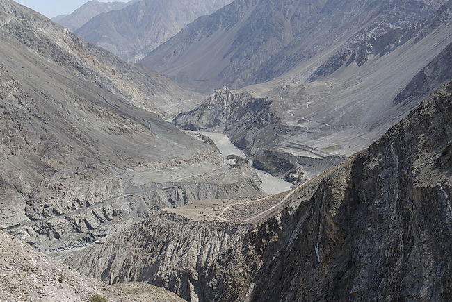
Sanddünen am Indus bei Chilas. Der Fluss bringt gewaltige Sandmengen aus den Karakorumgletschern mit. Bei Temperaturen bis zu 40 Grad Celsius verdunstet der Regen bevor er die Talsohle erreicht. Am sogenannten Pamirknoten bei Jaglot, nahe dem Zusammenfluss von Indus und dem Hunzafluss, stoßen drei Kontinentalplatten zusammen, welche den Himalaya mit dem Nanga Parbat, den Hindukusch und das Karakorumgebirge tragen.
Sand dunes near Chilas by the Indus River. The Indus River is transporting enormous amounts of sand from the Karakoram glaciers. At temperatures up to 40 degrees centigrade rain evaporates before reaching the valley. This place at Jaglot where Indus and Hunza River meet is called 'Pamir Knot', as this is also the junction point of three tectonic plates, carrying the Himalayas with Nanga Parbat, the Karakoram and the Hindukush Range.
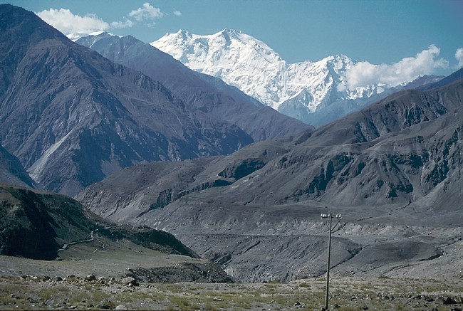 |
Der Nanga Parbat vom Industal. Nanga Parbat seen from the Indus Valley. |