Adamello: Lobbia Alta
Als Südpol der Ostalpen wird das Gebigsmassiv des Adamello und der Presanella manchmal bezeichnet. In der Tat sind der Mandronegletscher mit dem Pian di Neve und der Lobbiagletscher die einzigen Plateaugletscher Italiens. Die gesamte vergletscherte Fläche des Adamello beträgt etwa 42 Quadratkilometer, davon ist der Mandronegletscher mit 18 Quadratkilometern auch der grösste Gletscher Italiens. Etwa halb so gross sind der Lobbiagletscher mit (8 qkm) und der Laresgletscher (10 qkm). Die Presanellagruppe ist deutlich weniger vergletschert. Zentraler Stützpunkt für zahlreiche Hochtouren ist die Lobbia Alta Hütte (3040 m) im Zentrum der Adamelloberge, während man die Presanella von der Denzahütte (2298 m) - erreichbar vom Tonalepass - besteigt.
The Adamello - Presanella range is sometimes called the south-pole of the eastern alps. Indeed the Mandrone Glacier with Pian di Neve and Lobbia Glacier are the only Italian plateau glaciers. The whole glacial area of the Adamello Range covers approximately 42 square kilometers of which the Mandrone Glacier is the largest Italian glacier (18 km²). Lobbia Glacier (8 km²) and Lares Glacier (10 km²) are about half the size. Significantly less glaciers are found in the Presanella Range. The central base in the Adamello area is the Lobbia Alta Hut (3040 m) whereas Presanella is climbed from the Denza Hut (2298 m) which is reached from the Tonale Pass.
 |
|
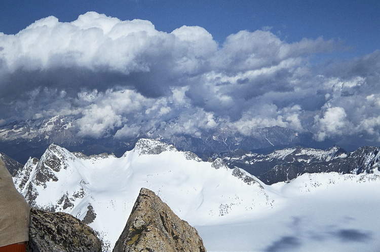
Am Gipfel des Monte Vioz (3645 m) hat man einen umfassenden Blick auf die Presanella- und Adamelloberge.
The summit of Monte Vioz shows a comprehensive view of the Presanella and Adamello mountains.
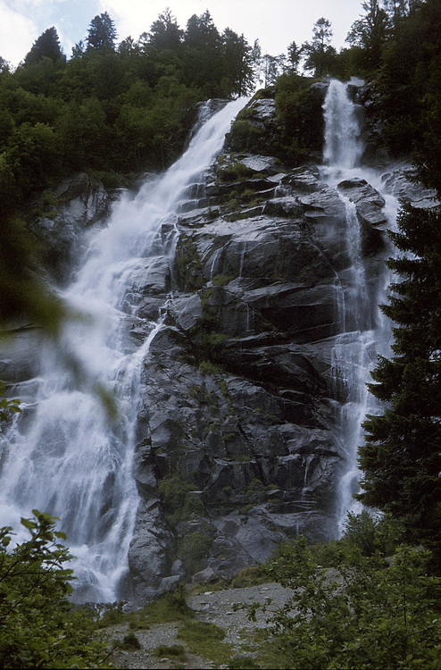 |
Von Madonna di Campiglio fährt man südwärts hinunter nach Carisolo und biegt kurz vor dem Ortseingang in das Val di Genova ein. Nach etwa 4 km stürzen von rechts die Nardisfälle (Cascate di Nardis) herab, deren Wasser aus dem Nardisgletscher stammt, der südwestlich der Cima Presanella im oberen Val di Nardis liegt. The Nardis Cascades in the Genova Valley south of Madonna di Campiglio receive their water from the Nardis Glacier which is situated in the upper Nardis Valley south-west of Cima Presanella. |
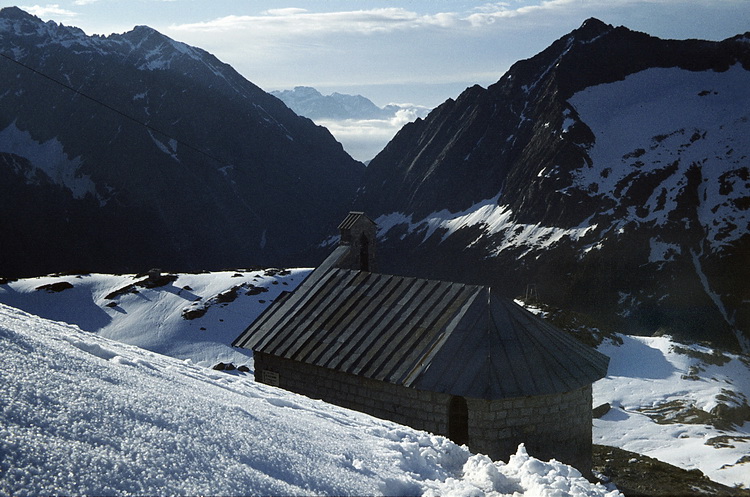

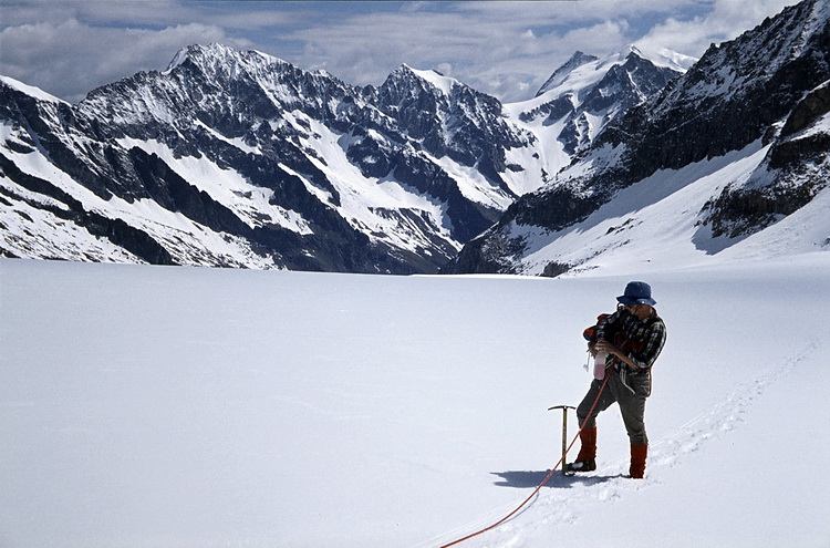
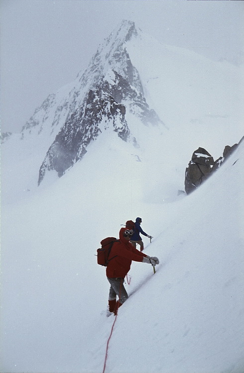
Kapelle neben dem Rifugio Mandrone (2440 m) mit Blick ostwärts auf das wilde, tief eingeschnittene Val di Genova. Vom Rifugio Bedole (1700 m) steigt man in 2 Stunden zum Rifugio Mandrone auf. Trotz der südlichen Lage kann es im Sommer auch im Adamellogebiet reichlich Neuschnee geben! Vom Rifugio Mandrone (2440 m) hat man einen schönen Blick auf die Zunge des Mandronegletschers und die drei Lobbiagipfel. Der Anstieg auf den Gletscher zur Lobbia Alta Hütte (3040 m) erfolgt rechts der Spaltenzone.
Chapel beneath the Mandrone Hut (2440 m) high above the wild, deeply cut valley of Val di Genova. The ascent from the Bedole Hut (1700 m) to the Mandrone Hut takes about 2 hours. Inspite of its southern location you can have lot of fresh snow in the Adamello area - even in summer! From the Mandrone Hut (2440 m) we had a nice view towards the three Lobbia peaks and the Mandrone Glacier which crossed leaving the crevasses to the left.
 |
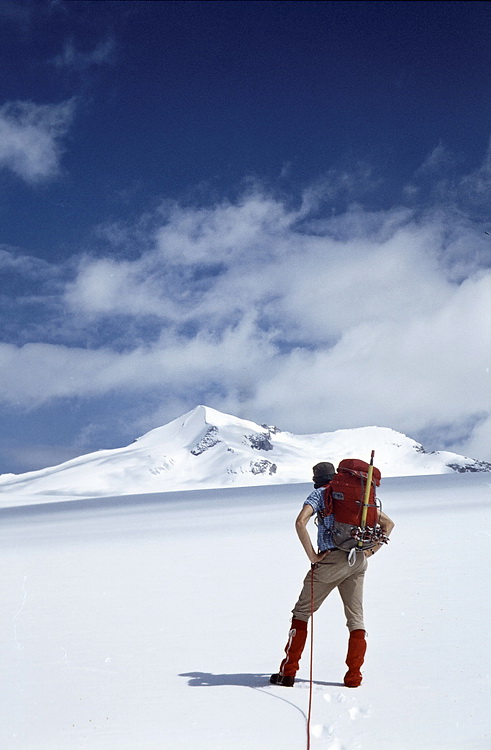
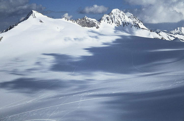
Der flache Mandronegletscher ist 2-4 km breit und 8 km lang. Die Trasse zur Lobbia Alta Hütte (3040 m) war mit Stangen markiert. Der Tiefblick vom der Lobbia Alta hat gezeigt, dass auch hier verdeckte Spalten zu queren sind. Im Hintergrund rechts die dreigipfelige Presanella, der Monte Cercen und die Cima Busazza. The flat Mandrone Glacier is 2-4 kms wide and 8 kms long. The track to the Lobbia Alta Hut was marked with poles. Looking down from the Lobbia Alta later we could see that we had in fact crossed a lot of hidden. snow-covered crevasses. In the background the three summits of Presanella, Monte Cercen and Cima Busazza. |
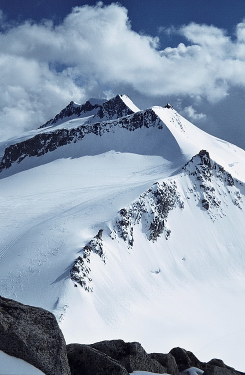
Blick vom Mandronegletscher südwestwärts zum Corno Bianco (3434 m). Der Adamellogipfel liegt nochmals etwa 2 km dahinter. Der Anstieg zum Adamello kann über den Corno Bianco oder links davon über den Mandronegletscher gemacht werden. Ohne Schwierigkeiten in einer halben Stunde von der Lobbia Alta Hütte erreichbar ist der Gipfel der Lobbia Alta (3196 m). Er bietet einen hervorragenden Blick auf die Gletscher des Adamellogebietes, die Presanella und hinüber zur Brenta. Hier der Blick südwärts zum Dosson di Genova mit dem Corno della Croce (3276 m), wo in einer Scharte noch eine Kanone aus dem 1. Weltkrieg steht.
South-eastern view from the Mandrone Glacier towards Corno Bianco (3434 m). The summit of Adamello is still 2 kms behind. Adamello can be climbed via Corno Bianco or left of it following the Mandrone Glacier. The summit of Lobbia Alta is reached easily from the Lobbia Alta Hut in about half an hour. From there one has a magnificent view to the glaciers of the Adamello range, Presanella and the Brenta mountains. This is the view in southern direction to Dosson di Genova with Corno della Croce (3276 m) where you still can find a canon from World War I.
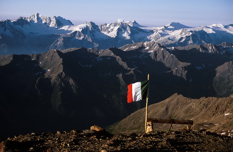
Blick von der Lobbia Alta nach Nordosten zur dreigipfeligen Presanella. Die linke Einsattelung ist der Passo Cercen, den man von der Denzahütte erreicht, nach rechts erfolgt der Aufstieg zum Freshfieldsattel zwischen der Cima di Vermiglia (links) und dem Monte Gabbiolo (3458 m - Mitte). Hinter dem Monte Gabbiolo quert man nach rechts zur Cima Presanella. Genau über der Bildmitte die Ago de Nardis (Nardisnadel - 3289 m) und die Corne delle Rochette (3289 m). Rechts der Blick von der Lobbia Alta nach Osten zur wolkenverhangenen Brenta. Im Mittelgrund rechts der Passo di Folgorida (2939 m), links davon die beiden Gipfel des Crozzon di Folgorida (3079 m).
North-eastern view from Lobbia Alta towards the three summits of Presanella. The saddle to the left is the Cercen Pass, which is reached from the Denza Hut. From there the further ascent leads up to the Freshfield Saddle between Cima di Vermiglia (left) and Monte Gabbiolo (3458 m - the central summit). Behind Monte Gabbiolo a traverse to the right leads to the main summit of Cima Presanella. In the center of the picture Ago de Nardis (the Nardis needle - 3289 m) and Corne delle Rochette. The right picture shows the cloud covered Brenta mountains in eastern direction. In front of them the Falgorida Pass (2939 m), left of it the twin summits of Crozzon di Falgorida (3079 m).
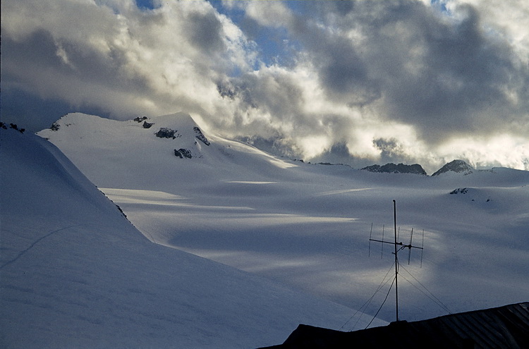
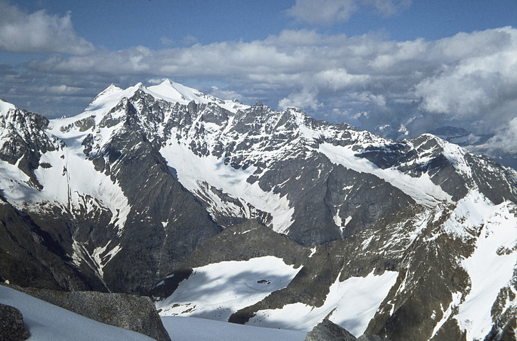
Der Blick nach Südosten von der Lobbia Alta geht über den parallel zum Mandronegletscher verlaufenden Lobbiagletscher zum Crozzon di Lares (3354 m - links). Die Einsattelung rechts vom Gipfel ist der Passo di Cavento (3191 m), über den man ostwärts zum dritten grossen Gletscher des Adamello, dem Vadretta di Lares und zur Care Alto Hütte gelangt. Der Care Alto (3462 m) - das Firndreieck hinter dem Corno di Cavento (3402 m - rechts der Bildmitte) ist der südlichste und zweithöchste Gletschergipfel des Adamellogebietes. Der abendliche Blick von der Lobbia Alta Hütte zum Corno Bianco (3434 m) nach Westen ließ noch auf besseres Wetter hoffen.
South-eastern view to the Lobbia Glacier and Crozzon di Lares (3554m - left). The gap right of the summit is the Cavento Pass (3191 m), which can be traversed to reach the Care Alto Hut and the Lares Glacier, the third large glacier in the Adamello area. Care Alto, the snow covered triangle behind Corno di Cavento (3402m - right of the center) is the southmost and second highest summit of the Adamello range. The evening view from the Lobbia Alta Hut towards Corno Bianco (3434 m) gave us some hope for improving weather conditions.
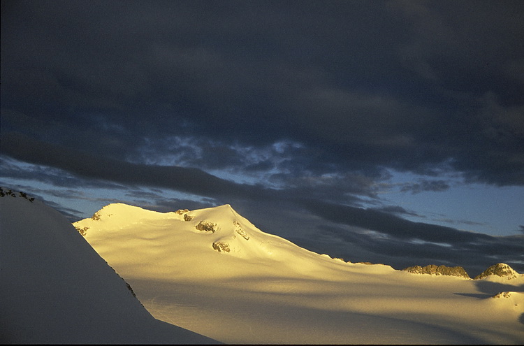
Die Wolken am Morgenhimmel kündigten allerdings schlechtes Wetter an und so endete diese Tour im Schneetreiben am Passo di Cavento unterhalb des Crozzon di Lares (3354 m). The upcoming morning clouds disappointed our hopes |
 |