Märchenwiese am Nanga Parbat
Märchenwiese heisst die Almenlandschaft im Rakhiot Tal nördlich des Nanga Parbat auf etwa 3200 – 3500 m Höhe. Die ersten Expeditionen waren überrascht von den blühenden Bergwiesen und Wäldern, nachdem sie aus dem wüstenhaften Industal heraufgestiegen sind. Nur in diesen Höhen regnet es genügend und mit jedem Kilometer talauswärts wird es trockener und wärmer. Tato bedeutet 'warm' und ist eine kleine Siedlung auf etwa 2300 m im Rakhiot Tal, benannt nach einer warmen Quelle in der Nähe. Früher war es ein beschwerlicher Fussmarsch von der Rakhiotbrücke über den Indus herauf nach Tato, heute überwindet eine Schotterstrasse die etwa 1000 Höhenmeter. Mit einem Zwischenlager lässt sich der Jiliper Peak (5206 m) besteigen.
Fairy Meadows is the name of an area of alpine pastures in the Rakhiot Valley north of Nanga Parbat. The members of the first expeditions were surprised by the blooming alpine meadows and forests they found at altitudes between 3.200 and 3.500 m after ascending from the desert-like Indus Valley. It is only at these altitudes that the necessary amounts of rain are falling. Tato (meaning 'warm') is the name of a small village in the Rakhiot Valley (2300 m) which is named after a hot spring nearby. In 1981 we still had to walk the 1000 m starting at Rakhiot Bridge in the Indus Valley. In the meantime a gravel road has been built and Tato can be reached more or less comfortably by car. With one additonal camp Jiliper Peak can be climbed (5206 m).
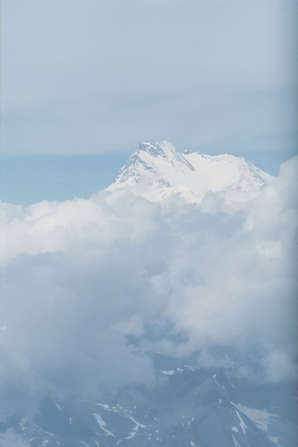 |
Flug nach Gilgit - 1981 durfte man noch mit der Kamera ins Cockpit. Links der Nanga Parbat (8125 m), daneben der erste Blick zu den Siebentausendern des Karakorum: In der Mitte der Malubiting (7458 m), Spantik (7027 m - 2.Gipfel rechts davon) und der Leila Peak (6985 m). On the light to Gilgit. In 1981 we were still allowed to take photos directly from the cockpit. Passing Nanga Parbat (8125 m) we finally got a first view of the Karakoram 7000 m peaks (above). In the center Malubiting (7458 m), Spantik (7027 m - the second summit right of it) and Leila Peak (6985 m). |
 |
Wir starteten wir um Mitternacht mit einem kleinen Bus in Gilgit, um im Morgengrauen an der Rakhiotbrücke den Aufstieg nach Tato über den Buldarkamm zu beginnen. Am Tag ist es dafür zu heiss. We left Gilgit at midnight to reach the Rakhiot Bridge at the break of dawn and start the ascent to Tato across the Buldar Ridge. An early start can be recommended as it is too hot during the daytime. |
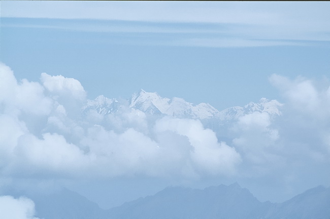
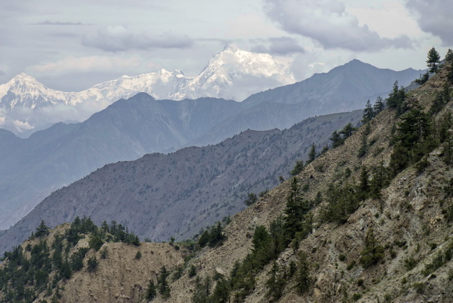
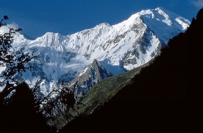
Nach Sonnenaufgang geht der Blick vom Buldarkamm nordwärts zu den Karakorumbergen. Von links: Dobani (6134 m), dahinter Diran (7257 m) und Phuparash (6785 m) rechts. 1000 m über dem Industal beginnt die erste Vegetation, darunter ist es zu trocken.
After sunrise we had a nice view towards the Karakoram mountains. From left to right: Dobani (6134 m) with Diran (7257 m) behind it and Phurapash (6785 m- right). Vegetation is not found until about 1000 m above the Indus Valley as it is too dry at lower altitudes.
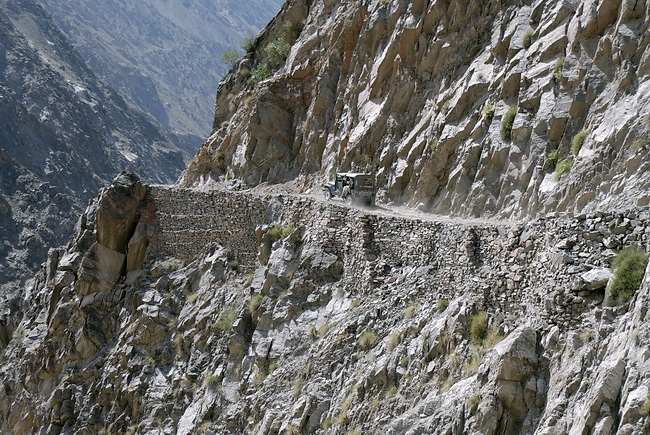
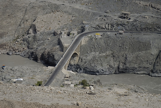
Seit einiger Zeit gibt es eine unbefestigte Strasse nach Tato auf der dem Buldarkamm gegenüber liegenden Seite des Rakhiotbaches. Aussicht auf der Fahrt nach Tato: im Mittelgrund der Buldarkamm, dahinter ein Seitental des Indus, der links ausserhalb des Bildes liegt und im Hintergrund der Malubiting (7458 m - Mitte).
In the meantime a gravel road has been built to connect Tato and the Indus Valley. The dominating peak in the center behind the Buldar Ridge is Malubiting (7458 m).
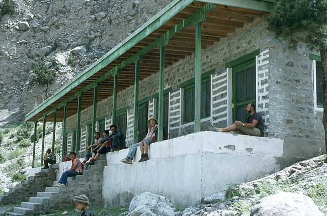 |
Das Schulhaus war früher die einzige Übernachtungs-möglichkeit in Tato. In the past the schoolhouse in Tato was the only place to stay overnight. |
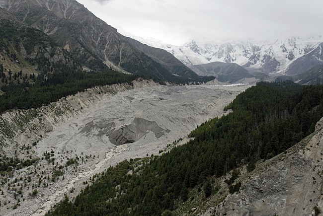

Von Tato geht es nochmals 700 Höhenmeter bergan, bis man oberhalb der Zunge des Rakhiotgletschers die Märchenwiese erreicht. Sie wurde von den ersten Expeditionen so genannt, weil es dort wie in den Alpen Wälder und blühende Bergwiesen gibt. Mittlerweile gibt es auch auf der Märchenwiese nette kleine 'Appartements'.
From Tato another 700 m have to be climbed until Fairy Meadows is reached just above the tongue of the Rakhiot Glacier. The name was given to this place by the first expeditions because of the beautiful scenery with forests and blooming alpine meadows. In the meantime nice little 'appartements' are available even at Fairy Meadows.
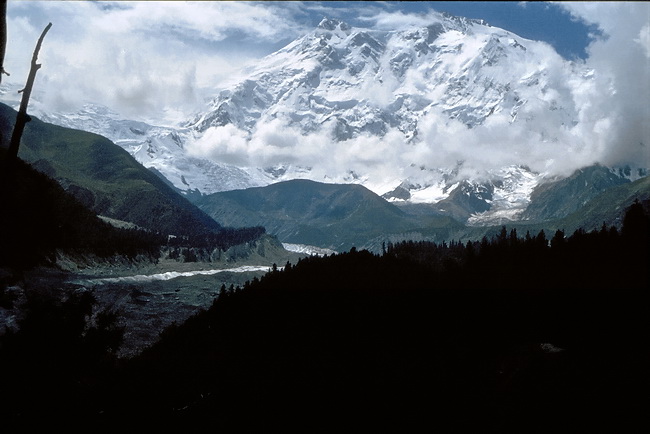
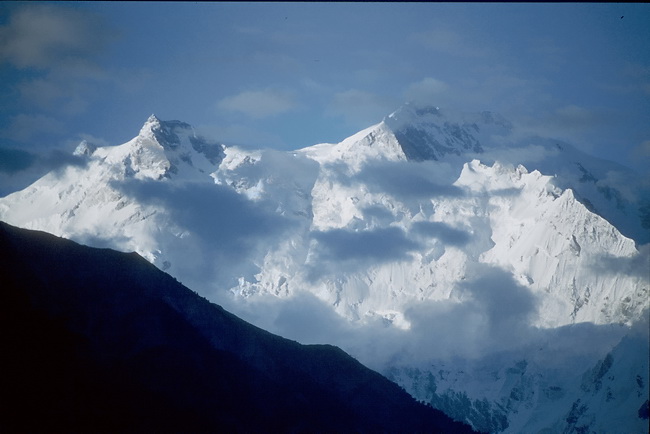
Überdimensional wirkt der Nanga Parbat welcher die Märchenwiese um fast 5000 m überragt. Leider war er im August 2007 kaum zu sehen, so dass wir den alten Film von 1981 einscannen mussten. Der Hügel hinter der Biegung des Rakhiotgletschers hat fast Mt. Blanc Höhe. Dort ist auch der Platz für das Basislager der Nanga Parbat Expeditionen. Auch 1981 war der Himmel oft wolkenverhangen. Die besten Blicke gab es am frühen Morgen.
An overwhelming view of Nanga Parbat which is rising nearly 5.000 m above the Fairy Meadows. Unfortunately the weather was too bad in August 2007 so we had to scan some old photos of 1981. The base camp of the Nanga Parbat expeditions is situated on the hill behind the bend of the Rakhiot Glacier at approximately Mont Blanc altitude. Also in 1981 the sky was often overcasted and the best time to take shots was in the early morning hours.


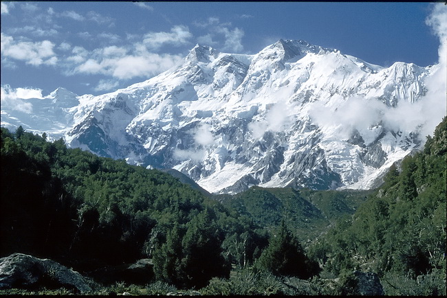
Der höchste sichtbare Punkt ist der Nordgipfel (7816 m) am rechten Ende des im Schatten liegenden Grates. Hinter diesem Grat liegt der Hauptgipfel des Nanga Parbat. Der Silbersattel, über den Hermann Buhl bei seiner Erstbesteigung den Gipfel erreichte liegt hinter dem hier sichtbaren Ostgipfel (7597 m).
The highest visible point of Nanga Parbat is the north summit (7816 m) at the right end of the shady ridge. The main summit is hidden behind this ridge. The Silver Saddle which Hermann Buhl had to cross during the first ascent of Nanga Parbat lies just behind the eastern summit (7597 m).
 |
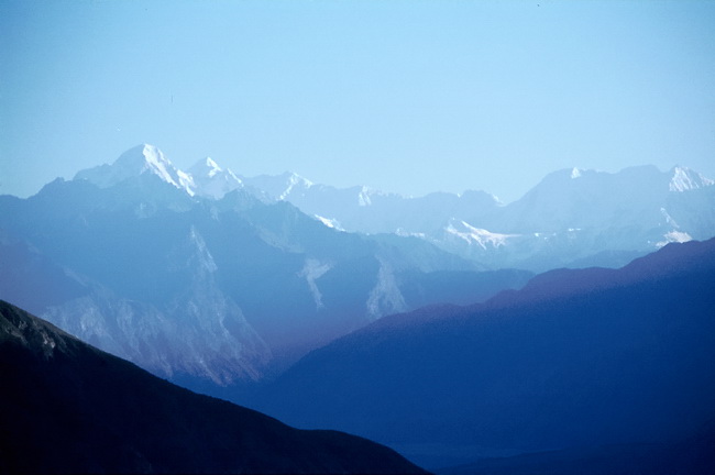
Verbindungsgrat vom Nanga Parbat zum Ganalo Peak. The ridge that connects Nanga Parbat and Ganalo Peak. |
 |
Der Ganalo Peak (6606 m) liegt südwestlich des Nanga Parbat. Ganalo Peak (6.606 m) south-west of Nanga Parbat. |
 |
Links der Mitte der Mittlere Chongra Peak (6455 m), rechts der südliche Chongra Peak (6448 m). Im Vordergrund der Rakhiotgletscher. Central and Southern Chongra Peak (6455 m and 6448 m) with the Rakhiot Glacier below. |
 |
Über die Gletschermulde unterhalb des
Rakhiot Peak (7070 m - in Wolken) erfolgte die Anstiegsroute der
Erstbesteiger des Nanga Parbat. The route of the first ascent lead through the glacial hollow below Rakhiot Peak (7070 m in clouds). |
 |
Der Aufbruch von Tato zur Rakhiotbrücke war vor Tagesbeginn in einer Mondscheinnacht. Nach Sonnen-aufgang zeigte sich zum letzten Mal der Nanga Parbat. Final view of Nanga Parbat on our way back down to the Rakhiot Bridge. |