Karakorum Highway II
Gilgit (1450 m) ist der Ausgangspunkt der meisten Unternehmungen und Expeditionen im Karakorumgebirge. Von Islamabad gibt es bei ausreichenden Sichtbedingungen täglich drei Flüge der PIA. Busse fahren von Rawalpindi über Swat (704 km) oder über Besham am Karakorum Highway (628 km). Die Jeep Piste über den 4173 m hohen Babusarpass war früher die einzige direkte Verbindung von Rawalpindi durch das Kaghantal nach Gilgit. Sie wird heute auch von Mountainbikern befahren. Nenneswert ist die Flutkatastrophe von 1841, als sich nach einem gewaltigen Erdrutsch der Indus und Hunzafluss zu einem riesigen See aufstauten.
Gilgit (1.430 m) is the starting point of most undertakings and expeditions in the Karakoram Range. There are about three flights from Islamabad to Gilgit by the PIA provided that the weather conditions are acceptable. Busses are driving from Rawalpindi via Swat 704 km or Besham at the Karakoram Highway (628 km). In earlier days the Jeep trail across the 4.173 m Babusar Pass was the only direct connection from Rawalpindi to Gilgit through the Kaghan Valley. It is still used today by mountain bikers. One thing to be mentioned is the great flood disaster in 1841 when a large landslide had been damming up Indus and the Hunza River resulting in a lake of enourmous size.
Gilgit
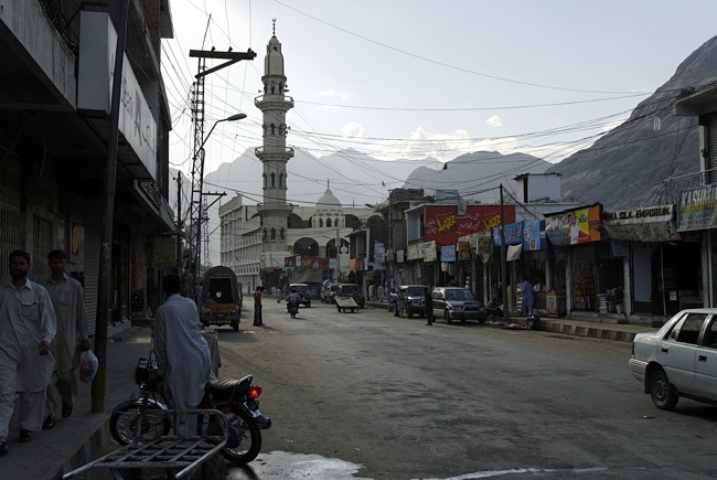
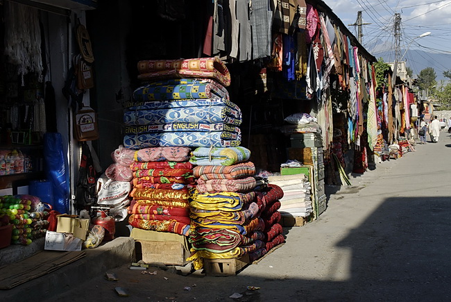
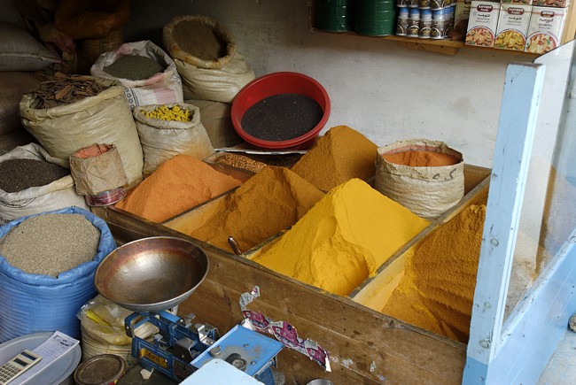

Gilgit, die Haupstadt der Northern Areas ist das geschäftige Stadt, die als Versorgungsstützpunkt für die Bewohner der umliegenden Gebirgstäler dient. Zwar gibt es hier keine ausgesprochenen Sehenswürdigkeiten, ein Bummel durch die Stadt und ihre Basare lohnt sich aber in jedem Fall. Die Stadt liegt am Gilgitfluss kurz bevor dieser von Westen kommend in den Hunzafluss einmündet.
Gilgit, the capital of the Northern Areas is a busy town which serves as supply center for the inhabitants of the nearby valleys. Although there are no special sights to see it's always a good idea to take a stroll through the streets and bazars of this town. The city is situated along the Gilgit River just bevor it flows into the Hunza River.
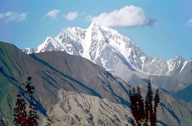 |
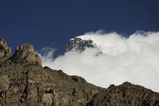
Der Dobani (6134 m) ist Gilgits Hausberg. Dobani (6134 m) the dominating peak above Gilgit. |

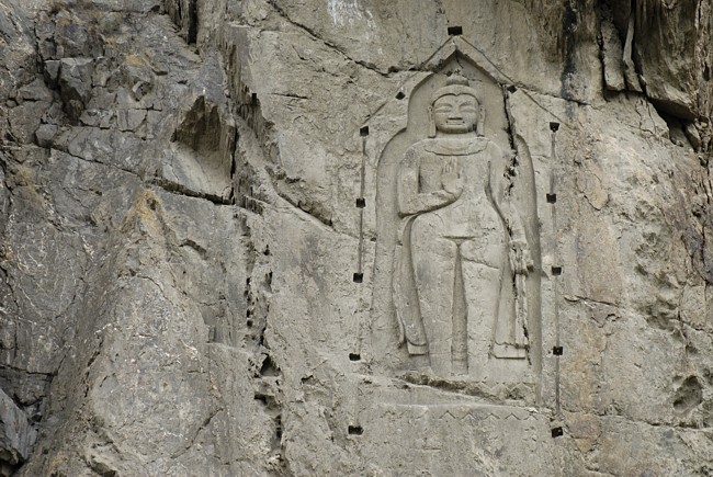
10 km von Gilgit entfernt bei Kargah steht diese Buddhastatue in Fels gemeisselt. Sie wird auf das 6. bis 7. Jahrhundert datiert, also eine Zeit, in welcher in Tibet noch der Bönglaube herrschte. Die Figur ist etwa 4 m hoch und stellt wahrscheinlich den zukünftigen Buddha Maitreya dar (stehend statt im Lotussitz). Hundert Jahre vor Errichtung dieser Statue reiste Bodhidharma, der Begründer des Zen, von Nordindien nach China, und 100 Jahre später brachte Padmasambhava den Buddhismus nach Tibet.
The Buddha statue near Kargah - about 10 km outside Gilgit - is dated back to the 6th to 7th century a time, when the Bön Religion was still dominating in Tibet. The statue is 4 m high and is most probably showing Buddha Maitreya (standing instead of sitting in Lotus Position). About 100 years before this statue was created, Bodhidharma - the founder of the Zen Buddhism - had traveled from Northern India to China and 100 years later Padmasambhava introduced the Buddhism to Tibet.
Karimabad und Umgebung
Nach dreistündiger Fahrt von Gilgit erreicht man Karimabad im mittleren Hunzatal, 112 km von Gilgit entfernt. Obstgärten und Terrassenfelder zeichnen die Metropole des Hunzatales aus. Karimabad bietet ein unvergleichliches Panorama auf Diran, Golden Peak (Spantik), den Hispar Muztagh und den Ultar Muztagh.
The 112 km drive from Gilgit to Karimabad in the central Hunza Valley takes about three hours. Terraced fields and orchards are typical for the capital of the Hunza Valley. The panorama at Karimabad is extraordinary as it covers Diran, Golden Peak (Spantik), Hispar Muztagh and Ultar Muztagh.
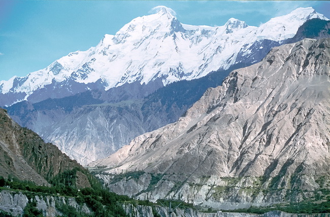
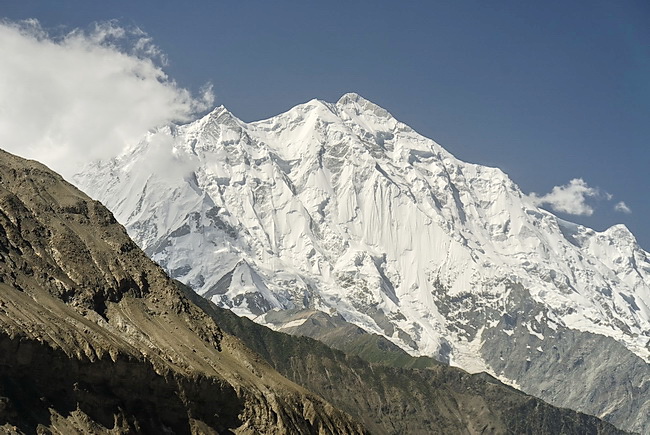
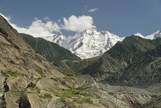
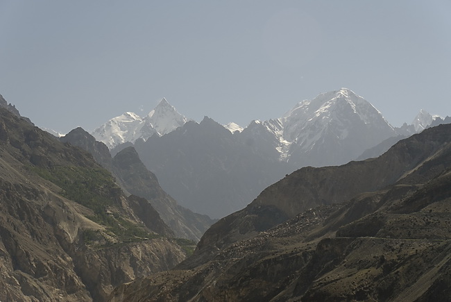
Erster Blick auf den Rakaposhi ('Fischschwanz' - 7788 m) von Westen. Der Höhenunterschied vom Hunzafluss zum Gipfel beträgt über 6000 m! Der Aussichtspunkt kommt ganz unvermittelt nach einer Strassenbiegung bei Sikandarabad etwa auf halbem Weg von Gilgit nach Karimabad. Rechts die Nordflanke der Rakaposhi, der 1958 von einer britisch-pakistanischen Expedition erstbestiegen wurde.
First view of Rakaposhi ('fish tail' - 7788 m) and its west face. The difference in altitude between the Hunza River and the summit is more than 6000 m. The picture was taken halfway between Gilgit and Karimabad from a viewpoint near Sikandarabad. The north face of Rakaposhi (right picture) was first climbed in 1958 by a British-Pakistani Expedition.
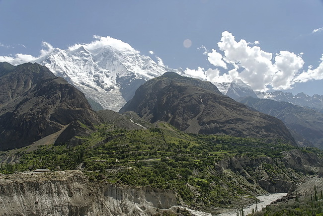 |
Der Rakaposhi steht als einzelner Berg völlig frei über dem Hunzatal. Über dem Hunzafluss die Ortschaft Minapin. Rakaposhi is towering freely high above the Hunza Valley. The village opposite the Hunza River is Minapin. |
 |
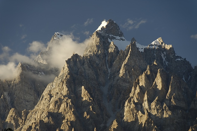
Namenlose Graterhebungen (6060 m) zwischen Rakaposhi und Diran. Im Mittelgrund die Moräne des Minapin-gletschers. The peaks behind the moraine of the Minapin Glacier are just elevations of the ridge between Rakaposhi and Diran (6600 m). |
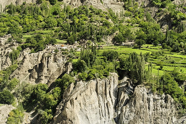 |
Aufgrund seiner ausgeklügelten Bewässerung ist das mittlere Hunzatal ein blühender Garten mit vielen Pappelhainen und Obstplantagen. Because of its sophisticated irrigation system the central Hunza Valley looks like a blooming garden with poplar forests and fruit plantations. |
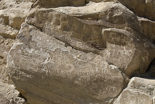 |
Felsgravuren bei Ganesh nahe Karimabad beweisen, dass das Hunzatal schon in der Jungsteinzeit besiedelt war. Carvings in Ganesh near Karimabad prove that the Hunza Valley was already populated in the early Stone Age. |
 |
Der Spantik (7021 m), auch Golden Peak genannt von Karimabad aus. Spantik (7021 m - also called Golden Peak) seen from Karimabad. |
 |
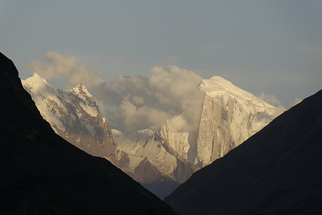
Diran (7266 m) im Abendlicht. Diran (7266 m) is the last evening light. |

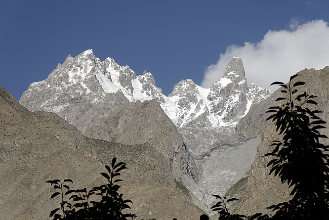
Bei Karimabad sieht man in nordöstliche Richtung auf den Hispar Muztagh mit Lupghar Sar (7200m), Momhil Sar (7443m) und Trivor (7720m).
Near Karimabad Hispar Muztagh appears in north-eastern direction with Lupghar Sar (7200m), Momhil Sar (7443m) und Trivor (7720m).
 |
Schon dem Schweizer Arzt Maximilian Bircher-Brenner, dem Erfinder des Birchermüeslis, war die gesunde Hunzakost bekannt: getrocknete Aprikosen, Trauben, Äpfel, Nüsse, Aprikosenöl, Weizen, Gerste, Hirse, Kohl, Spinat, Lauch, Joghurt und mineralienreiches Gletscherwasser. It was already the Swiss doctor Maximilian Bircher-Brenner, the inventor of the Bircher Muesli who knew about the healthy food of the Hunza Valley: dried apricots, grapes, apples, nuts, apricot oil, wheat, barley, millet, cole, spinach, leek, joghurt and glacier water of high mineral content. |
 |
Der Bulkit Yaz Gletscher im Ostgrat des Ultarmassivs mit dem Obelisk des Gulmit Tower (5810 m). The Bulkit Yaz Glacier near Gulmit is flowing down from the Ultar Range. To the right the obelisk shaped Gulmit Tower( 5810 m). |
 |
Die Pasu Kathedralen von Gulmit aus mit dem Hauptgipfel Tupopdan (6106 m) rechts der Bildmitte. Im Vordergrund der Hunzafluss. The Pasu cathedrals with its main peak Tupopdan (6106 m) right of the center. In the foreground the Hunza River near Gulmit. |
 |
Teleaufnahme des Tupopdan im Abendlicht. Telephoto of Tupopdan in the evening light. |
Baltit Fort
700 bis 1000 Jahre alt schätzt man das Baltit Fort hoch über Karimabad, wo die Mirs (Fürsten) von Hunza residierten. 1997 vom Aga Khan Trust for Culture renoviert stellt es heute ein Museum dar, welches das Leben der Hunzukuts dokumentiert und heute vom Baltit Heritage Trust betrieben wird.
The Baltit Fort high avove Karimabad was the residence of the former Mirs (princes) of Hunza 700 to 1000 years ago. It was renovated in 1997 by the Aga Khan Trust for Culture and is used nowadays as museum to document the life of the hunzukuts, run by the Baltit Heritage Trust.
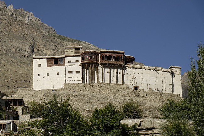
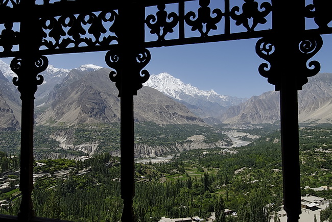
Unverkennbar sind die tibetischen Einflüsse im Baustil. Vom Fort hat man einen unvergleichlichen Blick auf die Umgebung von Karimabad und die Rakaposhi Kette. Ganz links am Bildrand der Diran.
The tibetian influence on the architectural style is clearly visible. The fort is also a nice vantage point with a nice view of the area near Karimabad and the Rakaposhi Range. Left in the picture we can even see Diran.
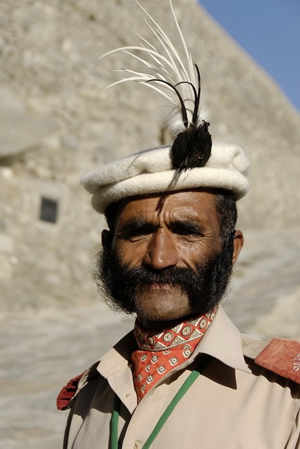
Der stolze Wächter des Baltit Forts.
The proud guardian of Baltit Fort.
Vom hier aus sieht man auch auf die beiden Ultar Gipfel: Bojohagur Duanasir ( links) und Ultar Peak (7350m rechts). Mit einem letzten Blick zum Ultar Hauptgipfel verlassen wir Hunza.
From this point both Ultar peaks are also visible: Bojohagur Duanasir (7318m left) and Ultar Peak (7350m right). With a last view of the main summit of Ultar we are leaving Hunza.