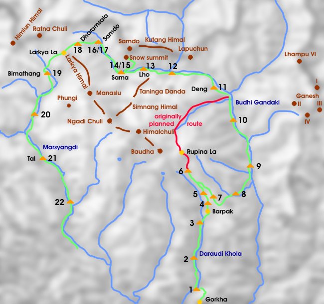
Manaslu Trek: Gorkha - Shyala
Verglichen mit der nahegelegenen Umrundung des Annapurna Massivs ist es auf der Manaslu Runde noch relativ einsam. Vielleicht liegt dies daran, dass aufgrund der Schneelage nicht immer möglich ist, die Pässe Rupina La und Larkya La zu überschreiten. Auch wir mussten auf den Rupina La verzichten, die Alternative zurück über einen 3000 m hohen Höhenrücken hinunter ins Budhi Gandaki Tal war jedoch mehr als nur eine Notlösung.
Trekking in the Manaslu area is still a lonesome undertaking compared to the very popular Annapurna Circuit. One of the reasons could be that the crossing of Rupina La and Larkya La is not always possible due to the snow conditions. In our case we had to cancel the Rupina Pass but found a very worthwhile alternative back along a nice ridge down to the Budhi Gandaki Valley.
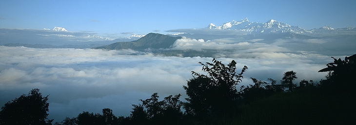
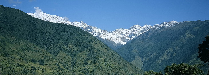
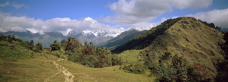
Blick von Gorkha auf Annapurna (links) und Manaslu Himal, den wir auf unserer Tour im Gegenuhrzeigersinn umrunden.
View from Gorkha towards Annapurna (left) and Manaslu Himal. This trek leads around the Manaslu Massiv in counter-clockwise direction.
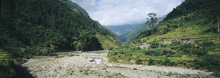
Die ersten Tage führt der Weg durch das Tal des Daraudi Khola.
During the first days we walked along the Daraudi Khola Valley.
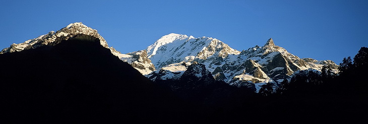
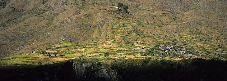
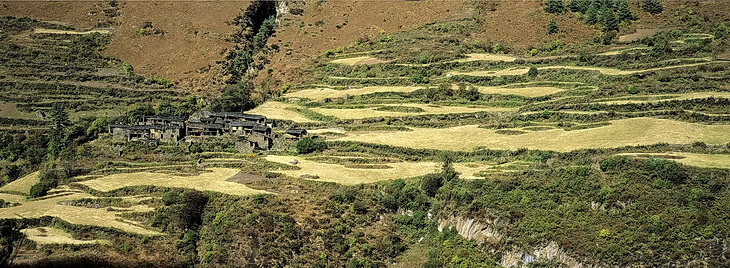
1150 Höhenmeter sind es von Lager 3 hinauf nach Barpak und das auf 2050 m liegende Lager 4. Hier sahen wir auch zum ersten Mal den Rupina La (links davon der Boudha Himal - 6672 m). Knapp 10 km nordöstlich von Barpak liegt das Lager 5 (2815 m) auf einer Almwiese.
The difference in altitude between Camp 3 and Camp 4 (2050 m) near Barpak is around 1150 meters. It was the first time we could spot Rupina La (left of it Boudha Himal - 6672 m).
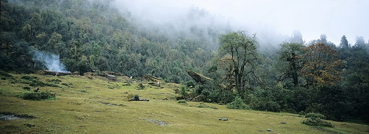
About 10 km north-east of Barpak we established camp five on a nice alpine meadow (2815 m).

In Lager 6 unterhalb des Rupina La erfuhren wir dann, dass an eine Überquerung des Passes aufgrund der Schneelage nicht zu denken war. Ein kleiner Umweg über einen Bergrücken mit schöner Aussicht auf Boudha und Ganesh brachte uns ins Budhi Gandaki Tal, wo wir bei Deng wieder auf unsere ursprünglich geplante Route trafen.
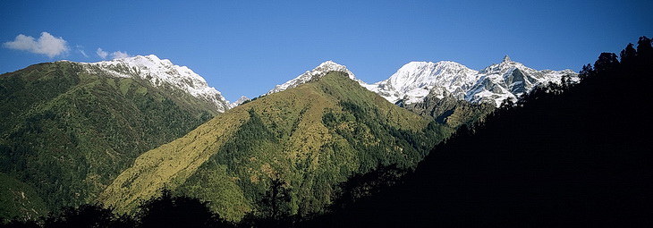
Bild 1/2: Der Boudha Himal im Nordwesten.
Bild 3: Im Osten die Siebentausender des Ganesh Himal.
Bild 4: Blick zurück auf unsere Alternativroute und den Rupina La.
At Camp 6 below Rupina La we were told that the traverse of the pass was not possible due to the amount of snow. Alternatively we chose a detour following a nice panorama ridge and down to the Budhi Gandaki River where we joined our planned route near the village of Deng.
Picture 1/2: Boudha Himal in north-western direction
Picture 3: To the east the 7000 m peaks of Ganesh Himal.
Picture 4: View back to our alternative route and the Rupina Pass.
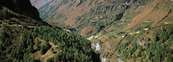
Der Blick über das Budhi Gandaki Tal zwischen Philim und Deng. Im Norden tauchen Lapuchun (5960 m) und der Dwijen Himal (5521 m) auf.
View across the Budhi Gandaki Valley between Philim and Deng and to Lapuchun (5960 m) and the Dwijen Himal.
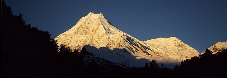
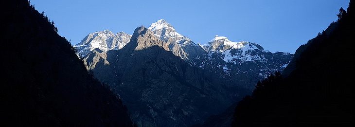
Zwischen Deng und Lho befinden wir uns in einem engen Tal, noch sind die hohen Berge nicht zu sehen. Dann allerdings erschien im Morgenlicht der Manaslu (8163 m).
Between Deng and Lho we were following a narrow valley with the higher mountains still out of sight but then Manaslu (8163 m) appeared in the morning light.
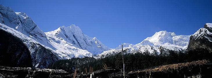
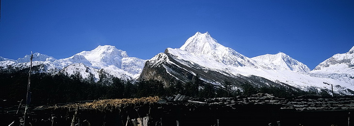
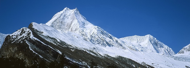
Zwischen Lho und Sama ließ das Panorama kaum noch Wünsche offen. Vom Simnang Himal (6251m) über Ngadi Chuli (7871 m) bis zur markanten Spitze des Manaslu (Bild 2 und 3) reicht der Blick.
Between Lho and Sama we had an excellent panorama starting with Simnang Himal (6251 m) and Ngadi Chuli (7871 m) up to the prominent peak of Manaslu (pictures 2 and 3).