Madeira: Die Bergwelt
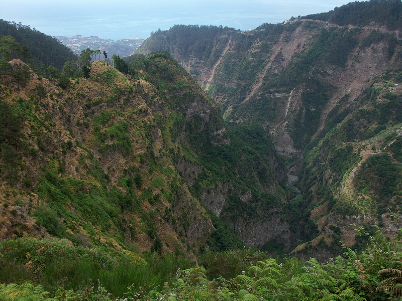

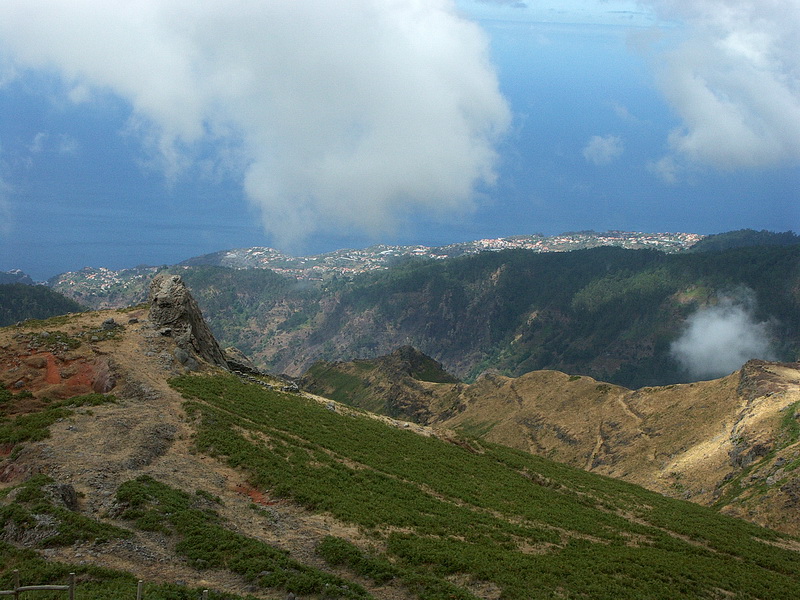
In Funchal zweigt eine Nebenstrasse ins Nonnental (Curral das Freiras) ab. Die neue Strasse führt durch einen Tunnel, die alte windet sich an steilen Bergflanken empor bis auf 1100 m. Blick nach Süden zum Meer mit Funchal im Hintergrund. Von Eira do Serrado erreicht man zu Fuss in 10 Minuten einen atemberaubenden Aussichtspunkt auf einer Felskanzel. Im Vordergrund die üblichen Souvenirläden.
At Funchal a side road turns off into the valley of Curral des Freiras (meaning the 'Valley of the nuns' ). While the new road leads conveniently through a tunnel, this road winds up steep hill slopes to an qltitude of 1100 m. We are looking in southern direction towards Funchal and the sea. A breath-taking viewpoint on top of a rock spur is reached 10 minutes from Eiro do Serrado - accompanied by the usual souvenir shops.
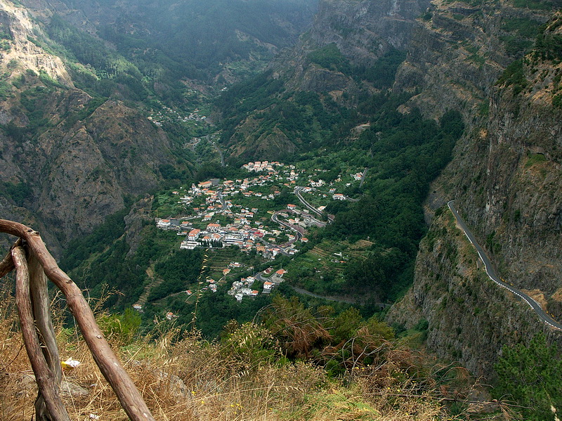
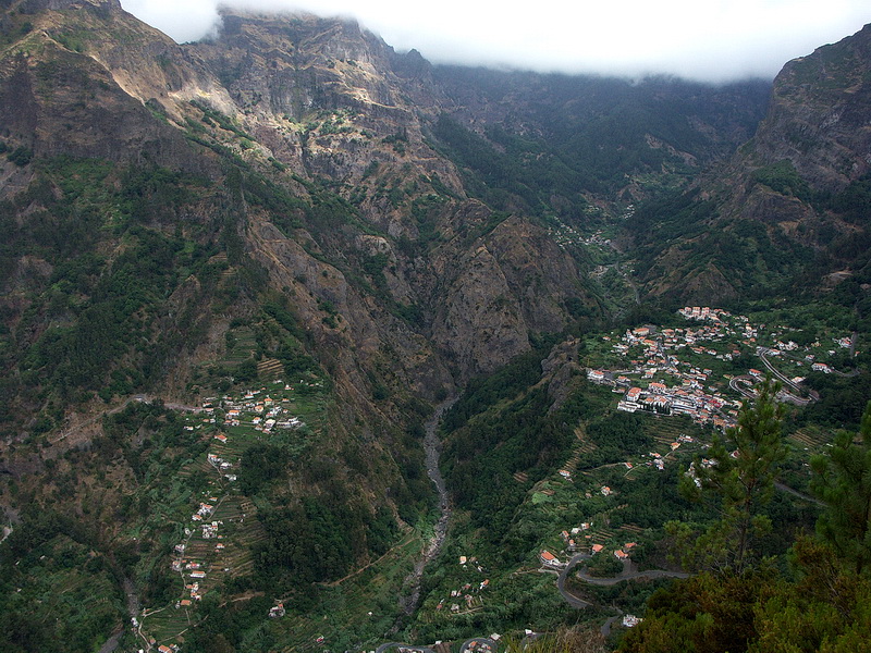
Tiefblick vom Miradouro Eira do Serrado auf den Ort Curral das Freiras. Nach Curral das Freiras (Nonnental) zogen sich 1566 die Nonnen des Klosters Santa Clara in Funchal zum Schutz vor Piraten zurück. Heutzutage schätzt man als lokal stuff den ausgezeichneten Kastanienlikör von Curral, der überall auf Madeira erhältlich ist.
View down from Miradouro Eira do Serrado to Curral des Freiras. Curral das Freiras und die in Passatwolken gehüllte Nordkette. Curral des Freiras and the cloud covered northern range. In 1566 the nuns of Santa Clara Monastery in Funchal retreated to Curral des Freiras (Valley of the Nuns) to protect themselves against pirates. Nowadays Curral is better known for its excellent chestnut liquor which is available all over Madeira.
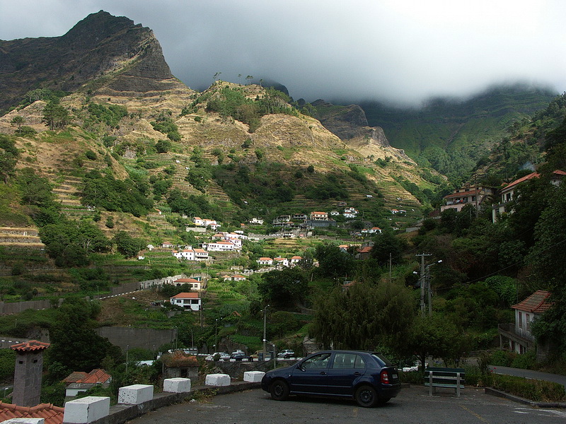

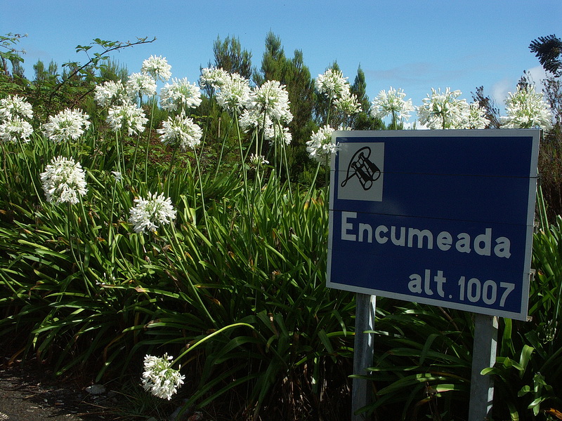
Westlich von Funchal endet nach einem Tunnel die Autobahn bei Ribeira Brava. Von dort führt ein enges Tal zur Nordküste, entweder durch einen Tunnel oder über die Boca de Encumeada. Sie befindet sich etwas rechts der wolkenverhangenen Berge. Blick von der Passstrasse zur Boca de Encumeada zurück nach Süden auf den Ort Serra de Agua und zum Meer bei Ribeira Brava.
At Ribeira Brava west of Funchal the motorway ends. From there a narrow valley leads to the north coast. It can either be reached using the tunnel or by crossing Boca de Encumeada (left of the cloud covered mountains). View back south from the pass road that leads to Boca de Encumeada. Below the village of Serra de Agua and behind the sea near Ribeira Brava.
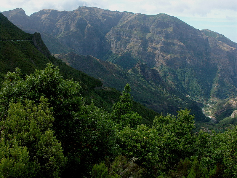
Am Parkplatz auf der Boca de Encumeada. Auch hier dürfen die Blumen nicht fehlen. Der Ort rechts unten im Tal ist Serra de Agua. Blick von der Boca de Encumeada nach Süden zum Massiv des Terreiros (1143 m) zwischen dem Nonnental und Ribeira Brava.
The parking place at Boca de Encumeada covered with flowers. View from Boca da Encumeada in southern direction to the maassif of Terreiros (1143 m) between the Valley of the Nuns and Ribeira Brava. Down to the right the village of Serra de Agua.
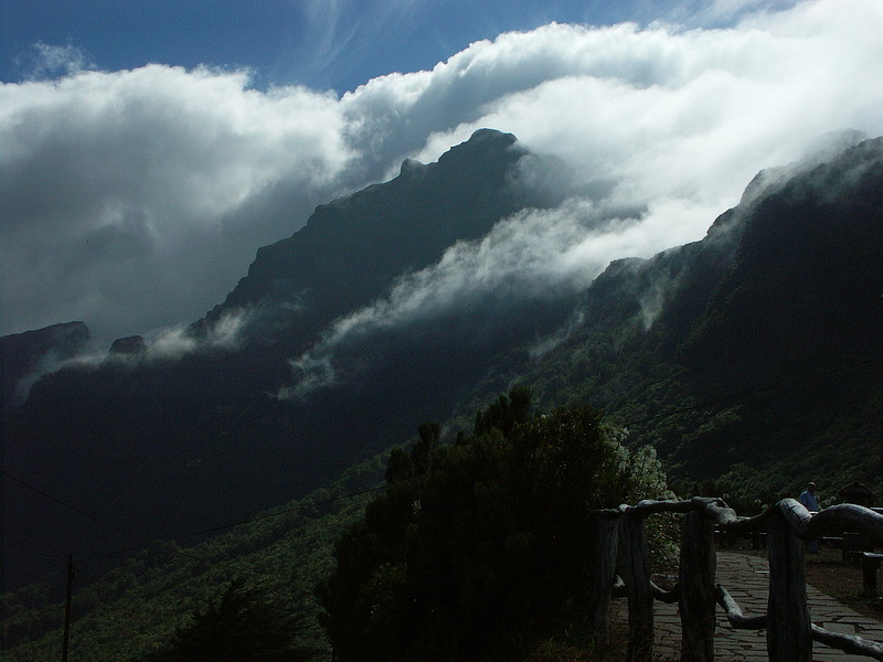
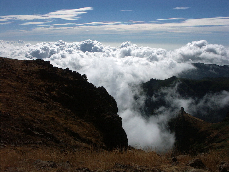
Passatwolken umströmen den Gipfel des Pico de Cabra (1580 m) östlich der Boca de Encumeada. Er gehört zum Hauptkamm, der sich ostwärts bis zum Pico Ruivo hinzieht. Von der Boca de Encumeada führt durch steile Felswände und Tunnels eine gut ausgebaute Strasse in eine völlig andere Landschaft: das 1600 m hoch gelegene Plateau Paul da Serra, auch Campo Grande genannt. Die fast baumlose Hochebene liegt oft im Nebel und erinnert an eine nordische Landschaft.
Trade wind clouds flow around the summit of Pico de Cabra (1580 m) east of Boca de Encumeada. It is part of the main ridge which extends in eastern direction until to Pico Ruivo. long steep rock faces and through quite a few tunnels a well build road leads us from Boca de Encumeada into a completely different landscape. At an altitude of 1600 m the plateau Paul da Serra - also called Campo Grande - reminds of a northern landscape and is very often covered in mist.
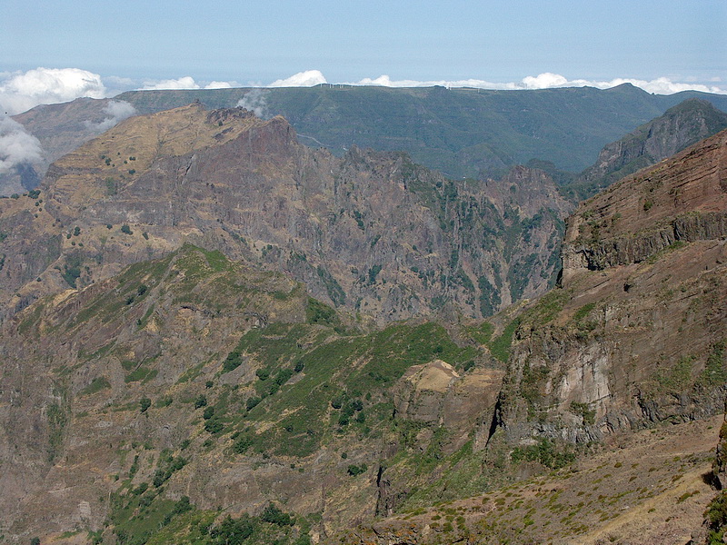
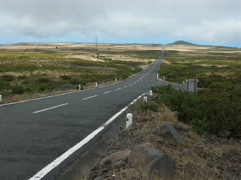
Ein Blick vom südlichen Rand des Campo Grande auf den 1500 m tiefer liegenden Atlantik, der keinen Horizont bildet, sondern in der Ferne mit dem Himmel verschmilzt. Blick vom Pico do Arieiro (1818 m) auf das Hochplateau Paul da Serra im Westen, etwa 15-20 km entfernt. Im Mittelpunkt links der Pico do Grande (1654 m), rechts davon erkennt man in den Abhängen des Hochplateaus die Straße, welche von der Boca de Encumeada (verdeckt) hinaufführt. Auf dem Plateau sind eine Reihe von Windkraftanlagen in Betrieb.
View from the southern Rim of Campo Grande down to the Atlantic Ocean 1500 m below which smoothly merges into the sky. View from Pico do Arieiro (1818 m) to the plateau Paul da Serra about 15-20 km west.The summit left of the center is Pico do Grande (1654 m). Right of it we can see the road that leads from Boca de Encumeada (hidden) up to the top of the plateau where quite a few wind-energy facilities are running.

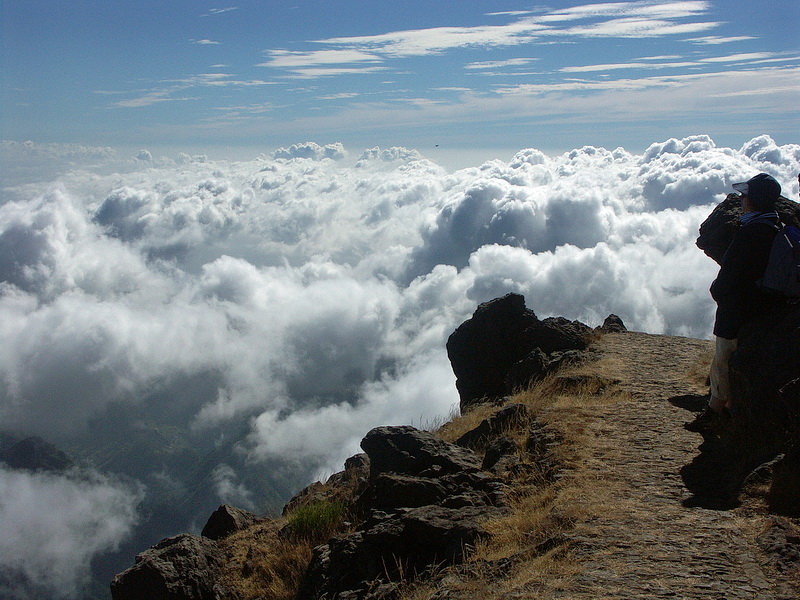
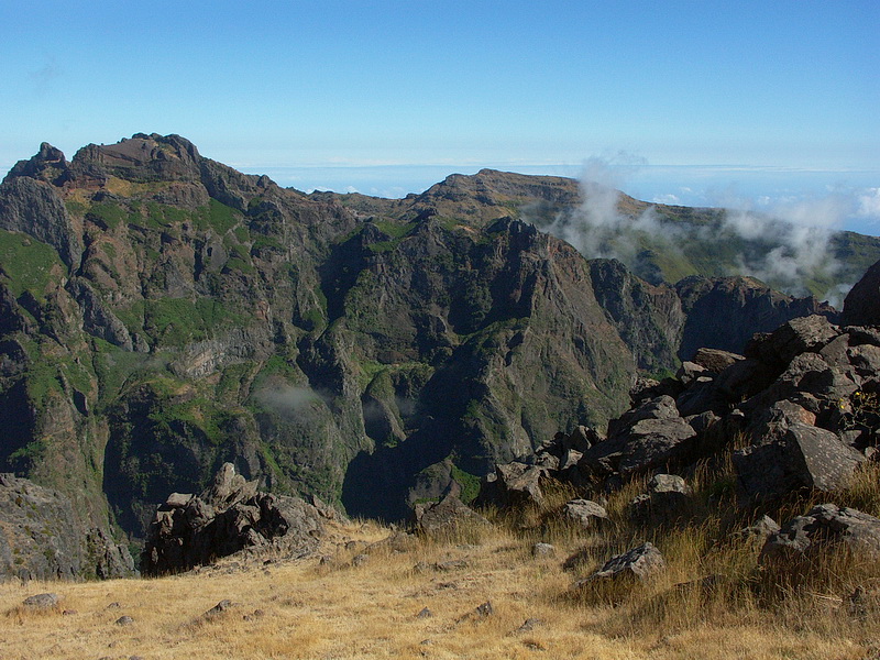
Von Funchal führt eine gut ausgebaute Straße über den Paso de Poiso (1400 m) nach Santana an der Nordküste. Von einer Serpentine oberhalb der Ortschaft Faja do Cedro Gordo hat man einen schönen Blick nach Südwesten auf den Pico Ariero (1818m, links) und den Pico das Torres (1851 m - Mitte). Die Auffahrt mit dem Auto auf den Pico do Arieiro (1818m, großer Parkplatz unterhalb des Gipfels), dem dritthöchsten Berg Madeiras, in den frühen Morgenstunden, lohnt sich. Tagsüber ist der gesamte Hauptkamm meist in Wolken. Blick nach Nordosten, tief unten links das Tal, welches nach Santana führt. Am Gipfel bläst oft auch im Sommer ein kalter Wind, im Winter gibt es Schnee!
A well built road connects Funchal and Santana on the north coast via the Paso de Poiso pass. Just above the village of Faja do Cedro Gordo one has a nice view of Pico Arieiro (1818 m - left) and Pico das Torres (1851 m - center). Driving up to Pico do Arieiro (1818 m - large parking below the summit) in the early morning hours is really worthwhile as main ridge is mostly covered in clouds during the day. Below the valley leading to Santana. Even in summer a cold wind is blowing at the summit, in winter you'll even find snow.

Weiter südwärts (rechts) werden die Hänge des Pico do Arieiro flach und bieten leichte Wanderungen und Picknick Plätze. Tiefblick vom Arieiro ins 1000 m tiefer gelegene Tal der Nonnen (Curral das Freiras) nach Südwesten.
Further south (to the right) the slopes of Pico do Arieiro are flattening out - an ideal terrain for easy hikes and picnic places. 1000 m below Arieiro the Valley of the Nuns in south-westerm direction.
 |
Am Gipfel des Pico do Arieiro gibt es einen kleinen Rundwanderweg (20-30 Minuten), von dem diese Bilder gemacht wurden. Eine stellenweise ausgesetze Wanderung führt unter den Felsen des Pico das Torres (1851m, links) hinüber zum Pico Ruivo (1861m, Mitte), dem höchsten Punkt Madeiras (Zeit sowohl für Hin- als auch Rückweg jeweils 2,5 - 3 Stunden). The picture was taken on a circle hike at the summit of Pico do Arieiro (about 30 minutes). Another partly exposed hike passes the rocks of Pico das Torres (1851m - left) and leads to Pico Ruivo (1861 m - center), the highest point of Madeira (2.5 - 3 hours in each direction). |