Madeira: Erste Eindrücke

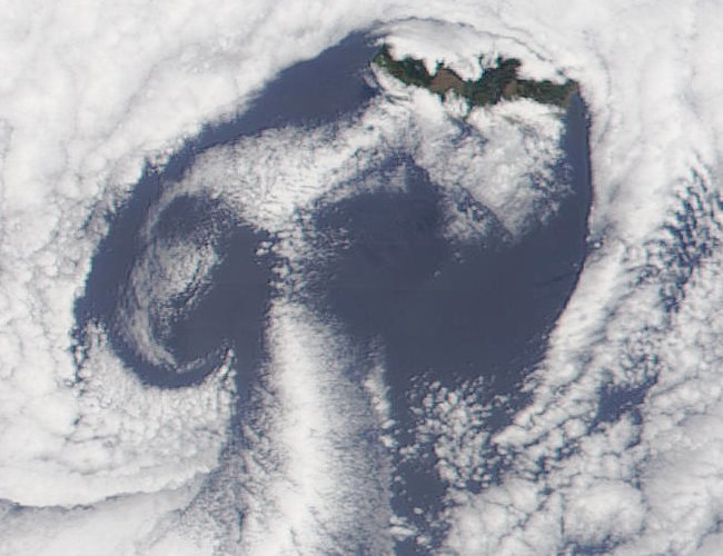
Madeira und die Kanarischen Inseln aus dem Weltall. Passatwolken bedecken einen grossen Teil der Insel.
Madeira and the Canaries seen from space. Trade wind clouds cover a great part of the island.
Quelle/Source: http://www.visibleearth.nasa.gov
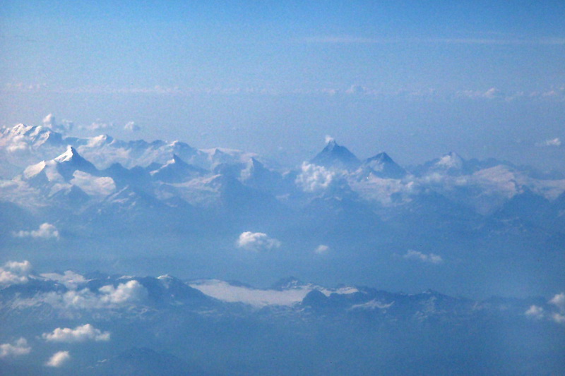
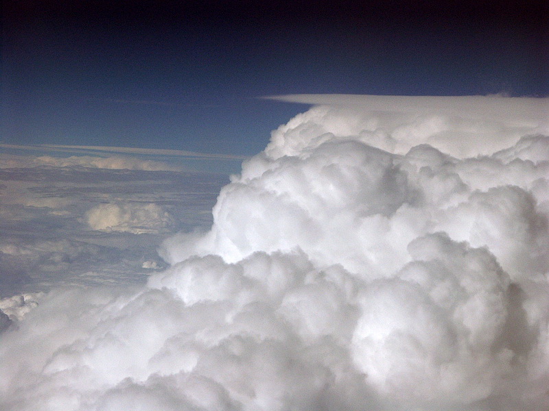
Flug über das Schweizer Mittelland mit Weisshorn und Monte Rosa links, sowie Matterhorn mit Dent d' Herens rechts. 10.000 m hohe Gewitterwolken auf dem Flug nach Madeira.
Flight across central Switzerland with Weisshorn and Monte Rosa (left), as well as Matterhorn and Dent d' Herens (right). Thunderstorm clouds at 10.000 m on the flight to Madeira.
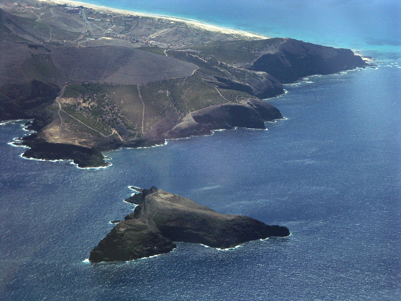
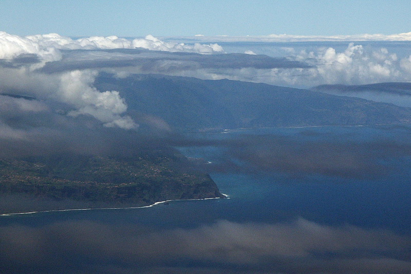
Die Badeinsel Porto Santo, die Madeira nordöstlich vorgelagert ist. Sie hat kilometerlange Sandstrände aber wenig Vegetation und ist wie das gesamte Archipel vulkanischen Ursprungs. Anflug auf Madeira mit Blick auf die Nordküste. Oft sind die Berge in Passatwolken gehüllt, die bedrohlicher aussehen, als sie es sind.
The island of Porto Santo, north-east of the main island has got miles and miles of sandy beaches but only little vegetation. Like the whole archipelago it is of volcanic origin. Approaching Madeira looking down on the east coast. Very often the mountains are covered by trade wind clouds which look more threatening than they are.
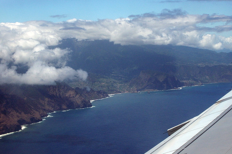
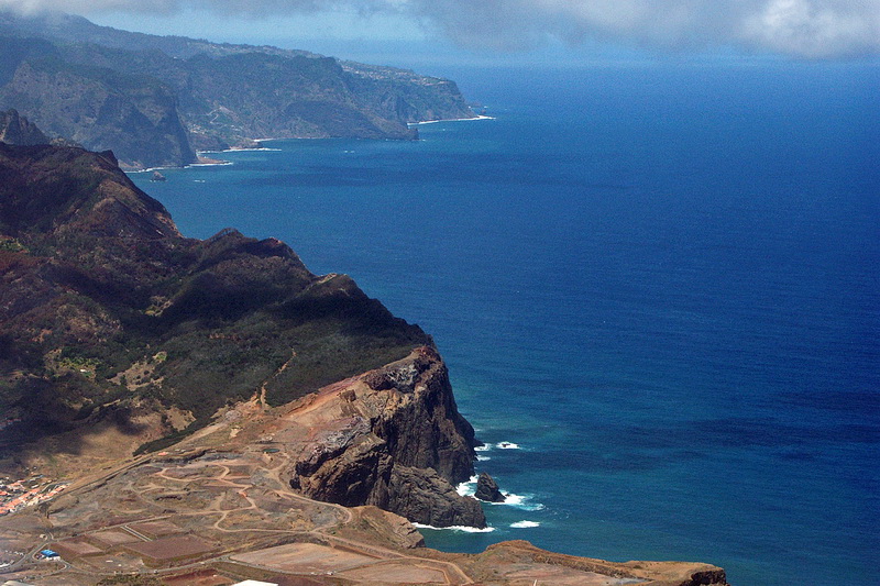
Die Nordostküste wird erkennbar. In der Mitte direkt am Meer der 590 m hohe Adlerfelsen (Penha de Aguia) bei Porto da Cruz. Im Tiefflug geht es über die östliche Halbinsel Porto de Sao Lourenco. Deutlich zu erkennen ist das abrupte Ende der grünen Vegetation.
The north-eastern coast becomes visible. The rock in the center of the picture is the 590 m 'Penha de Aguia' (eagles' rock) near Porto da Cruz. At low altitude we cross the eastern peninsula of Porto de Sao Lourenco. The sudden end of the vegetation becomes apparent.
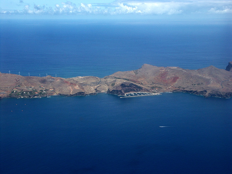

Madeira setzt auf Windenergie, weitere Anlagen stehen auf der Hochebene Paul da Serra. Rechts unten auf der Landzunge die gut ausgebaute Strasse, welche zu einem Aussichtspunkt auf der Halbinsel Porto de Sao Lourenco führt. Canical, der östlichste Ort auf Madeira - ebenfalls auf der Halbinsel Porto de Sao Lourenco.
At Madeira wind energy plays an important role, more of these facilities are erected at the plateau of Paul da Serra. The road leads to a vantage point at the Porto de Sao Lourenco peninsula. Canical, the easternmost village of Madeira is also situated at the Porto de Sao Lourenco Peninsula.
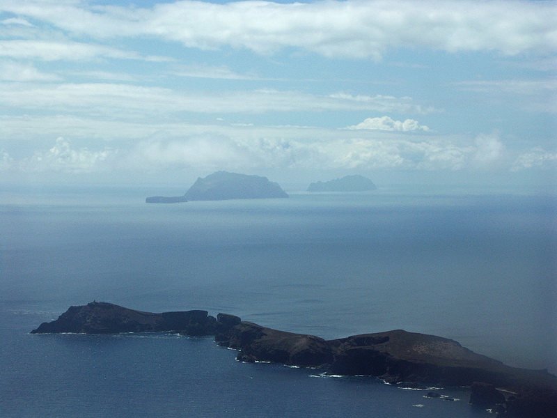
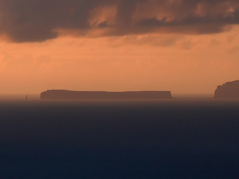
Blick aus dem Flugzeug nach Süden über den östlichsten Teil von Madeira hinweg zu den Ilhas Desertas, die unter Naturschutz gestellt wurden. Die Ilhas Desertas bei Sonnenaufgang in 25 km Entfernung von Madeira.
View in southern direction across the eastern part of Madeira towards the Ilhas Desertas which are legally protected. Ilhas Desertas at sunrise at a distance of about 25 km.
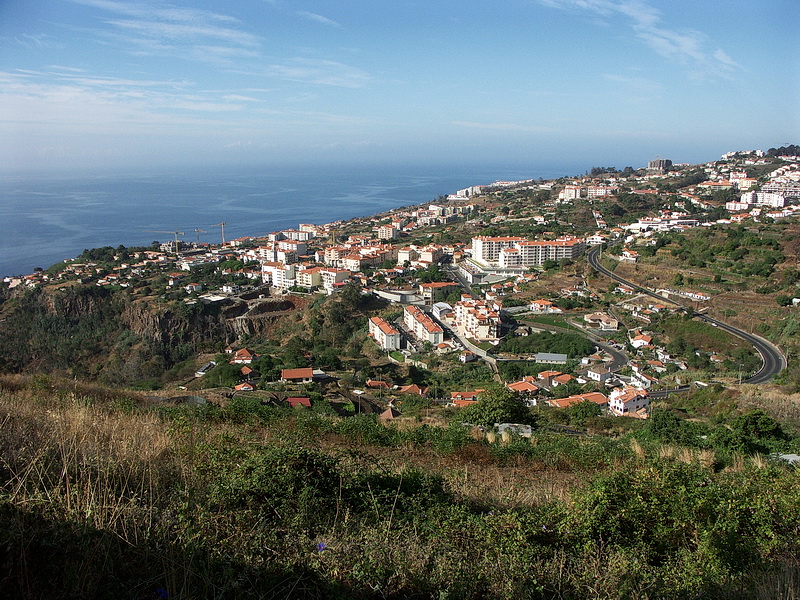
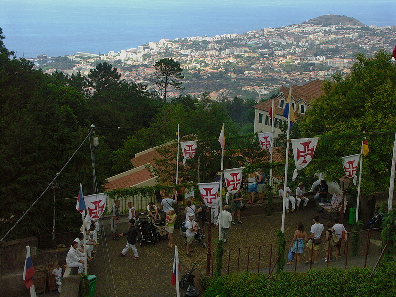
Die Südküste von Madeira ist trockener als der Norden. Das Flugzeug fliegt zunächst parallel zur Küste am Flughafen vorbei, um dann nach einer 180 Grad Kurve auf der Landebahn aufzusetzen, welche zum Teil auf Betonpfeilern ruht. Der Stadtteil Monte, 600 m über der Hauptstadt Funchal gelegen, mit der berühmten Kirche Nossa Senhora do Monte und dem Grab des österreichischen Kaisers Karl I . Während unten in der Stadt die Sonne schien, hingen über El Monte tiefe Passatwolken.
The south coast is more arid than the northern part. The plane passes the airport along the coastline and then turns back down to the runway which is mainly built on concrete pillars. Monte is a part of the capital Funchal which is situated 600 m above the town. It is famous for its church called Nossa Senhora do Monte and the grave of the Austrian emperor Karl I. While the city was lying in bright sunlight El Monte was still wrapped in clouds.
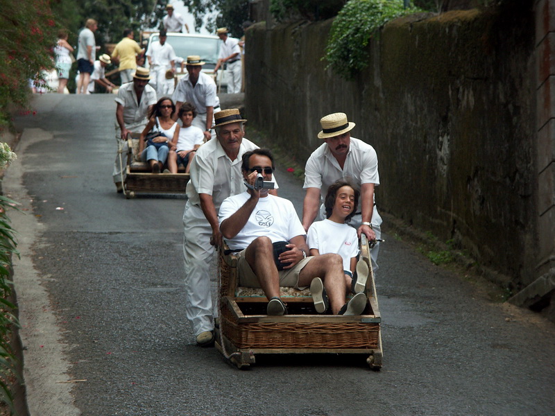 |
Zahlreiche 'Bobpiloten' warten unterhalb der Kirche Nossa Senhora do Monte auf ihren Einsatz um abenteuerhungrige Touristen in Korbschlitten die steilen Strassen hinunter zu fahren - Cool Runnings. Numerous 'bob pilots' are ready for action to manoeuvre adventurous tourists down the steep roads below the church of Nossa Senhora do Monte - Cool Runnings. |