Winterstaude
Die Winterstaude ist mit 1877 m der höchste Punkt eines über 5 km langen Bergkamms oberhalb von Bezau, über den eine der landschaftlich schönsten Wanderungen im Bregenzerwald führt. Das exzellente Gipfelpanorama, die leichte Kletterei am 'Hasenstrick' und der lange Grat zurück über den Niederekamm immer mit Blick auf die Schweizer Berge und den Bodensee, sind vor allem Herbsttagen ein ganz besonderes Erlebnis.
Winterstaude (1877 m) is the highest point of a 5 km mountain ridge above the town of Bezau and part of one of the finest hikes in the Bregenzerwald area. The excellent summit panorama, a short and easy climbing part called 'Hasenstrick' and the nice walk back across the 'Niedere' ridge with an excellent view of the Swiss mountains and Lake Constance are always a very special experience - particularly in autumn.
Von der Kanisfluh überblickt man den gesamten Grat, von der Mittelstation der Seilbahn (links oberhalb des Felssturzes im linken Teil des Bildes) bis zur Winterstaude in seiner ganzen Länge.
From the summit of Kanisfluh we could oversee the entire ridge from the intermediate station of the cableway (near the landslide in the left part of the picture) to the summit of Winterstaude in the center.
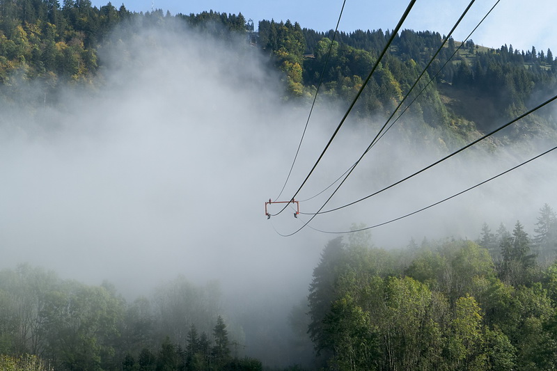
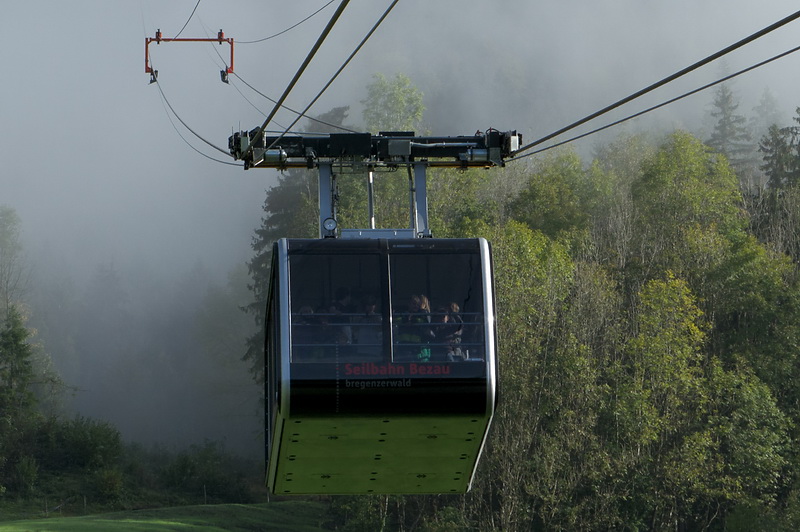
Glück gehabt: die Regenwolken der Nacht hatten sich noch rechtzeitig verzogen und es wurde insgesamt ein idealer Wandertag. Mit der 2010 erneuerten Seilbahn ging es zunächst hinauf zur Station 'Sonderdach'.
We were lucky as the rain clouds of the night had cleared away just in time so we had an ideal hiking day which we started at the middle station (Sonderdach) of the Bezau Cableway.
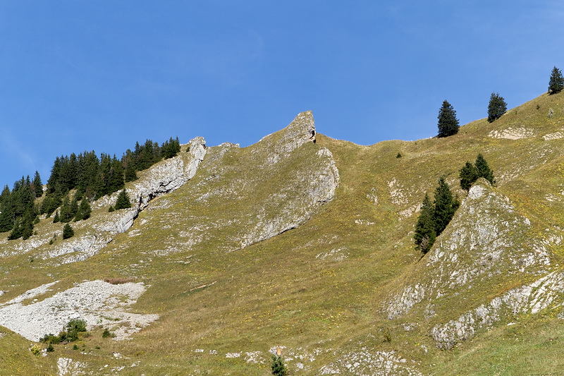
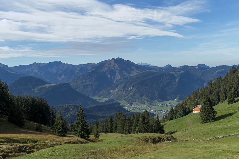
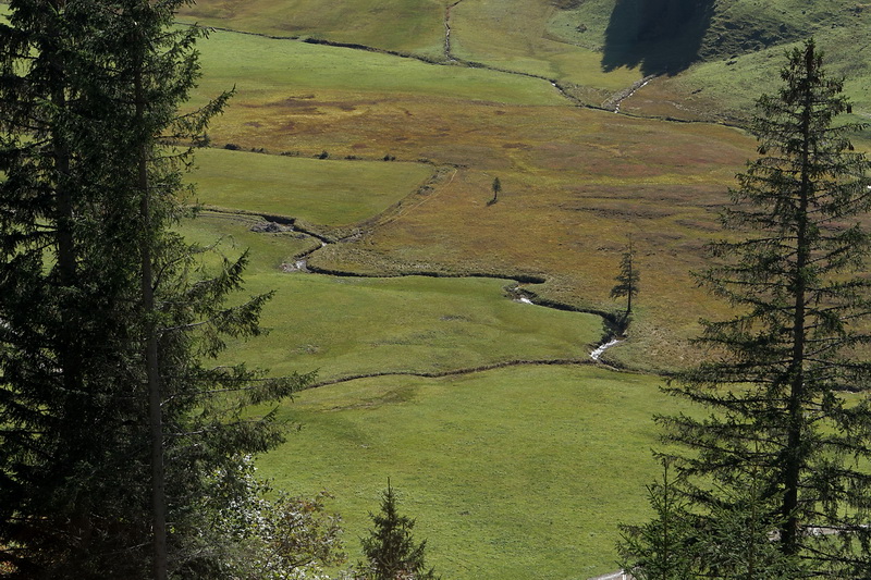
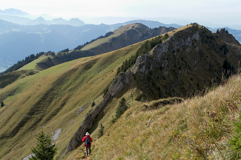
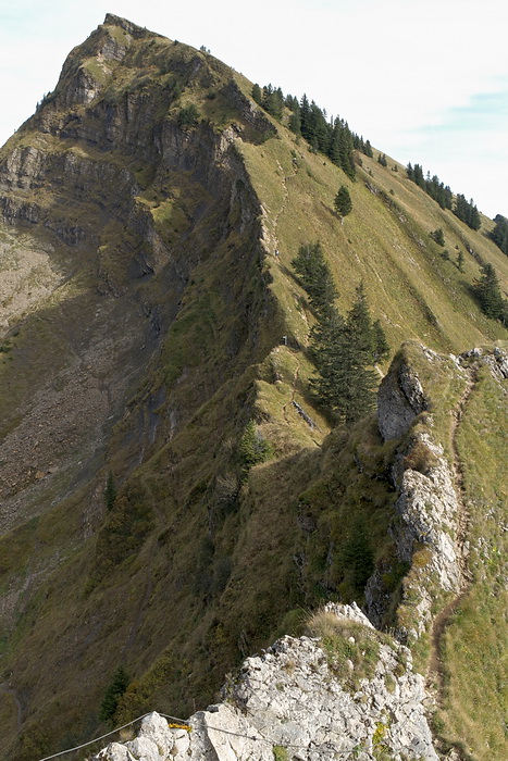
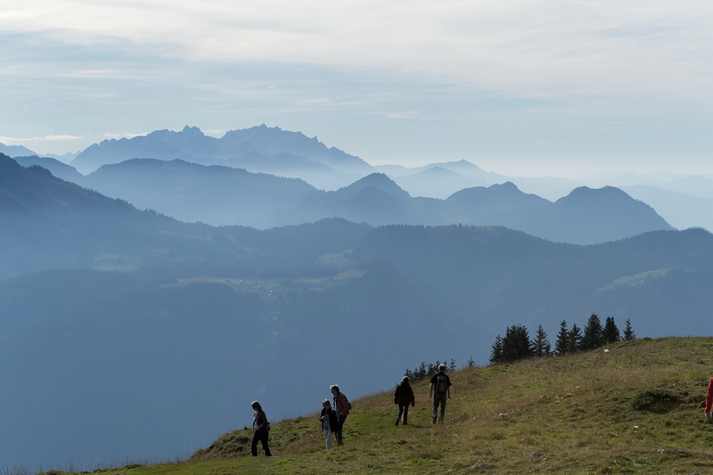
Bis zur Lingenauer Alpe direkt unterhalb des Gipfels steigt der Weg gemächlich an, danach geht es noch einmal 300 Höhenmeter steil bergauf. Links das 'Hasenstrick' genannte felsige Gratstück, das wir auf dem Rückweg überquerten.
The first part of the ascent was moderately steep and easy-going until we reached an alpine pasture called Lingenauer Alpe where the path steepened for the final 300 vertical metres. In the left picture we can see the rocky part of the ridge called Hasenstrick which we had to cross on the way back.
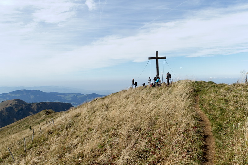
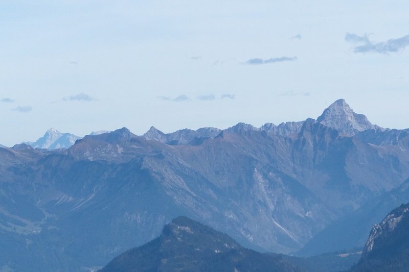
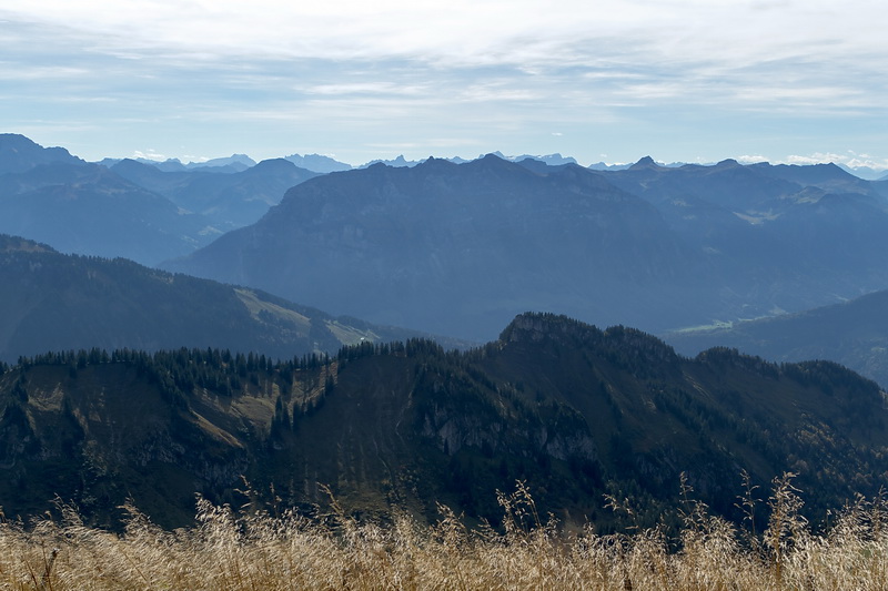
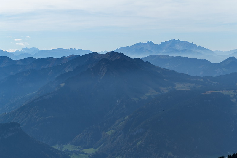
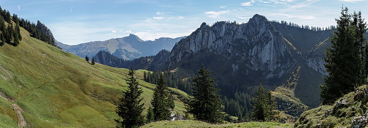
Auf dem Gipfel war relativ wenig Betrieb und so konnten wir in aller Ruhe die Rundsicht geniessen, etwa auf Zugspitze und Hochvogel (Bild 2) oder die Kanisfluh mit dem Rätikon dahinter (Bild 3) und natürlich auf die Ostschweizer Berge im Westen (Bild 4).
Much to our surprise we didn't meet many people on the summit so we could enjoy the panorama in complete silence: Zugspitze and Hochvogel (image 2) as well as Kanisfluh with the Rätikon range behind (image 3) up to the Swiss mountains in western direction (image 4).
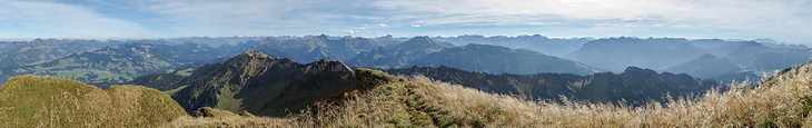
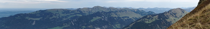
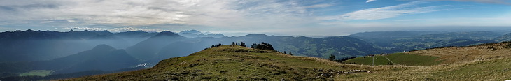
Das komplette Gipfelpanorama reicht von den Allgäuer- und Lechtaler Alpen über das Rätikon bis zu den Ostschweizer Bergen.
The entire panorama covers the Allgäu- and Lechtal Alps up to the mountains of Eastern Switzerland.
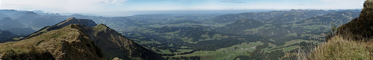
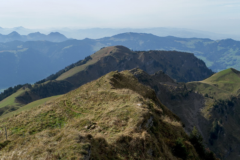
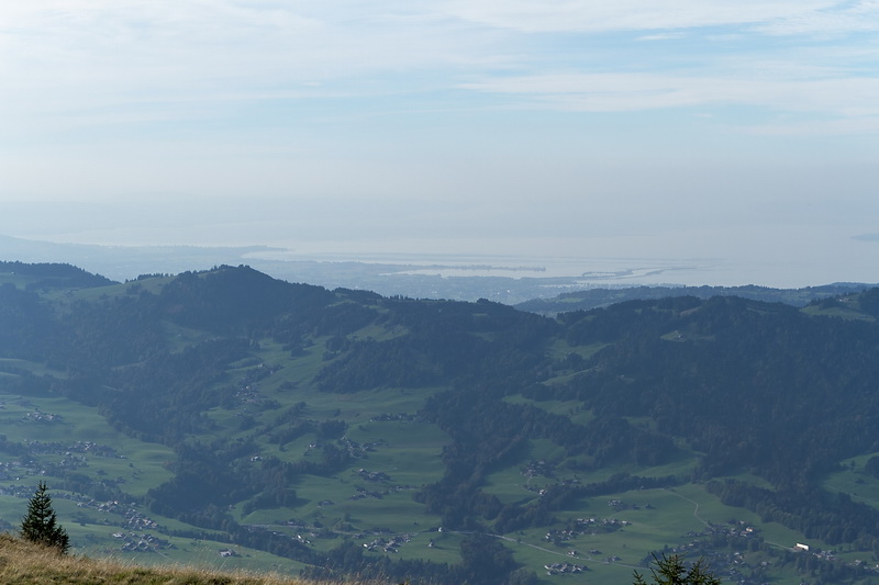
Und natürlich der Bodensee in der Verlängerung des lange Grates zurück zu Station links unter dem Gipfel der Niedere.
Last but not least Lake Constance in direction of the long ridge back across the 'Niedere' ridge up to the cableway station on the left below the summit.
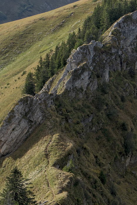
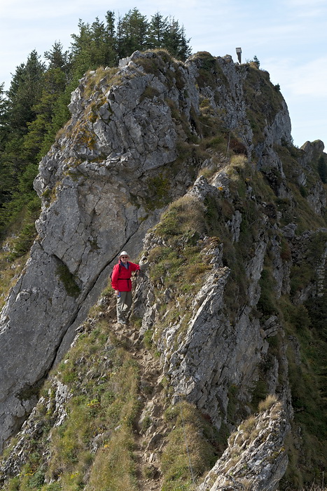
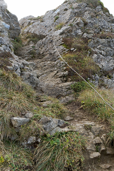
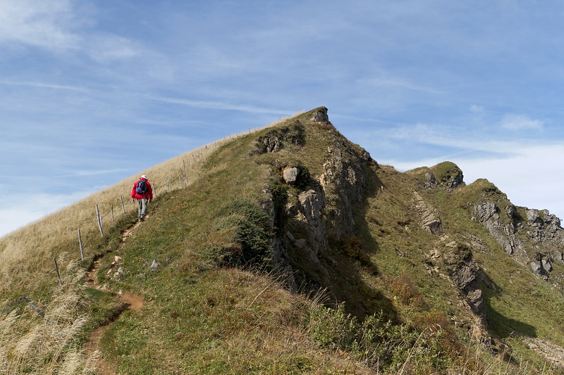
'Nur für Geübte' ist der sogenannte 'Hasenstrick'. Das kurze, felsige Gratstück erfordert Trittsicherheit, besonders bei Nässe, ist aber mit einem Drahtseil gesichert.
'For experienced hikers only' is written on the sign at the beginning of the so-called 'Hasenstick', a rocky part of the ridge which affords caution - especially in wet conditions - and which is belayed by a wire rope.
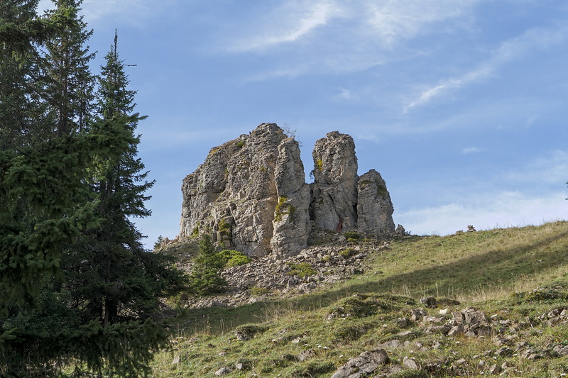
Vorbei an fotogenen Kalksteinformationen ging es gemütlich zurück zum Restaurant an der Bergstation der Seilbahn und von dort hinab zum Ausgangspunkt.
Passing photogenic rock formations we strolled back down to the restaurant near the cableway station and further down to our starting point.