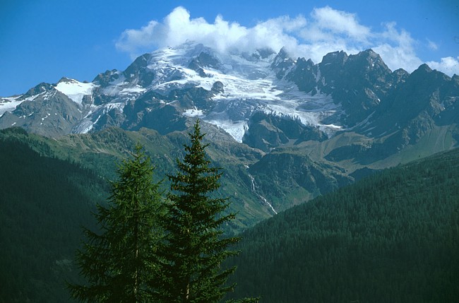
Ortlergebiet: Berge am Gaviapass
Der Passo di Gavia (2618 m) zählt zu den höchsten Alpenpässen. Er verbindet das Val Camonica und das Skigebiet am Tonalepass nördlich von Monte Adamello und Cima Presanella mit dem Valfurva, dessen bekannteste Hauptorte Bormio und Santa Catarina sind. Die Südrampe des Gaviapasses ist nach wie vor eine schmale, aber mittlerweile asphaltierte Strasse, auf der es bei Gegenverkehr sehr eng zugeht. Sehenswert ist der Talort Ponte die Legno mit seinem malerischen Dorfkern. Aus nördlicher Richtung ist der Gaviapass komfortabel vom mondänen Wintersportort Santa Catarina di Valfurva erreichbar, mit Blicken zur Punta di San Matteo und zum Pizzo Tresero. Östlich der Passhöhe baut sich die Pyramide des Corno dei Tre Signori mit einem kleinen Gletscher auf, westlich der Monte Gavia. Karte: Ortles - Cevedale 1:25.000.
With an altitude of 2618 m the Gavia Pass is one of the highest passes in the Alps. It is connecting the Camonica Valley and the ski resort around the Tonale Pass with the Valfurva Valley and its well-known towns like Bormio and Santa Caterina. In the meantime the southern part of the pass road has got an asphalted surface but it is still very narrow in some parts. A stop at the village of Ponte di Legno just below the pass can always be recommended for its picturesque center. From the north the Gavia Pass can be reached relatively easy passing the ski resort of Santa Catarina di Valfurva including some nice views of Punta di San Matteo and Pizzo Tresero. On top of the pass two peaks are dominating the scenery: the pyramid of Corno dei Tre Signori to the east and Monte Gavia in western direction. Map: Ortles - Cevedale 1:25.000
 |
Ein relativ selten beschriebener Gletscherberg auf dem Weg vom Bodensee zum Gaviapass ist die Cima dei Piazzi (3439 m). Aus Livigno kommend hat man diesen Blick von der Südrampe des Foscagno Passes. A less known glacial peak we passed on our way from Lake Constance to the Gavia Pass is Cima dei Piazzi (3439 m) which is viewed best from the southern part of the Foscagno Pass Road near Livigno. |
 |
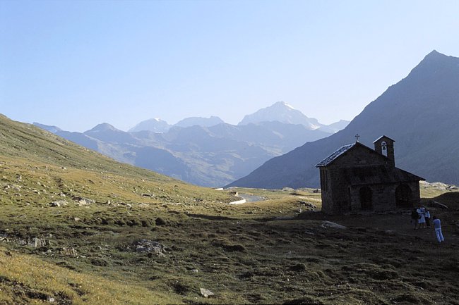
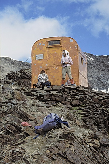
Als Übernachtungsgelegenheit für Touren am Gaviapass bietet sich die Berni Hütte an, die sich wenige Kilometer nördlich der Passhöhe befindet. An ideal palce to stay overnight is the Berni Hut, situated just a few kilometers north of the Pass. |
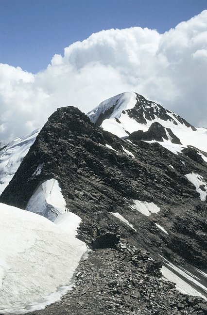
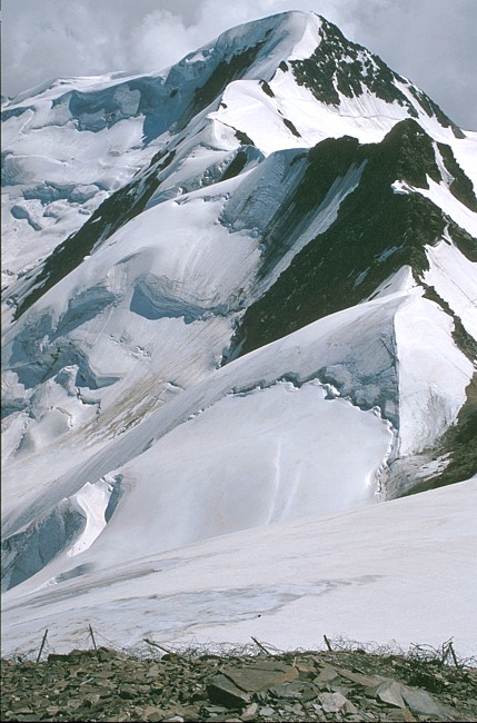
Der Berg im Schatten, rechts neben dem Ortler ist der Pizzo Tresero, eines unserer Tourenziele. Etwas weiter rechts der Corno dei Tre Signori mit dem Sforzellinagletscher (Vedretta della Sforzellina). Hinter dem nach rechts herabziehenden Grat (also südlich des Westgrates) befindet sich die Mulde des Vedretta dei Tre Signori. An dessen Nordufer führt ein Weg zur Bocchetta dei Tre Signori.
The Berni Hut a few kilometers north of the pass is an ideal starting point for hikes in this area as for example Pizzo Tresero, the shady peak right besides Ortler. Another summit worth to be climbed is Corno dei Tre Signori. The standard route via the Tre Signori Gap runs up the basin of the Tre Signori Glacier which cannot be seen from this point of view as it is hidden by the west ridge leading down right of the summit.
Corno dei Tre Signori (3360 m)
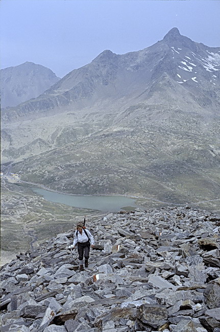
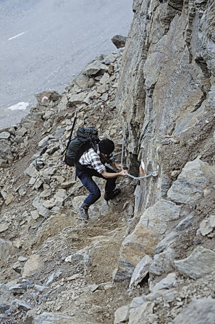
Anstieg über Blockgestein und Wegspuren zur Bocchetta dei Tre Signori. Im Mittelgrund der Lago Bianco und die Passhöhe des Gaviapasses am linken Bildrand. Im Hintergrund rechts der Monte Gavia (3223 m). Unterhalb der Bocchetta dei Tre Signori führt der Weg mit Drahtseilen gesichert durch eine Steilstufe.
The slopes leading up to the Tre Signori Gap (Bochetta dei Tre Signori) were covered with debris. The peak behind Gavia Pass and Lago Bianco is Monte Gavia (3223 m), another nice panorama summit. A rock step just below the gap required some caution but it was well belayed by wire cables.
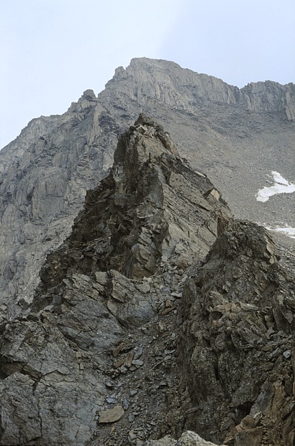
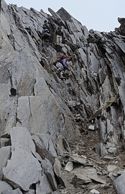
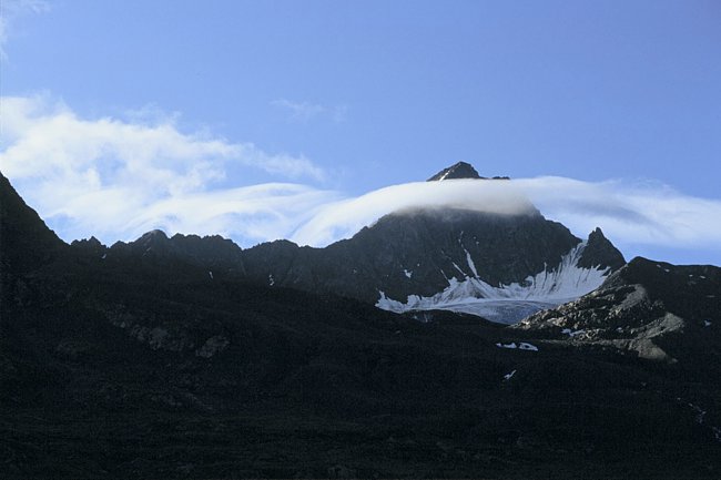
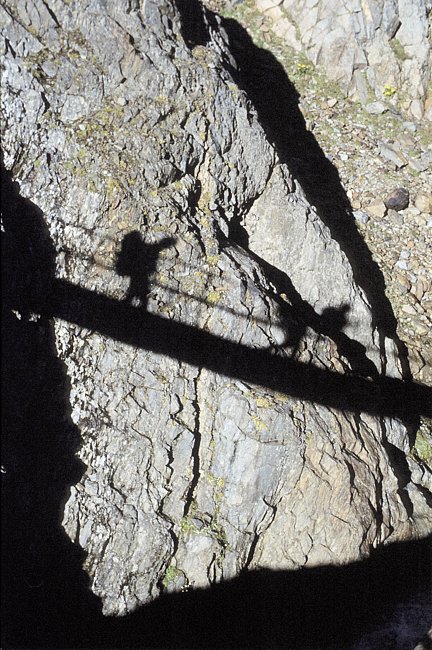
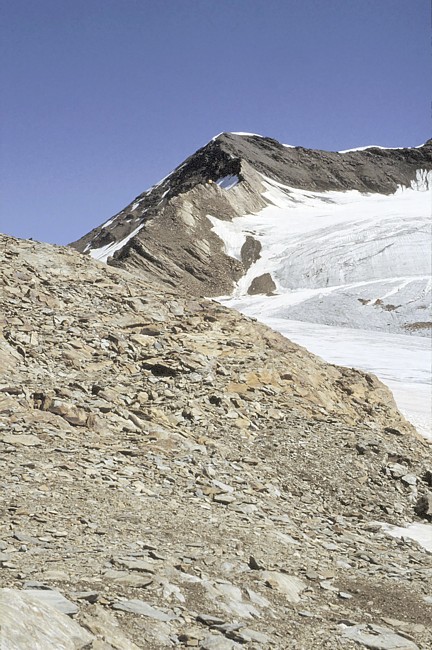
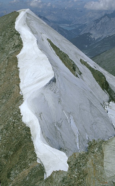
Von der Bocchetta dei Tre Signori führt der Normalweg durch die Felsrinne zum tiefsten Punkt des Ostgrates (über dem linken Rand des Schneefeldes). Die Felsrinne zum Ostgrat bietet leichte Kletterei und ist mit Drahtseilen versichert. Über den stellenweise schmalen Ostgrat führen Wegspuren zum Gipfel. Leider hatten wir kein Wetterglück, weshalb das Gipfelfoto fehlt.
The final part of the ascent seen from the 'Bocchetta dei Tre Signori' Gap. It leads up the couloir to the lowest point of the east ridge (just above the left part of the snow field). The couloir itself affords some easy climbing and is also belayed by wire cables. Parts of the following east ridge are quite narrow but traces lead up to the summit which unfortunately was covered with clouds and therefore the summit panorama was cancelled.
Pizzo Tresero (3594 m) - Punta Pedranzini (3599 m)

Schönes Wetter versprach der Tourentag zum Pizzo Tresero (ganz links). Der Weg zum Tresero führt unterhalb des Rifugio Berni (links im Bild) über den Bach und dann parallel zur Passstrasse nordwärts ins Dosegutal. Im Hintergrund der Monte Gavia (3223 m).
The weather report for the next day was very promising and so we set off for Pizzo Tresero (left). After crossing the brook below the Berni Hut the path follows the road in northern direction into the Dosegu Valley. In the background again: Monte Gavia (3223 m).
 |
Auf der 'Freundschaftsbrücke'
(Ponte Amicizia) wird der Dosegubach überquert, der den
gleichnamigen Gletscher entwässert. The 'Friendship Bridge' (Ponte Amicizia) crosses the Dosegu Brook which drains the glacier of the same name. |
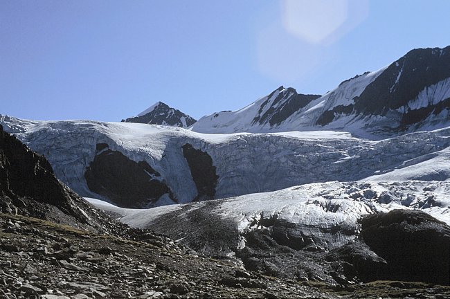
Auf gutem Weg geht es vom Dosegubach bergan, vorbei an der Zunge des Dosegugletschers auf etwa 2800 m Höhe. Alte Fotos auf der Bernihütte zeigten noch gewaltige Gletscherbrüche, die aber mehr und mehr im Schwinden sind. Im Hintergrund die Punta San Matteo (3678 m - Mitte) und der Monte Mantello (3517 m - rechts).
We continued on a good path and passed the tongue of the Dosegu Glacier at about 2800 m. Some old photos in the Berni Hut showed enormous ice-falls below Punta San Matteo (3678 m - left) and Monte Mantello (3517 m) but like in most alpine areas the glaciers are retreating rapidly.
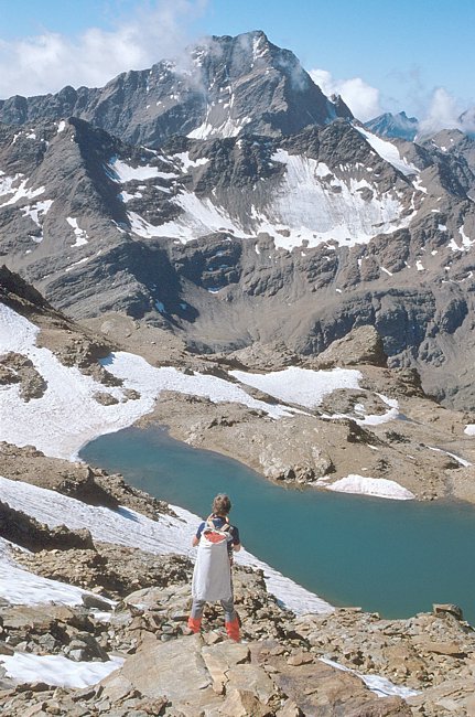
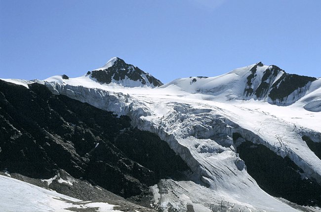
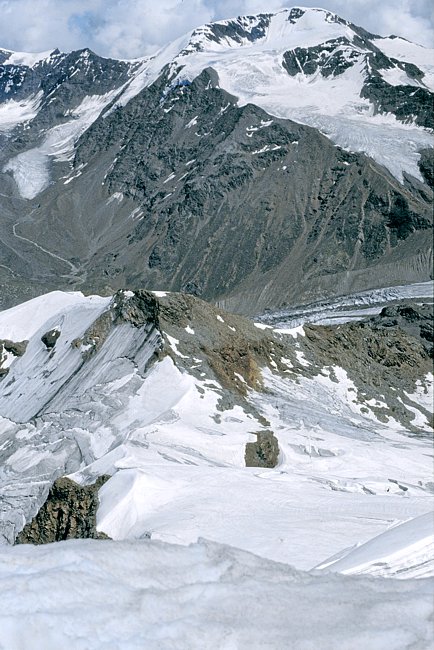
Auf etwa 3100 m hat man einen schönen Blick südwärts zum Corno dei Tre Signori (3360 m). Der See ist weder auf der Ortlerkarte 1: 50.000 noch auf der Karte 1:25.000 verzeichnet. Im Hintergrund der Gipfel des Pizzo Tresero mit seinem Südwestgrat. Über den Südwestgrat führen Wegspuren bis zum Gipfel.
At about 3100 m we had a nice view of Corno Dei Tre Signori (3360 m). The name of the lake below is open to speculation as it wasn' t mentioned on any of our maps. The summit of Pizzo Tresero and its south-west ridge on which we just followed the traces until to the summit.
 |
Im oberen Teil des Südwestgrates steht eine Notunterkunft auf 3420 m Höhe, das Bivacco Seveso. This shelter in the upper part of the south-west ridge (3420 m) is called Bivacco Seveso. |

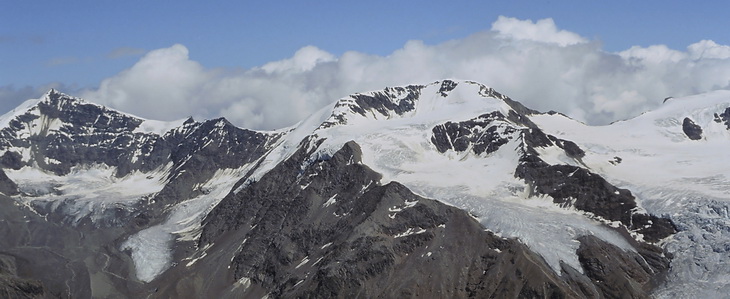
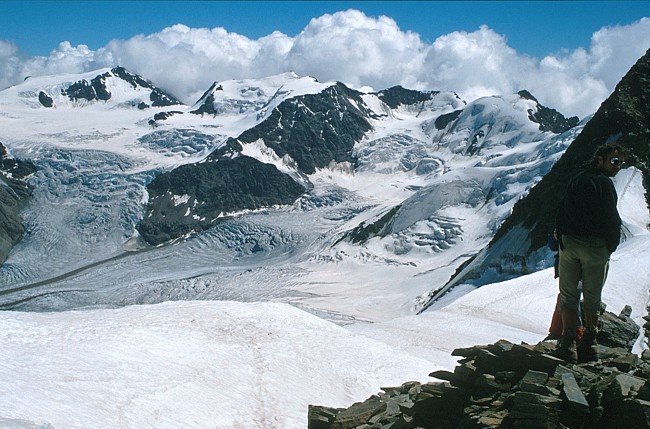
Vom Gipfel des Pizzo Tresero hat man eine umfassende Rundsicht. Im Hintergrund der Corno dei Tre Signori mit dem auch von der Bernihütte aus sichtbaren Sforzellinagletscher. Nach Nordwesten geht der Blick zum Lago di Cancano oberhalb Bormio und zur Silvretta. Im Tal Santa Catarina di Valfurva.
The summit panorama of Pizzo Tresero is excellent. In the background we can see Corno dei Tre Signori and the Sforzellina Glacier which is also visible from the Berni Hut. In north-western direction Lago di Cancano above the town of Bormio and the Silvretta Range can be spotted. The village down in the valley is Santa Caterina di Valfurva.
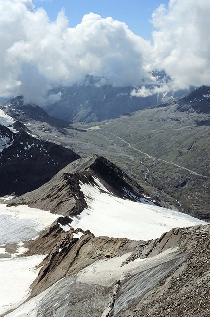
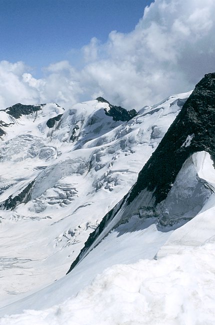
Blick vom Treserogipfel auf den Südwestgrat und die Gavia Strasse. Etwas oberhalb der Stelle, wo der Grat leicht nach rechts abknickt, liegt das Bivacco Seveso. Am tiefsten Punkt des Grates steigt man nach links ab und erreicht über Schneefelder den Anstiegsweg. Die Nordseite des Pizzo Tresero ist stark vergletschert. Ausgangspunkt ist in diesem Fall die Brancahütte (2487 m) auf der Moräne des Fornogletschers (Bildmitte - verdeckt). Im Hintergrund der Palon della Mare (3703 m).
View down the South-West Ridge to the Gavia Pass Road. The bivouac mentioned above is situated at the point, where the ridge bends right. The descent route is following the ridge until to its lowest point and then turns left down the snow fields. The ice-covered North Face of Pizzo Tresero is normally climbed from the Branca Hut (2487 m) which is situated on the moraine of the Forno Glacier below. In the background: Pallon della Mare.
Vom Gipfel des Pizzo Tresero sieht man sehr schön den Routenverlauf der Rundtour über Cevedale und Monte Vioz. Von der Casatihütte kommend erreicht man den Monte Cevedale (3769 m - links). Nach Süden absteigend überquert man den Monte Rosole (3529 m) mit einigen leichten Felsen und dem Bivacco Colombo. Über Firnhänge gelangt man zum Gipfelplateau des Palon della Mare (3703 m - Mitte) und nach einem kurzen Abstieg über steilen Firn geht es nochmals fast 2 km bergauf über den oberen Fornogletscher zum Monte Vioz (3645 m).
Another tour we introduced as Rundtour über Cevedale und Monte Vioz is partly visible from the summit of Tresero. Starting at the Casati Hut we first climbed Monte Cevedale (3769 m - left). Descending in southern direction we then traversed Monte Rosole (3529 m) and passed the bivouac shelter (Bivacco Colombo) where a few easy rocks had to be climbed. After that large snow fields lead up to the summit plateau of Palon della Mare (3703 m - center) and finally - after a short and steep descent - to Monte Vioz (3645 m).
Blick vom Pizzo Tresero ostwärts zur Punta Taviela (3612 m). Über die Eisrampe im Mittelgrund führt die Anstiegsroute zur Punta San Matteo (rechts ausserhalb des Bildes – siehe letztes Bild) von der Brancahütte. Weiter geht es zur Punta San Matteo, die von der Punta Pedranzini leicht verdeckt wird. Es lohnt sich – wie die folgenden Bilder zeigen – diesen Gipfel über Blockgestein und Wegspuren noch mitzunehmen.
View from Pizzo Tresero to Punta Taviela (3612 m). The ice-hump in the center is part of the ascent route to Punta San Matteo (not visible here - see final image) if you start at the Branca Hut. We followed the ridge to Punta San Matteo (partly hidden by the summit of Punta Pedranzini) which is quite worthwhile to be climbed additionally as the following pictures show.
Blick vom Gipfel der Punta Pedranzini (3599 m) zurück zum Pizzo Tresero (3594 m). Stacheldraht aus dem ersten Weltkrieg ziert den Gipfel der Punta Pedranzini. Im Profil die Punta San Matteo, die man vom Gaviapass kommend über die Schneehänge unterhalb der Gipfelfelsen und die gut erkennbare Firnschneide besteigt.
Pizzo Tresero (3594 m) seen from the summit of Punta Pedranzini (3599 m). Barbed wire, a remainder of World War I is decorating the summit of Punta Pedranzini. The right picture shows Punta San Matteo which can also be climbed from the Gavia Pass across the snow fields below the summit rocks and finally up the clearly visible snow ridge.
 |
Das Becken des Fornogletschers und seine Zuflüsse
vom Gipfel der Punta Pedranzini. Darüber von links: Palon della
Mare, Monte Vioz und Punta Taviela. The Forno Glacier basin and its tributaries seen from the summit of Punta Pedranzini. From left to right: Palon della Mare, Monte Vioz and Punta Taviela. |