Versuch am Pik Lenin / attempting Pik Lenin
Der Pik Lenin (7134 m) und die 30 ihn umgebenden Sechstausender schliessen das Alaital in einer fast 150 km langen Mauer nach Süden ab. Bereits im Jahre 1928 wurde der Gipfel von den Bayern Allwein und Wien sowie dem Tiroler Schneider bestiegen. Heute werden am Berg sechs verschiedene Aufstiege begangen, der Normalweg vom 'Internationalen Pamirlager' auf 3500 m führt über 3 Hochlager in 4 - 6 Tagen zum Gipfel. Für uns war in Lager 3 am Pik Rasdelnaya der Endpunkt erreicht. Eine Spaltenbergung und das darauffolgende schlechte Wetter liessen einen erneuten Gipfelversuch nicht mehr zu.
Pik Lenin (7134 m) and its 30 surrounding 7000 m peaks are building a nearly 150 km wall south of the Alai Valley. Its summit was already climbed in 1928 by the Bavarians Allwein and Wien and the Tyrolian Schneider. Today six different routes lead to the summit. The standard route from the 'International Pamir Camp' takes about 4 - 6 days. Our highest point was camp 3 at Pik Rasdelnaya. After taking part in a crevasse rescue the changing weather thwarted another summit attempt.
 |
Karte des Tourengebiets am Pik Lenin. Map of the Pik Lenin area. |

Vom Pamirlager Atschik Tash erreicht man zur ersten Akklimatisation einen etwa 4000 m hohen Höhenrücken mit Blick auf das Alaital und den Pik Petrowski (4825m). Der Anstieg auf den Pik Petrowski (4825 m) erfolgt über den Ostgrat links.
A 4000 m ridge just above the Atschik Tash Camp serves as a first acclimatisation tour with view across the Alai Valley and Pik Petrowski (4825 m). The ascent route to Pik Petrowski (4825 m) follows the east ridge to the left.
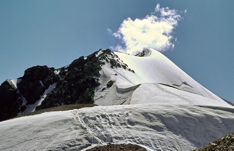
Südlich des Pik Petrowski erhebt sich ein schöner Gipfel, mit Punkt 4515 bezeichnet, der über die Schneefelder links und den anschliessenden Ostgrat bestiegen wird (Schnee und feiner Schutt).
Another nice summit south of Pik Petrowski is marked as point 4515. We climbed it via the snowfields to the left and the continuing east ridge (snow and debris).
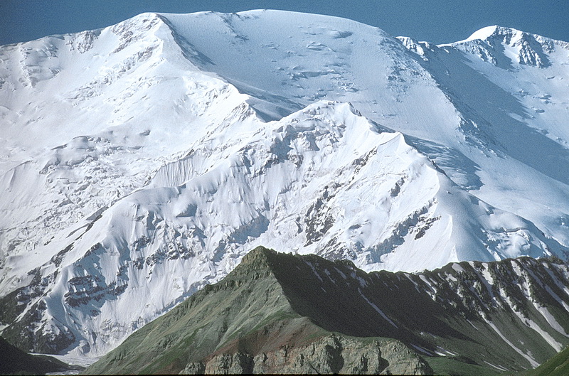
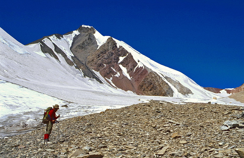
Etwas rechts oberhalb der Bildmitte führt der Weg zum Pik Lenin in ein Seitental und überquert den Höhenrücken dahinter auf dem Traveller Pass, auch Sandpass genannt. Der Nordsporn des Pik Lenin, über den eine anspruchsvolle Route verläuft (Teleaufnahme vom Pamirlager).
The ascent to Pik Lenin leads into a side valley (to the right - just above the center of this picture) and crosses the ridge behind to reach the Traveller Pass which is also called Sand Pass. The north spire of Pik Lenin with its demanding ascent route (telephoto from the Pamir Camp).
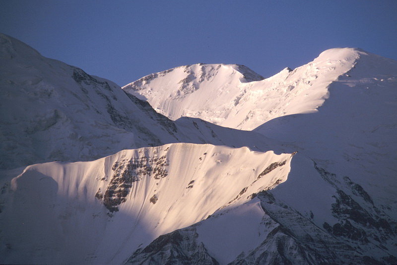 |
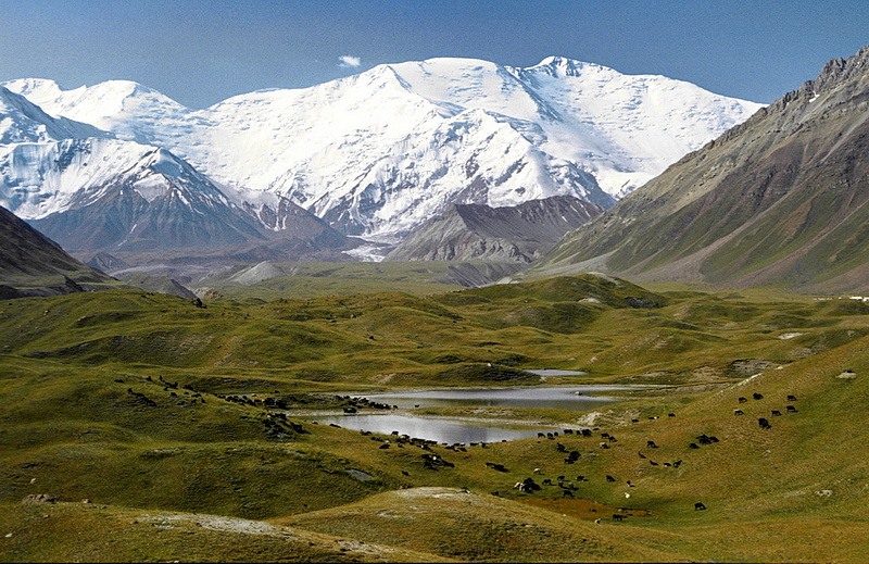
Pik Krylenko (6104 m) rechts und Pik der Einheit (Edinstwa, 6730 m) nach Neuschneefall in der Abendsonne vom Pamirlager aus aufgenommen. Pik Krylenko (6104 m) to the right and Pik Edinstwa (6730 m) in the evening sunlight with fresh snow as seen from the Pamir Camp. |

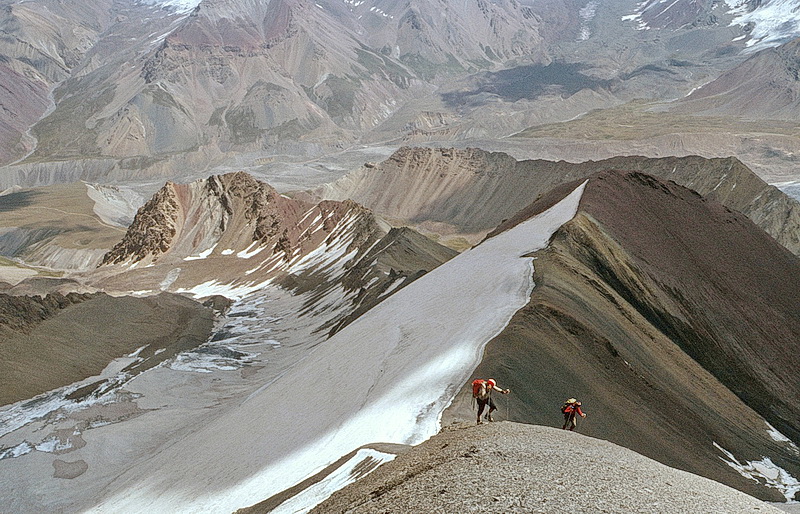
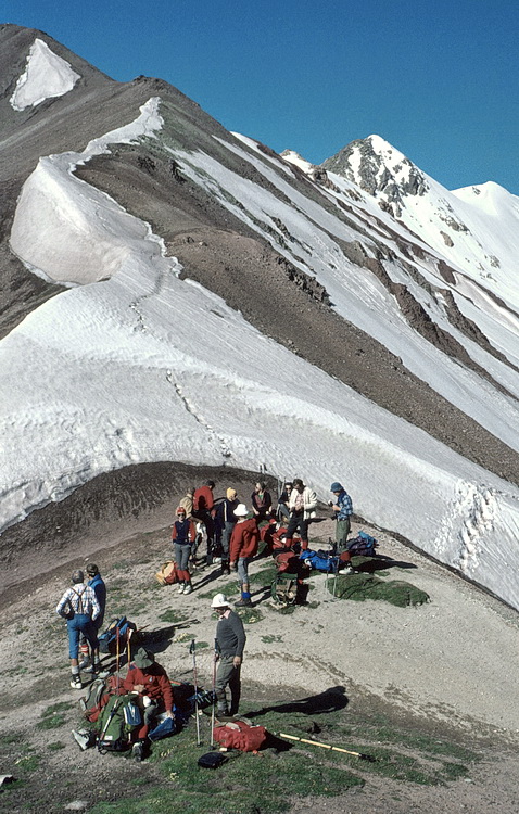
Aufstieg zum Traveller Pass (4200 m). Ascending Traveller Pass (4.200 m). |
 |
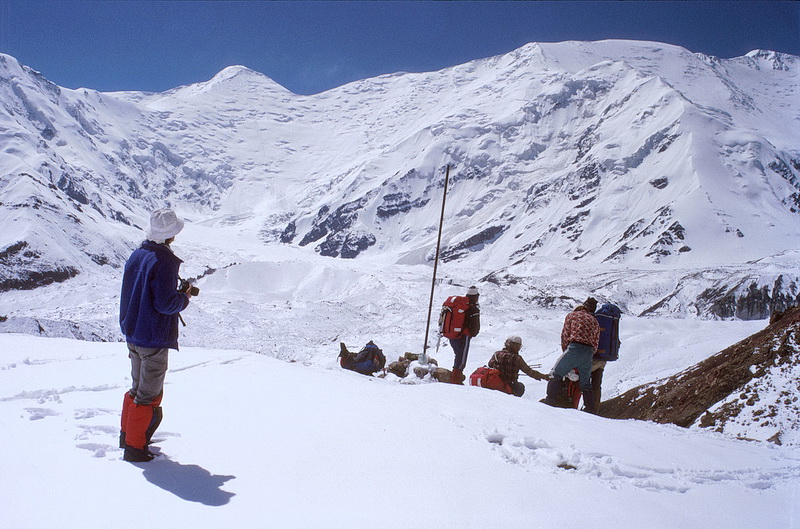
Blick vom Traveller Pass nach sommerlichem Neuschnee-fall auf den Lenin Gletscher, Pik Krylenko (6104 m) und den Pik Lenin (7134 m, rechts). Danach geht es auf sandigen Serpentinen einige hundert Meter zum Leningletscher hinab. View from Traveller Pass to the Lenin Glacier after |
 |

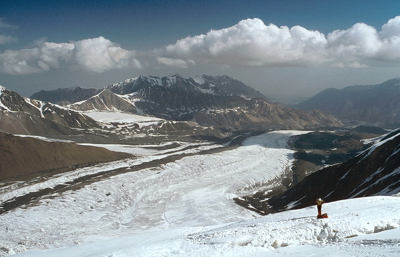
Vom mittleren Teil des Leningletschers erkennt man den Normalweg auf den Pik Lenin: aus der Gletschermulde auf den Pik Rasdelnaya (6148 m) ganz rechts und über den 6 km langen Grat auf den Pik Lenin etwas links der Bildmitte. Daneben der Blick vom Leningletscher nach Osten zum Pik Mir (4925 m).
The standard route to Pik Lenin as seen from the central part of the Lenin Glacier: to the right Pik Rasdelnaya (6148 m) followed to the left by the 6 km summit ridge of Pik Lenin. Right of it the Lenin Glacier with Pik Mir (4925 m) in eastern direction.
 |
Lager 1 am Pik Lenin (ca. 4600 m). Blick nach Westen zum Punkt 5689 m. Camp 1 at Pik Lenin (approx. 4600 m). View to the west to point 5689 m. |
 |
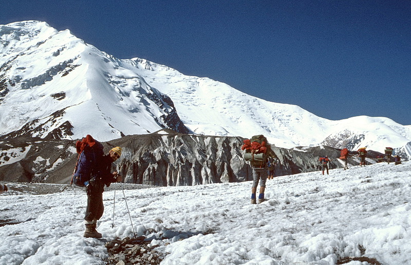
Aufstieg von Lager 1 nach Lager 2. Im Hintergrund der Pik Petrowski (4825 m). Between camp 1 and camp 2.In the background Pik Petrowski (4825 m). |
 |
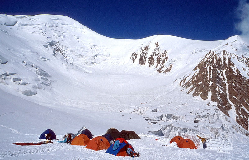
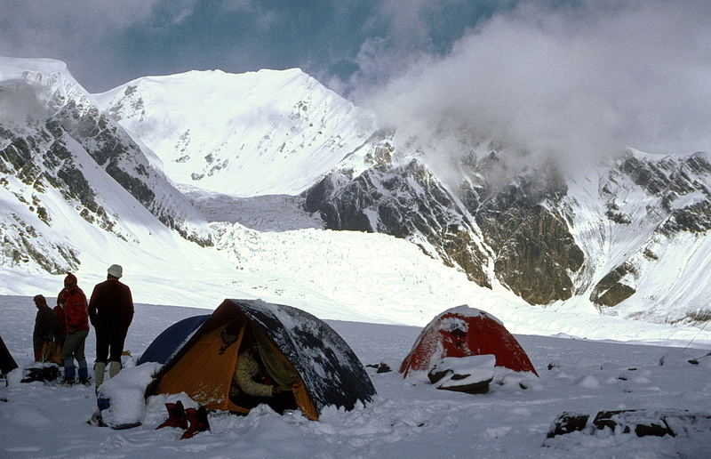
Blick von Lager 2 (ca. 5200m) hinauf zum Nordwestgrat des Pik Lenin. In der Mulde liegt ein weiteres Lager 2, allerdings ist dort die Spaltengefahr grösser. Im Hintergrund der Pik Rasdelnaya (6148 m), der zuerst über die Firnflanke rechts der Bildmitte und dann über den Nordgrat nach links bestiegen wird. View from camp 2 (5.200 m) up the north-western ridge of Pik Lenin. Another camp 2 is situated in the hollow behind but with an increased danger of crevasses. In the background Pik Rasdelnaya (6148 m) which is climbed via the snow slope right of the center following the north ridge to the left. |
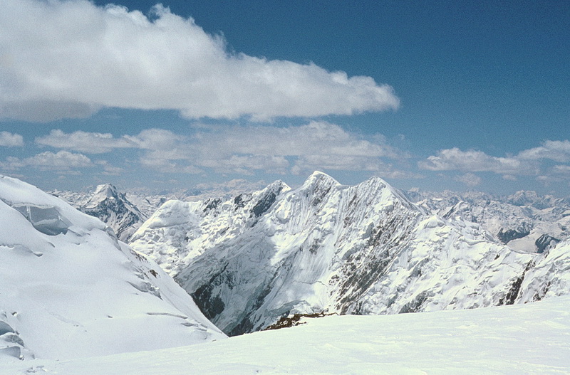 |
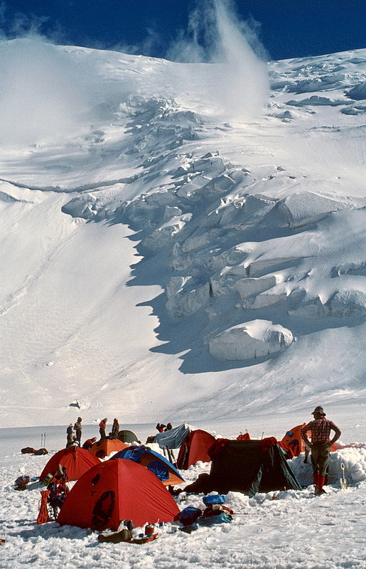
Auf dem Pik Rasdelnaya (6148 m) mit Blick nach Südwesten. Im Hintergrund rechts das Bergmassiv des Pik Revolution. South-western view from the top of Pik Rasdelnaya (6148 m). Ausschnittvergrösserung des oberen Bildes. The mountain range in the background is Revolution Peak. |