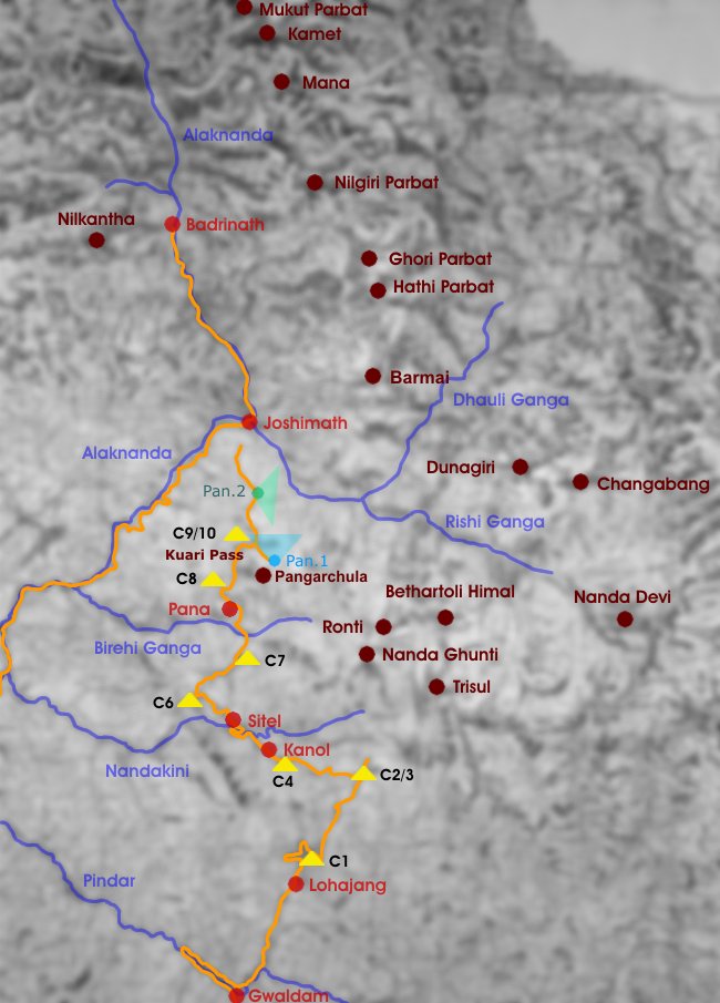
Garhwal Trek: Lohajang - Kuari Pass
Nordöstlich von Delhi befinden sich die Bergregionen Garhwal und Kumaon, die zusammen den indischen Bundesstaat Uttaranchal bilden. Der Garhwal Himal grenzt im Norden an Tibet, im Westen an Himachal Pradesh, im Osten an Nepal und im Süden an die Ganges-Tiefebene. Diese von den Quellflüssen und Schluchten des Ganges zerfurchte Gebirgslandschaft mit ihren hohen Bergen und tiefen Tälern ist die Heimat mehrerer Volksgruppen, die jedoch eine Gemeinsamkeit haben: ihre tiefe Religiosität. Hier vermischen sich Hinduismus, Animismus und Buddhismus. Die vielen hinduistischen Flussheiligtümer und Pilgerzentren sind Ausdruck der innigen Verbindung von Natur und Religion im Garhwal. Flüsse, Seen und Berge sind den Menschen heilig, und werden mit Gottheiten in Verbindung gebracht.
Die schneebedeckten Gipfel des Garhwal zählen zu den schönsten Bergen des mittleren Himalaya. Sie bilden eine fast durchgehende Bergkette, die im Nanda Devi gipfelt, dem mit 7816 m höchsten Berg Indiens. Die nachfolgenden Dias entstanden auf einer 11-tägigen Trekkingtour, die den Garhwal-Himal nordwärts vom Dorf Mandoli aus bis nach Auli, oberhalb von Joshimath gelegen, durchquert. Die Route folgt hierbei einem Abschnitt des historischen Lord Curzon Trails, benannt nach dem britischen Vizekönig, der Teile dieses Weges erwanderte.
The Indian state of Uttaranchal is formed by the mountain areas of Garhwal and Kumaon north-east of Delhi. The Garwhal Himal borders on Tibet in northern direction, Himachal Pradesh to the west, Nepal to the east and the Ganges plains in southern direction. This mountain scenery, furrowed by source rivers and canyons of the river Ganges is the home of several ethnic groups who have one thing in common: their deep religiousness. Hinduism, Animism and Buddhism are present in this area. Holy places along the rivers and pilgrimage destinations are expressions of a close connection between religion and nature in the Garhwal Range. Rivers, lakes and mountains are sacred and associated with divinities.
The snow-covered mountains of Garhwal are among the most beautiful mountains in the Central Himalaya. They are forming an almost continuous range culminating in Nanda Devi (7816 m), the highest mountain of India. The following slides were taken during an eleven days trek crossing the Garhwal area in northern direction from the village of Mandoli up to Joshimath. The trek is partly identical with the historical Lord Curzon Trail which is named after the British vice-king who had hiked on parts of this trail.
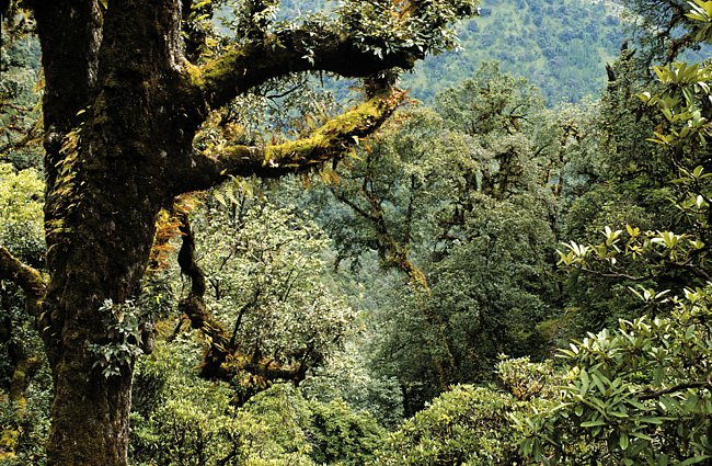

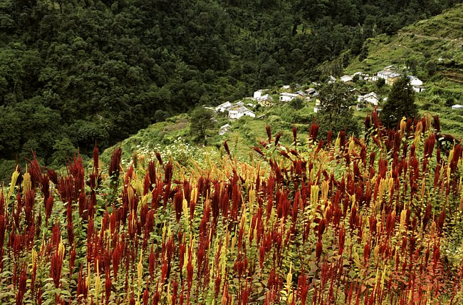
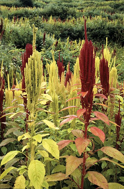
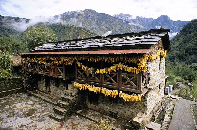
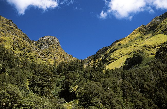
Wir begannen unseren Trek in Lohajang. Die erste Etappe führte durch Bergwald und vorbei an Amaranthfeldern zum ersten Lagerplatz auf einer Wiese oberhalb des Dorfes Didana (2440 m).
We started our trek at Lohajang. On the first day we walked through mountain forests, passing Amaranth fields and finally reached our first campsite above the village of Didana (2440 m).
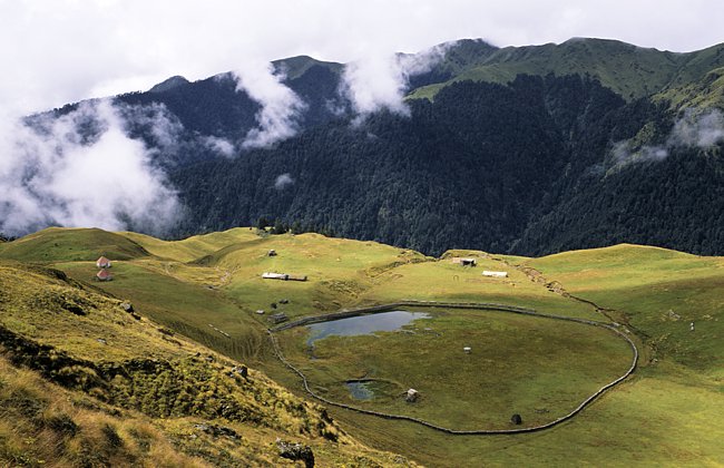
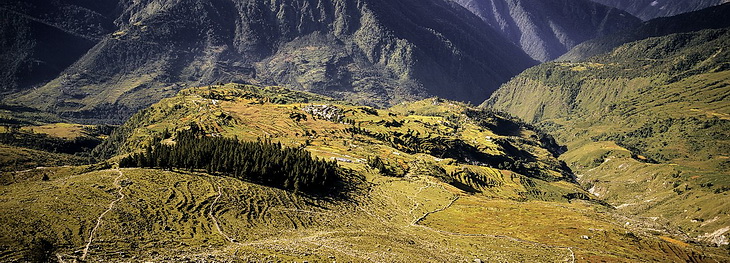
Buygal heißen die alpinen Blumenwiesen im Garhwal, die meist zwischen der Baum- und Schneegrenze in den Hochtälern liegen. Sie begleiteten uns die nächsten Tage bis zu unserem vierten Lagerplatz, dem Forsthaus (2700 m) bei Kanol. Dazwischen konnten wir kurz einen Blick auf die Nanda Ghunti (6309 m) werfen.
Buygal is the name for alpine meadows in the Garhwal area which are situated predominantely in the higher valleys between timber- and snow-line. We followed these meadows for the next days until we arrived at our fourth camp, the forest house (2700 m) near Kanol. Along the way we got the chance to catch a short glimpse of Nanda Ghunti (6309 m).
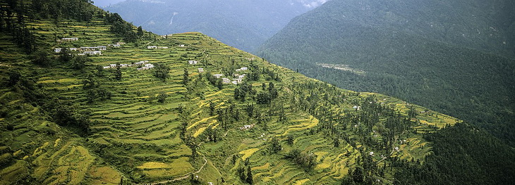
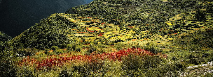
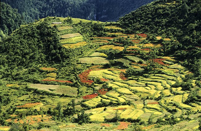
Am Anfang des Treks führt der Weg durch das Nandakini Tal vorbei an Ortschaften mit den für enge Bergtäler typischen Terassenfeldern.
At the beginning of the trek the path leads along the Nandakini Valley where we passed villages and terrace fields which are typical for narrow mountain valleys.

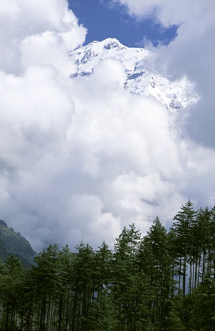
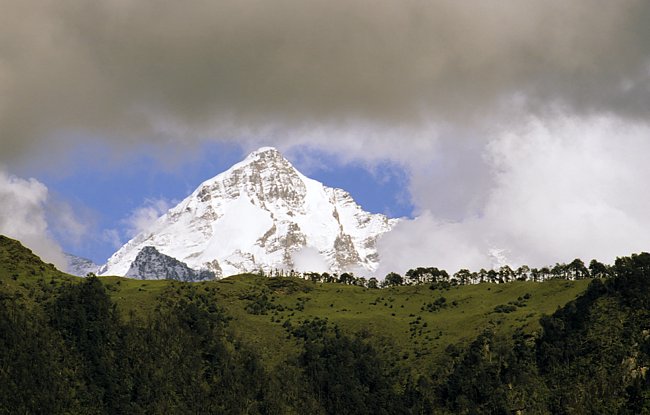
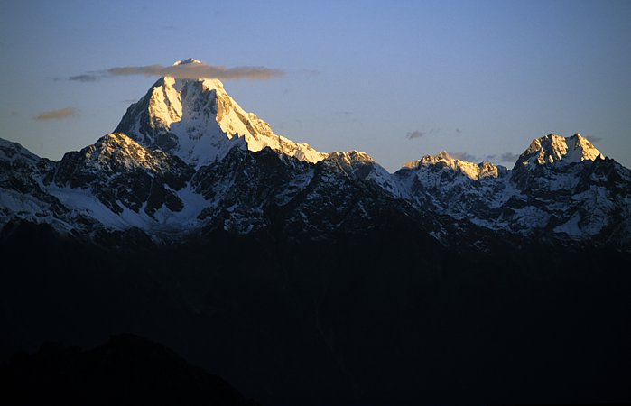
Weiter ging es durch das Nandakini Tal. Wie die Nanda Ghunti versteckte sich auch der imposante Trisul (7120 m) größtenteils in Wolken.
We carried on along the Nandakini Valley. Like Nanda Ghunti before the imposing Trisul (7120 m) was mostly covered with clouds.

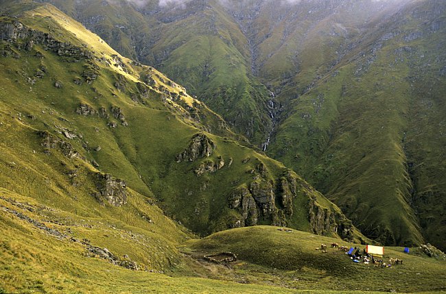
Auf dem Weg durch das Birehi Ganga Tal bis nach Pana waren hin und wieder auch höhere Gipfel zu erkennen. Nach Lagerplatz 8 begann der Aufstieg zum Kuari Pass (3600 m).
On our way up the Birehi Ganga Valley to the village of Pana we could spot some of the higher mountains. Camp 8 was the place where we started the ascent of the Kuari Pass.
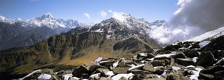
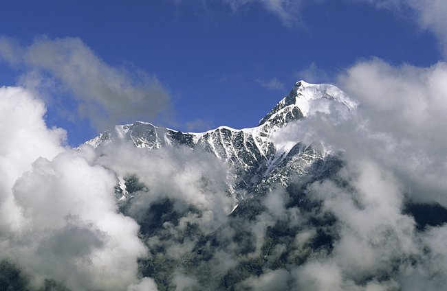
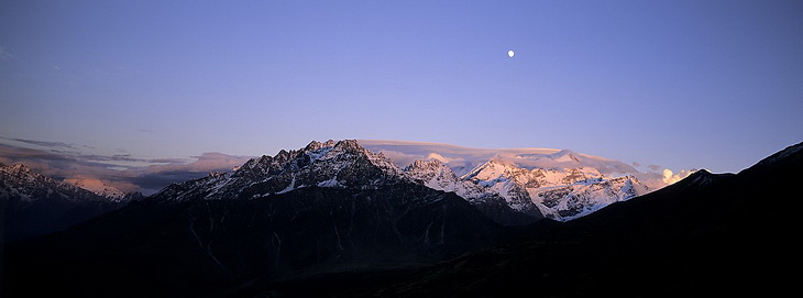
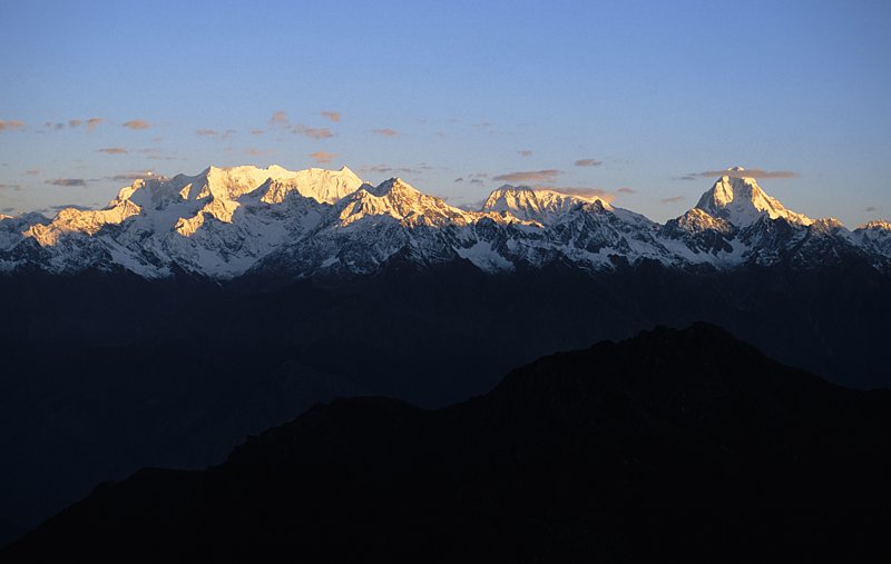
Auf dem Kuari Pass zeigen sich die Gletschergipfel der umliegenden Sechs- und Siebentausender. Links der Dunagiri (7066 m) mit der Spitze des Changabang (6864 m - rechts davon).
One of the first places to spot the ice covered 6000 and 7000 m peaks is the Kuari Pass. To the left Dunagiri (7066 m) and the top of Changabang (6864 m - left of Dunagiri).
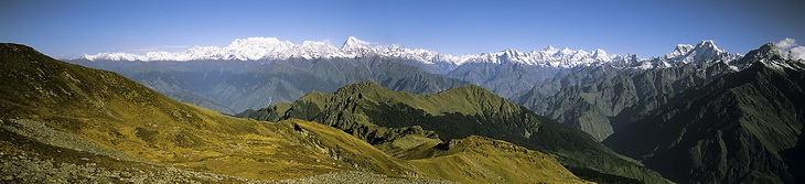
Das Panorama beim Aufstieg zum Pangarchula (4584 m), einem Aussichtsgipfel oberhalb des Lagers am Kuari Pass. Das Lager selbst liegt links unterhalb der Graterhebung, die wir als 'Hausberg' bezeichnet haben und von wo man ebenfalls einen hervorragenden Blick hat. Der Weg nach Auli führt über den nächsten Bergrücken oberhalb der Waldgrenze.
This panorama is taken from an attempt to climb Pangarchuli (4584 m), a panorama summit above the camp near Kuari Pass. The camp itself was situated down left of the hump in the ridge which we called 'Hausberg' (the nearest local hill) which also shows an excellent panorama and can be reached easily from the camp.
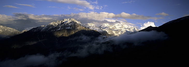
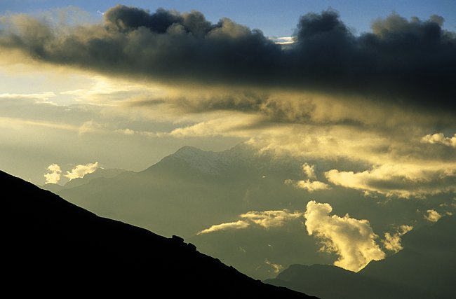
Sehr empfehlenswert ist eine abendliche Wanderung zum Hausberg auch wenn Nanda Ghunti (6309 m) bis zum Schluss in Wolken gehüllt war.
An evening walk up to the 'Hausberg' (mentioned above) can be very worthwhile although at this day Nanda Ghunti was still covered by clouds.

Ein einzigartiges Panorama beginnend in nord-westlicher Richtung mit Chaukhamba und Nilkantha.
A unique panorama starts in north-western direction with Chaukhamba und Nilkantha.
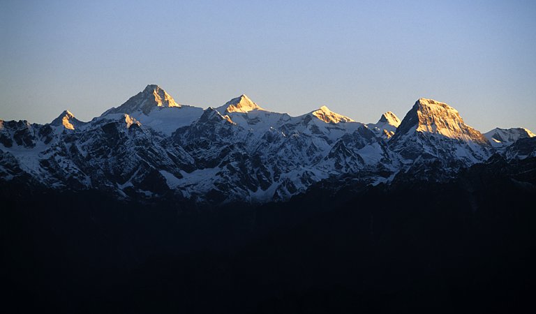

Nach Norden blickt man auf Kamet (7756 m), Mana (7272 m) und Nilgiri Parbat (6474 m) und im Südosten ist die Nanda Ghunti (6309 m) immer noch in Wolken.
In northern direction we could see Kamet (7756 m), Mana (7272 m) and Nilgiri Parbat (6474 m) and still in clouds Nanda Ghunti (6309 m).